
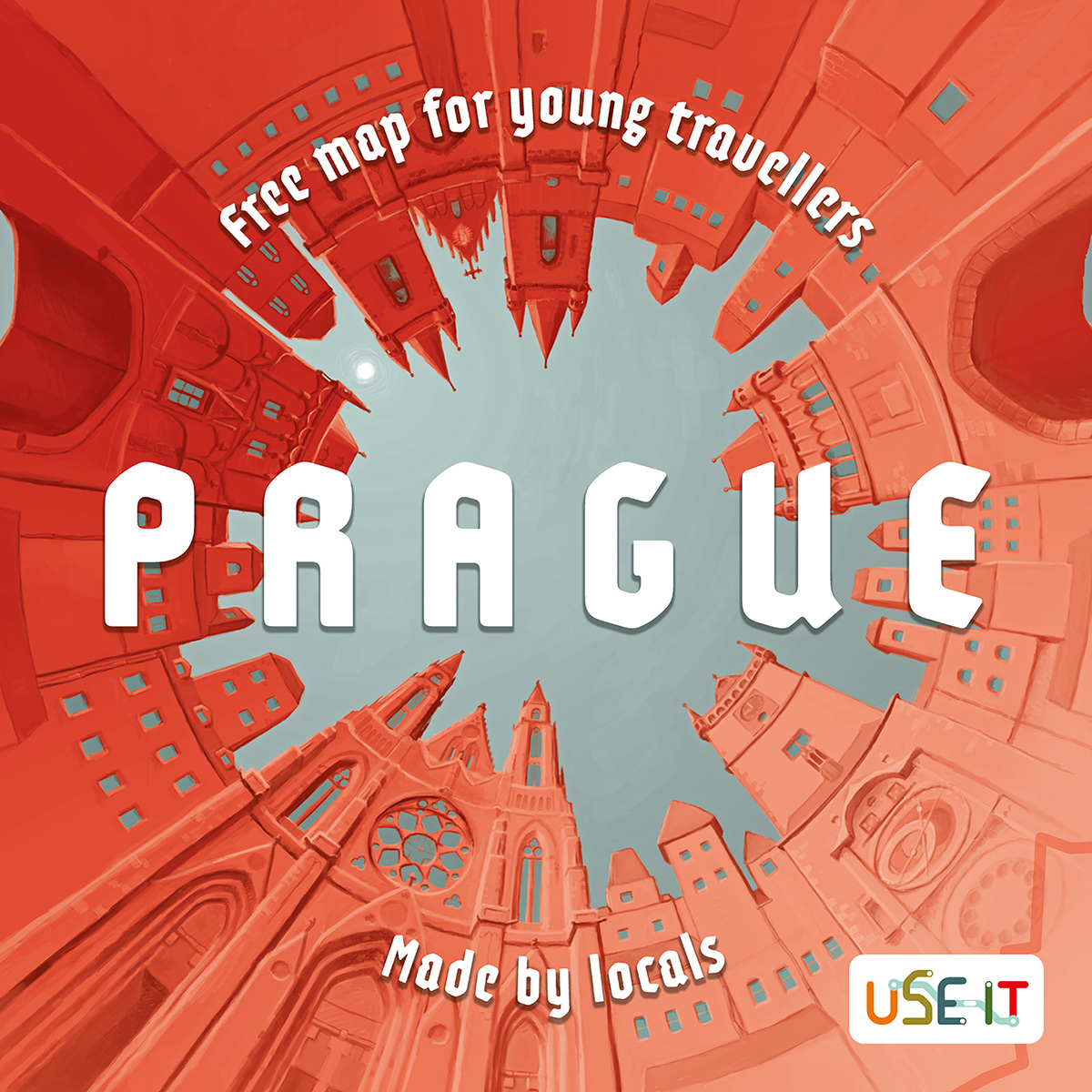
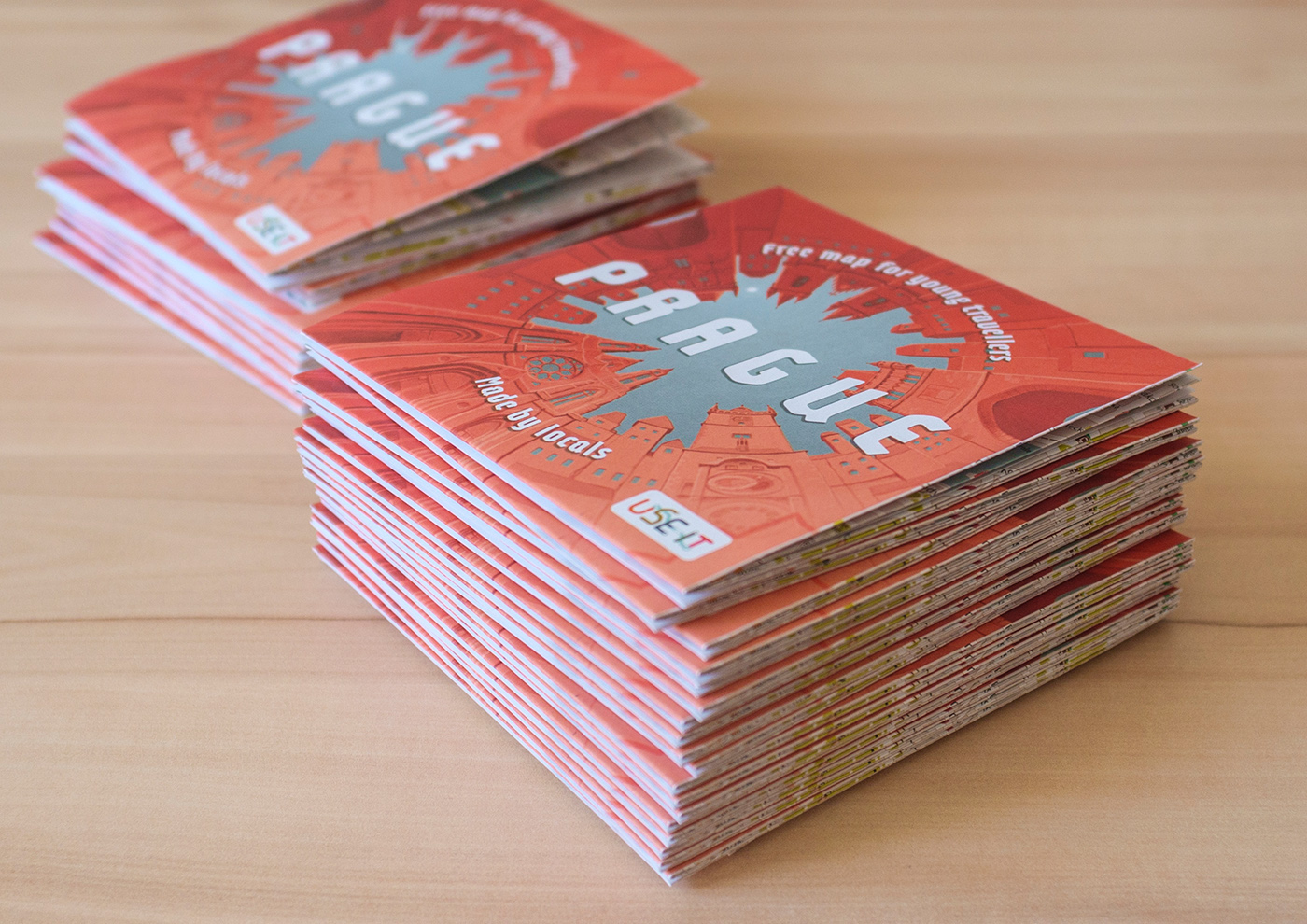
Creating Use-It Map Prague – Free Map for Young Travellers
Role: Art Director
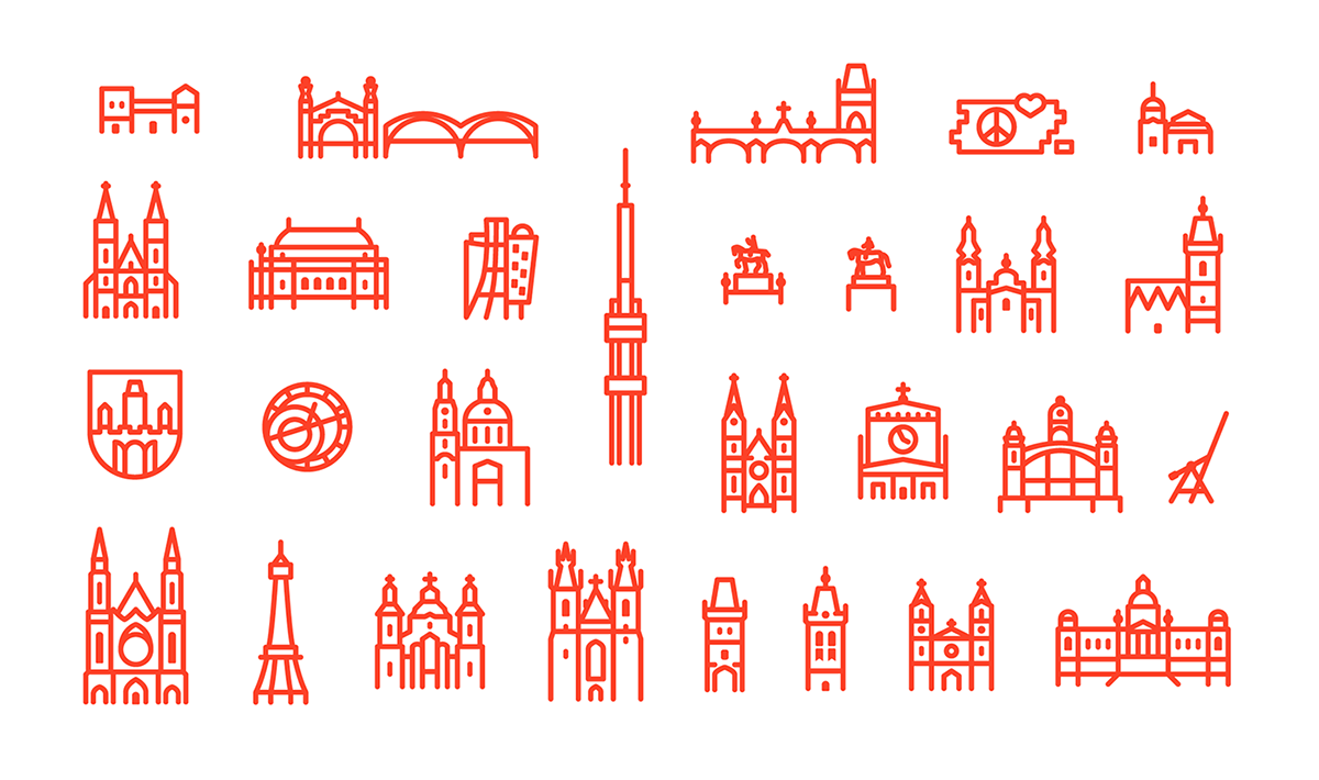
Responsibilities: Sketches, Layout, Design, Cartography data, Icon design, Illustrations
Year: 2017
Thanks:
- Michaela Klíčníková for smooth project coordination
- members of Jůzit, z. s. that found all those awesome places in Prague and created legible text
- cartographers from Jůzit, z. s. that guided me in the sea of hierarchy and visual clarity and corrected hundreds of mistakes
- USE-IT Europe for bringing the idea of free maps
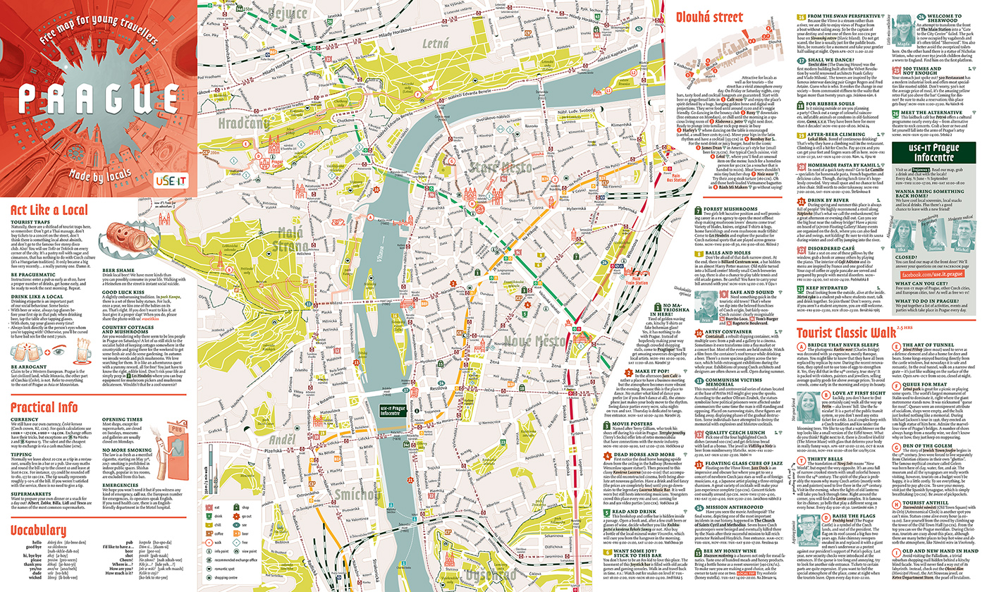
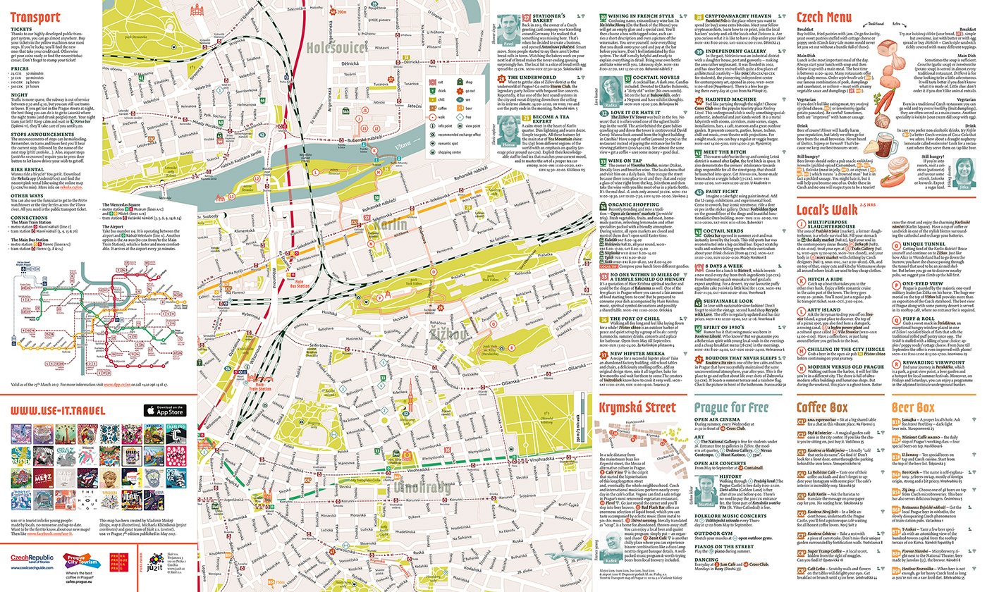
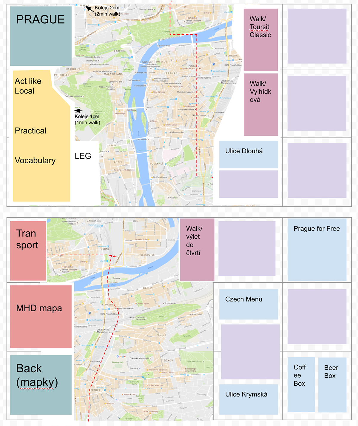
First layout of the map used for estimating of text amount needed. For this preview, I used Google map that contains my personal data. :)
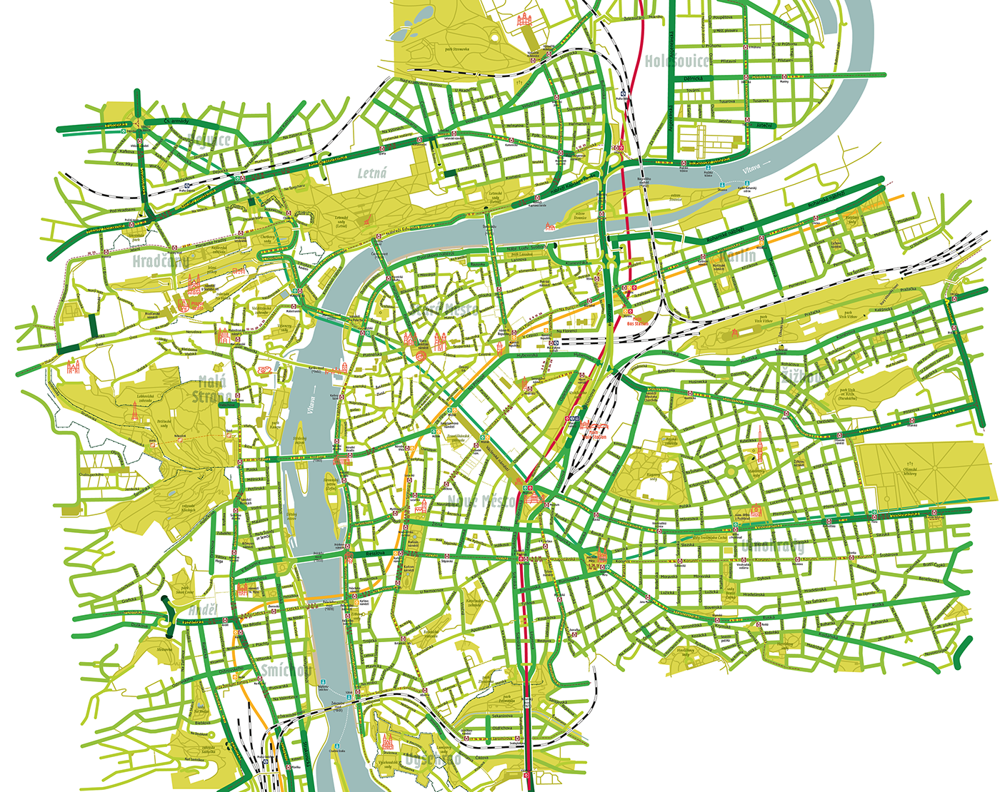
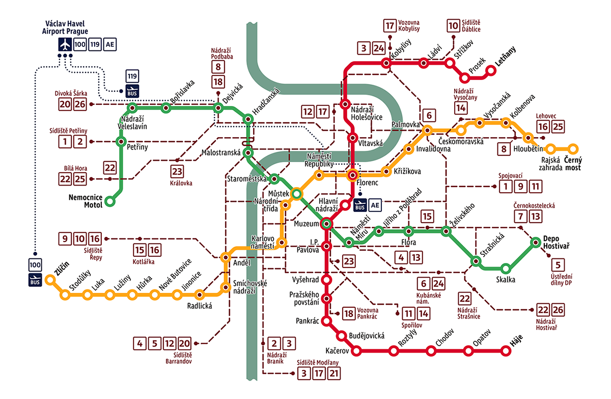
Creating own cartography data
I was certain I could handle the design part (layout, design, typography & illustrations), but what fascinated me more were the cartographic data. As previous years used old and bulky data from OpenStreetMap and with our decision to expand the area of the map to the east of Prague, I came with an idea to redraw the whole map.
Man, how silly I was. Creating the map took me more time than I expected, but luckily, I have learned a lot.
The map is redrawn from multiple sources and satellite pictures. For most parks, I had to found the original maps and then connect them into the main composition.
It is taken from the pedestrian perspective. You will not find tunnels for cars and some small streets here, stairs are slightly corrected for better readability. The width of streets is based on the real perception and not based on the traffic importance.
The core of the map is CC-BY-SA 4.0, so if you need a cartographic data of the centre of Prague, just contact me.
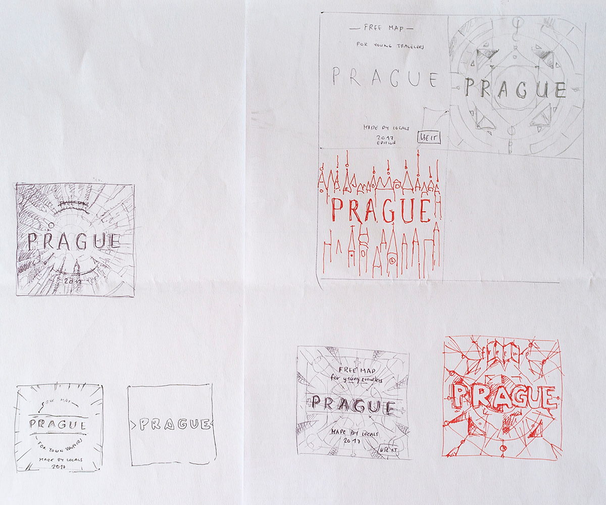
Sketches of main cover


And as always. Thanks for watching.