Dorthea Dix Park
Bike Trail System
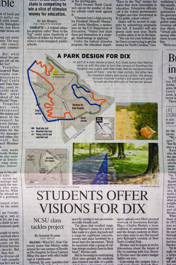
The Dorthea Dix Park area is 306 acres of varied terrain in the middle of Raleigh. A current problem in the city of Raleigh is that there is a large group of cyclists who ride: road cyclists who ride to workout, students commuting, mountain bikers who ride for the thrill. There are also many children in surrounding areas who have no safe place to ride because of busy streets. Can we design bike paths for these varied users to all use inside Dix Park?
I developed a map for three different types of cyclists, a trail signage system to correspond to each, and a system of pavement paint to correspond with each path and marker.
Bike Trail System
The Dorthea Dix Park area is 306 acres of varied terrain in the middle of Raleigh. A current problem in the city of Raleigh is that there is a large group of cyclists who ride: road cyclists who ride to workout, students commuting, mountain bikers who ride for the thrill. There are also many children in surrounding areas who have no safe place to ride because of busy streets. Can we design bike paths for these varied users to all use inside Dix Park?
I developed a map for three different types of cyclists, a trail signage system to correspond to each, and a system of pavement paint to correspond with each path and marker.
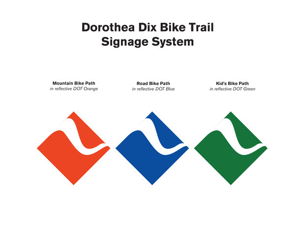

Physical mock up of Road Bike path signage using 3M reflective sheeting, used on road signs for extremely high visibility from great distances.

Stop Motion Video riding a section of the Mountain Bike trail. The stones to the side of the trail are painted orange to mark sections of the Mountain Bike Trail, since paint can't be used as it is on the Road Bike path

Climb finish on the road bike path. Marked using pavement paint.

Start of a climb on the road bike path
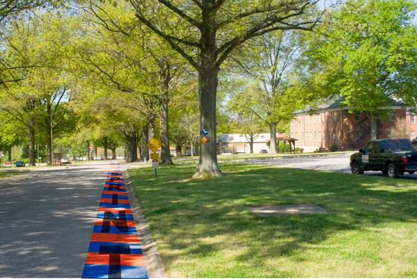
Sprint Start on section of the map where the Mountain Bike trail overlaps with the Road Bike path, indicated by blue and orange stripes, corresponding to each trail.


Detail shot of poster showing Road Bike path Climb finish line
The project was then featured in North Carolina's News & Observer on the cover of the Triangle section.
The physical article is below, but is also featured in full on their website below.
http://www.newsobserver.com/2009/06/29/42642/students-offer-visions-for-dix.html
The physical article is below, but is also featured in full on their website below.
http://www.newsobserver.com/2009/06/29/42642/students-offer-visions-for-dix.html