This series of maps covers Waterways World’s initial series of pull-out guides (from 2008 onwards) plus ongoing features on restoration and new-build projects. Though the scale and detail varied, the palette and typography remained consistent – slowly evolving in some aspects – as a clear, approachable, modern design.
Typeface is Meta Plus and (in later maps) Minion. Road data is from Ordnance Survey Open Data (or tracings from the New Popular Edition in the earliest maps), hill-shading from SRTM, and waterway information from my own research and knowledge.

Birmingham Canal Navigations - system map.

Barnsley, Dearne & Dove - restoration map.

Neath, Tennant & Swansea canals - restoration map.

The Ashby Canal.

The Basingstoke Canal.
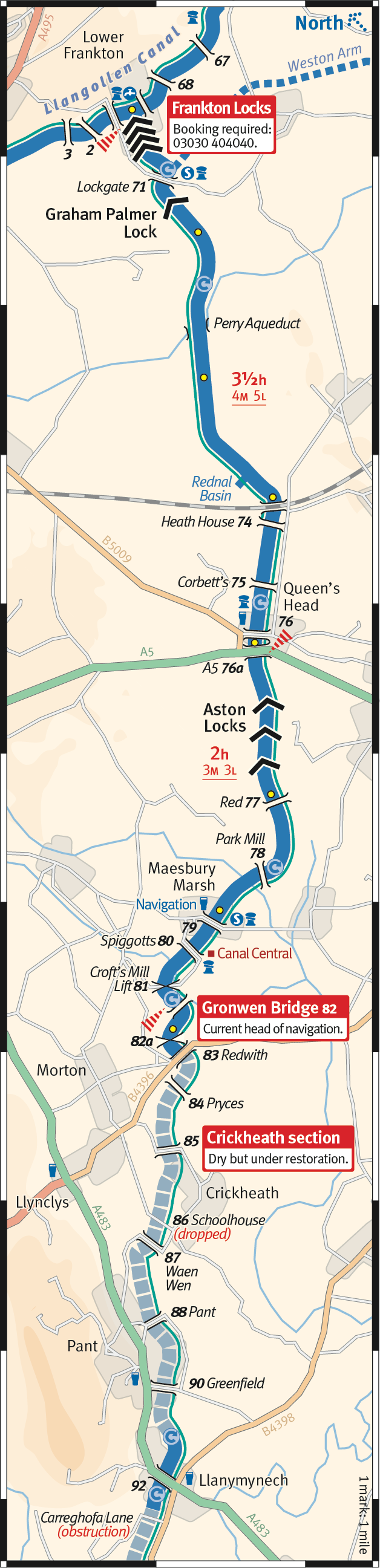
The Montgomery Canal.

The Trent & Mersey Canal.
