World & Country Population Map
Summary
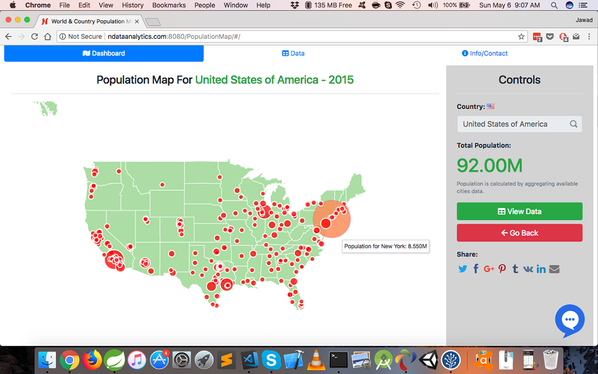
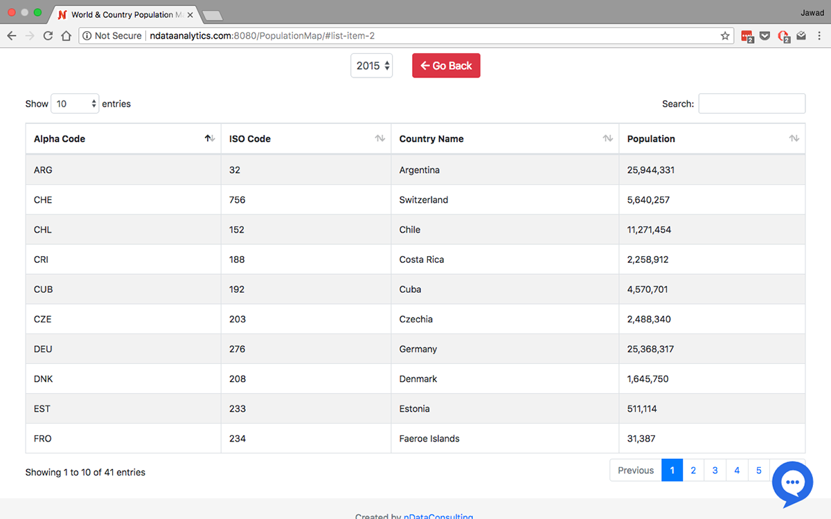
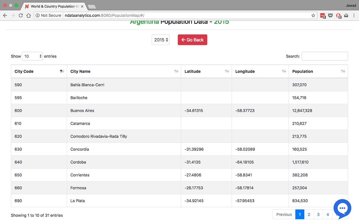
This World population dashboard allows to interactively explore global population data from years 1970-1995 for over 200 countries. This dashboard allows you to dig deeper into each country by visualizing population data for each city. This visualization uses census data collected by United Nations Statistics Division(UNSD). This dashboard integrates data from multiple sources to provide a unified picture of global and local population. This dashboard integrates country codes data along with location data for major cities of the world for each country with census data.
This dashboard uses DataMaps for the mapping solution, MongoDB as a database, Java Spring as a backend and Javascript/jQuery/d3.js code for front end. You can view an exhaustive list of all plugins and technologies used in the technologies section below.
You can view the interactive dashboard and interact with it here: http://bit.ly/2HSeHEj
You can find blog post detailing technical details about this dashboard here: http://www.jawadrashid.com/PopulationMap
Feel free to email me at jawad@ndataconsulting.com. Plus more contact information is present in the interactive dashboard in info tab.
Tools Used
Backend: Java Spring, MongoDBFroNT END: DataMaps, jQuery, D3.js, Bootstrap, jQueryUI, FontAwesome, jQuery UI Slider Pips, EasyAutocomplete, DataTables, Social Share Kit, Loading Overlay, Lodash, D3 Legend
Screenshots


Video Demo

