California Yes Voting Ratio For Required Labeling of GMO in 2012
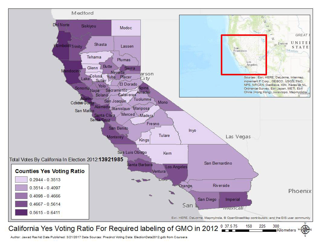
First at the base level i got date from source a file contained ElectionData2012.gdb. The dateset contained counties boundaries from state of Calinfornia and in addition seperate data for voting in 2012 election which contained location information, Yes voting to the ballot and total votes in each ballot station. First step involved using spatial join to use spatial information to add total votes and total YES voting for each county. Once the voting data using spatial join was sumarized to counties level then i added symbology to showcase for each county the propotion of YES to total votes. So the more brighter the color for the county meant more people votes YES for the option.Next, i switched to layout mode in ARCGIS and added more information like title, scale bar, data source and legends. At last step titles were added for counties in addition to minimap on top right to show the location of voting


