Generating Streamlines from Digital Elevation Model(DEM)
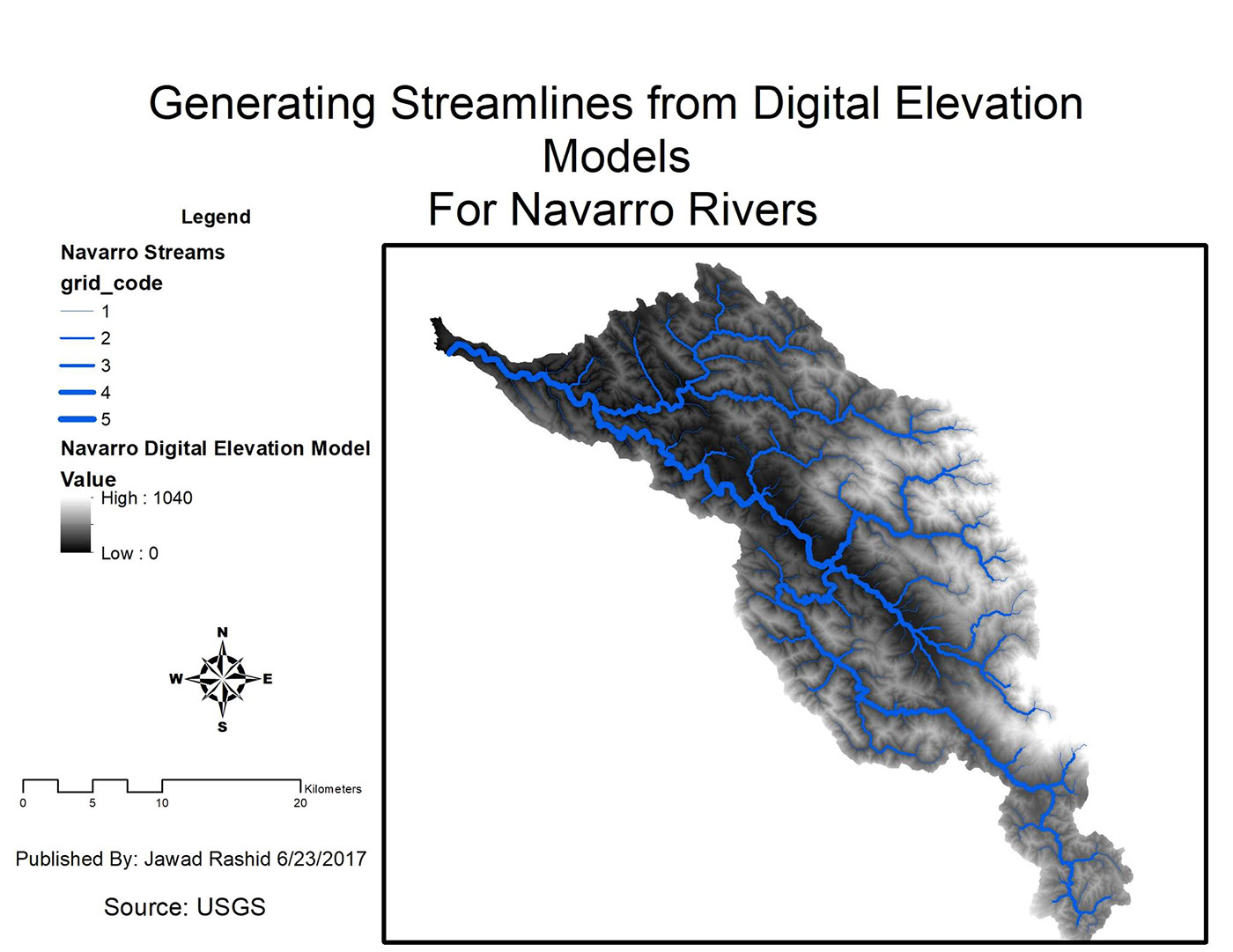
Starting with Digital Elevation Model(DEM) for Navarro Rivers i created a map showcasing the different major streams using #ArcGIS. Initially i had only DEM model(i.e. only digital elevation no rivers information) and use this to generate flow direction. From there i was able to find flow accumulation to determine the major rivers. Finally run more geo-processing tools to generate areas with highest accumulation and then categorize the different level of accumulation to different width of streamlines.


