![data visualization cartography information design World Map africa videography 3D Landscape map design Digital Art shaded relief](https://mir-s3-cdn-cf.behance.net/project_modules/1400/89799c196355959.661ea8199a50b.jpg)
(Almost) World map and
Southern Africa
Custom maps realized for XOverland Expedition.
For this project we realized the design of two big maps in a panoramic format and realized the shaded relief effect for digital animation and printed maps.
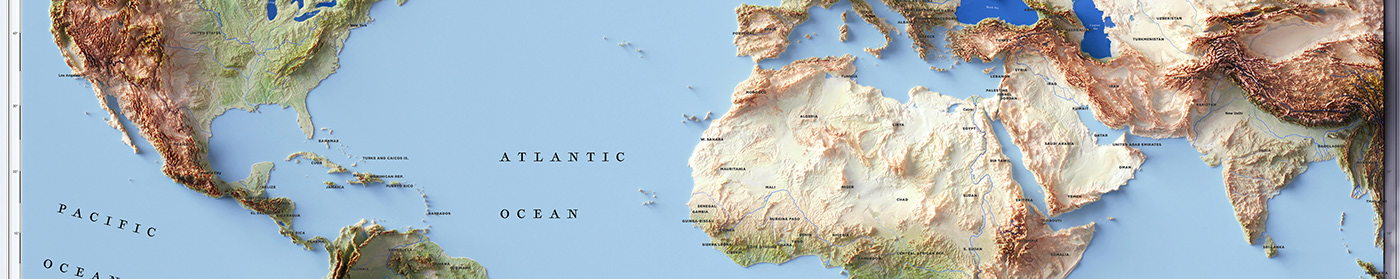
The world map starts in this way:
![data visualization cartography information design World Map africa videography 3D Landscape map design Digital Art shaded relief](https://mir-s3-cdn-cf.behance.net/project_modules/1400/48c6a0196355959.661ea8199af89.jpg)
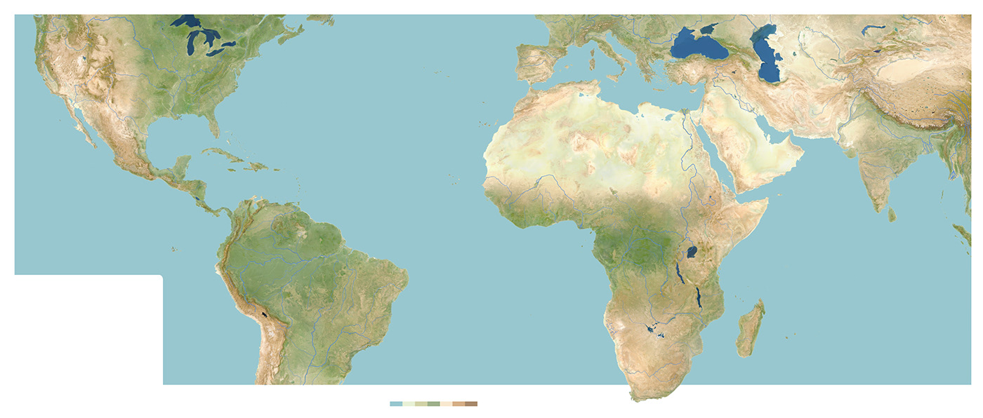
We realized a second map base too, but it was discarded during the testing phase.
![](https://mir-s3-cdn-cf.behance.net/project_modules/1400/ac6856196355959.661ea8167db97.jpg)
Set up the shaded relief
![data visualization cartography information design World Map africa videography 3D Landscape map design Digital Art shaded relief](https://mir-s3-cdn-cf.behance.net/project_modules/1400/05cbf5196355959.661ea8199b4a3.jpg)
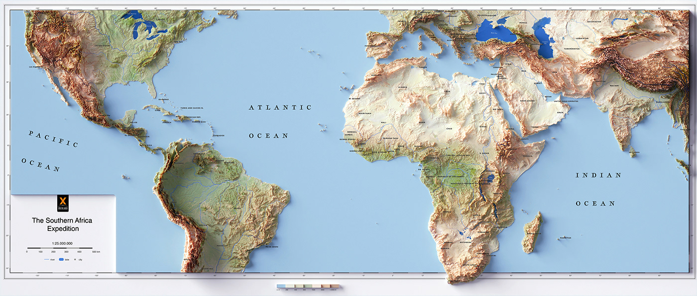
And the final map is here!
![data visualization cartography information design World Map africa videography 3D Landscape map design Digital Art shaded relief](https://mir-s3-cdn-cf.behance.net/project_modules/1400/a6beb4196355959.661ea8199a9bc.jpg)
We needed a Southern Africa too, so we start again from the base map:
![data visualization cartography information design World Map africa videography 3D Landscape map design Digital Art shaded relief](https://mir-s3-cdn-cf.behance.net/project_modules/1400/ac2ac6196355959.661ea8199a002.jpg)
Once again only the second map was choosen of the two drawn
![data visualization cartography information design World Map africa videography 3D Landscape map design Digital Art shaded relief](https://mir-s3-cdn-cf.behance.net/project_modules/1400/5070c5196355959.661ea8199c131.jpg)
Relief time
![data visualization cartography information design World Map africa videography 3D Landscape map design Digital Art shaded relief](https://mir-s3-cdn-cf.behance.net/project_modules/1400/63416f196355959.661ea8199bc59.jpg)
And final map of Southern Africa
![data visualization cartography information design World Map africa videography 3D Landscape map design Digital Art shaded relief](https://mir-s3-cdn-cf.behance.net/project_modules/1400/2c2489196355959.661ea819997c6.jpg)
Here some screenshot from the 1Ep of the XOverland Expedition.
![](https://mir-s3-cdn-cf.behance.net/project_modules/1400/6e977a196355959.661ea818136e2.png)
![](https://mir-s3-cdn-cf.behance.net/project_modules/1400/7f7a00196355959.661ea81812b11.png)
![](https://mir-s3-cdn-cf.behance.net/project_modules/1400/5d849a196355959.661ea81813d2c.png)
![](https://mir-s3-cdn-cf.behance.net/project_modules/1400/69e0ac196355959.661ea81813061.png)
![](https://mir-s3-cdn-cf.behance.net/project_modules/1400/2bd7c2196355959.661ea81814367.png)
If you like our work, want to see our daily work or want to say hello to our studio, consider to follow our Instagram or X account.
Otherwise if are interested in our prints or have a custom request check our shop Vizcart.io
For inqueries or commission, feel free to contact us at hello@vizart.io