Great Britain
We have selected some maps of the Island from Bartholomew's Survey Atlas of 1912 and the Bartholomew Revised Half-Inch Map of the 1940s.
This work is complementary to that published earlier which showed Britain and Ireland at a larger scale.
This work is complementary to that published earlier which showed Britain and Ireland at a larger scale.
If you want to see our daily work or want to say hello to our studio, you can find us on Instagram and Twitter.
Otherwise if you are interested in our fine art prints check our shop vizcart.io
Otherwise if you are interested in our fine art prints check our shop vizcart.io
For inqueries or custom commission, feel free to contact us at hello@vizart.io
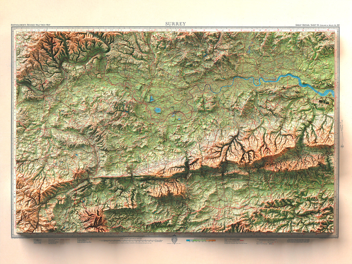
Surrey, 1942
Topographic map


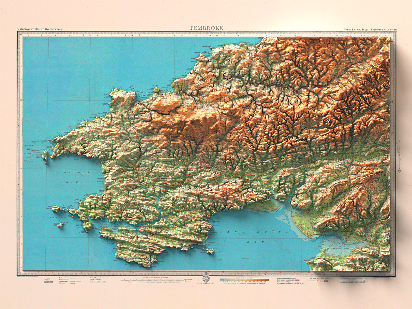
Pembroke, 1942
Topographic map


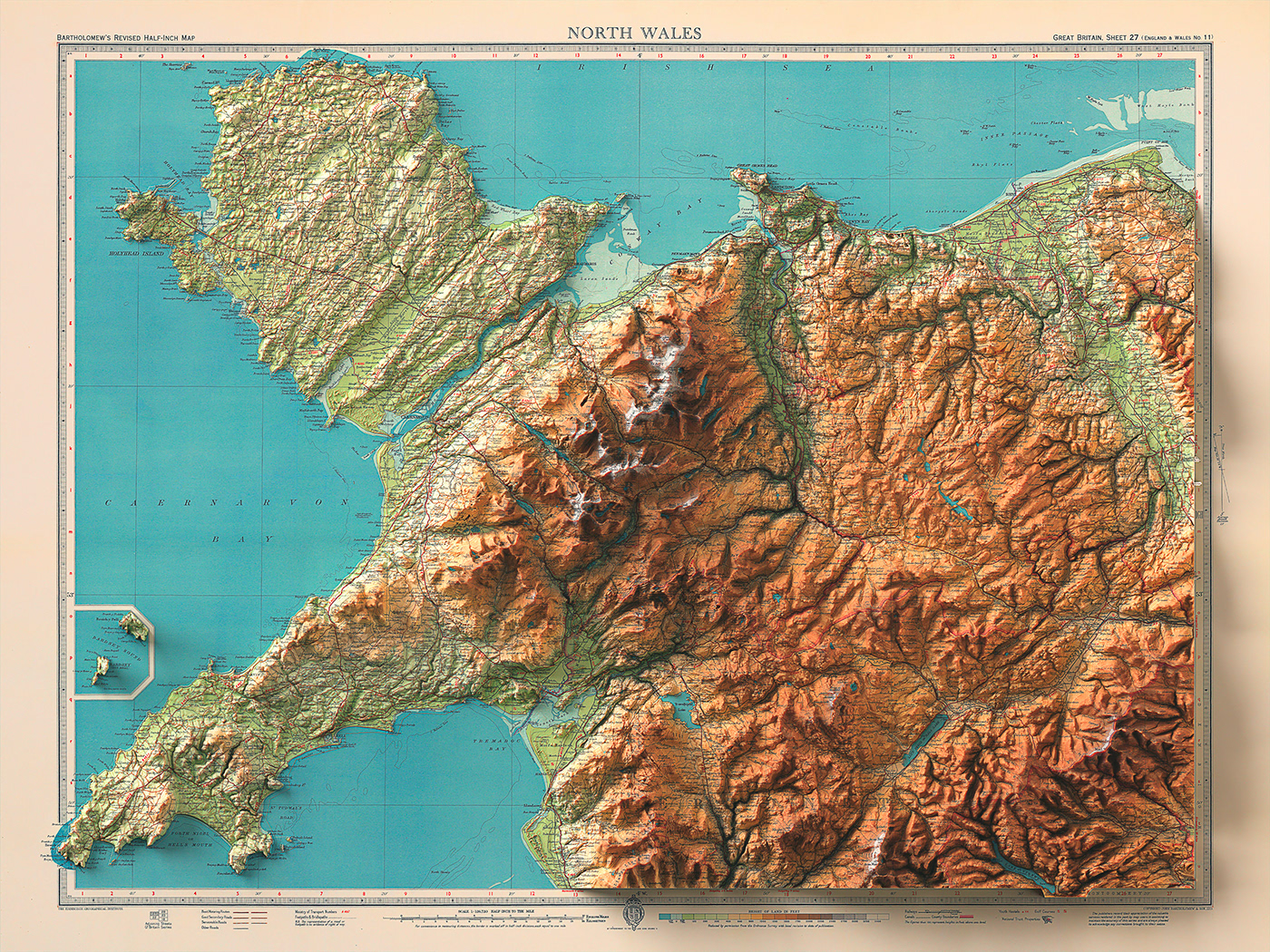
North Wales, 1941
Topographic map


Merseyside, 1941
Topographic map


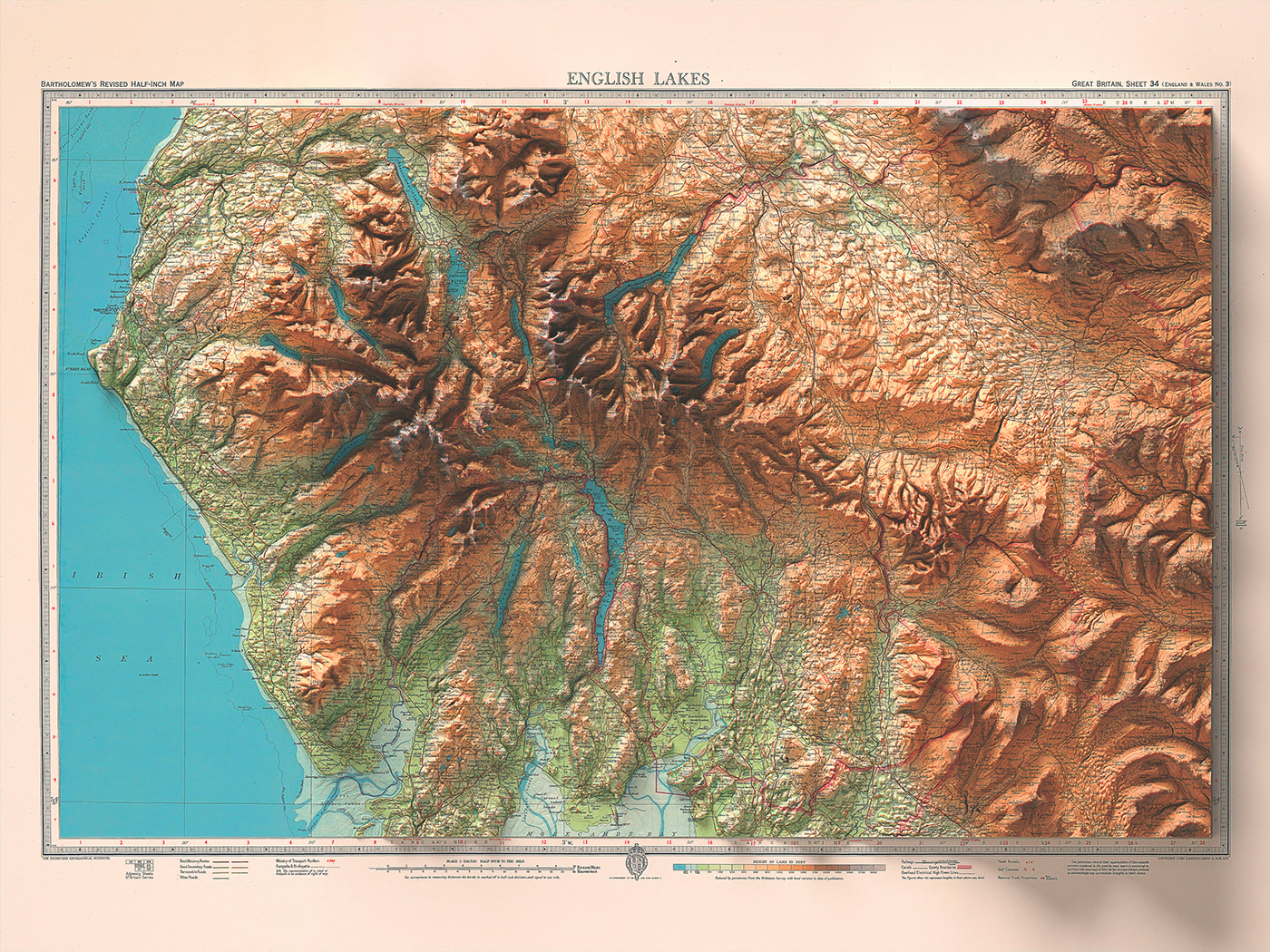
English Lakes, 1941
Topographic map


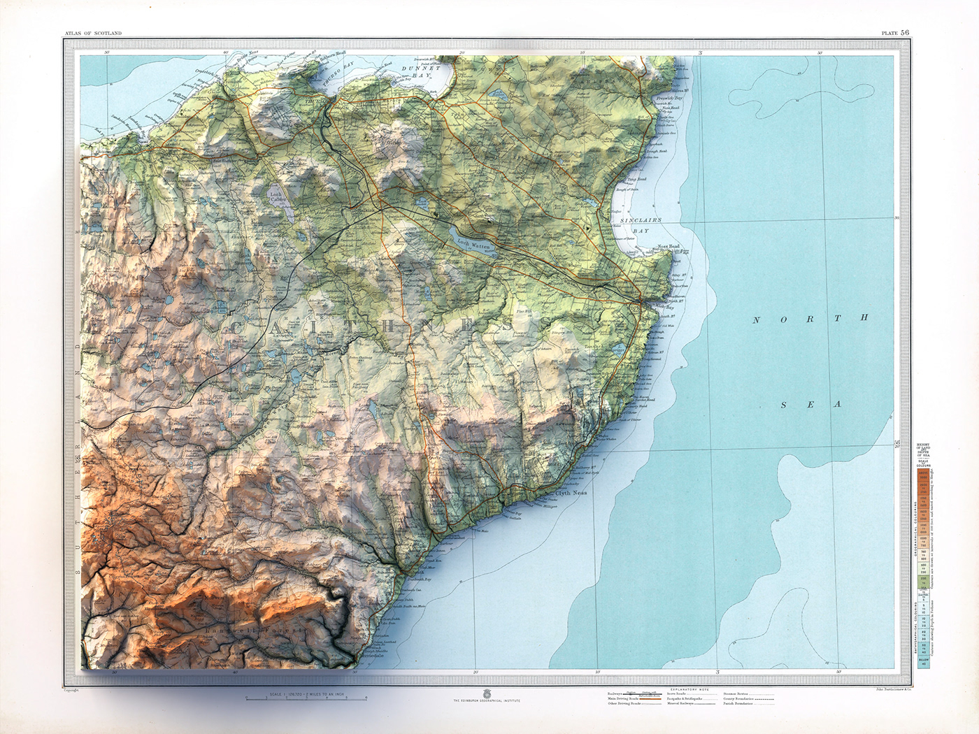
Thurso, 1912
Topographic map


Ullapool, 1912
Topographic map


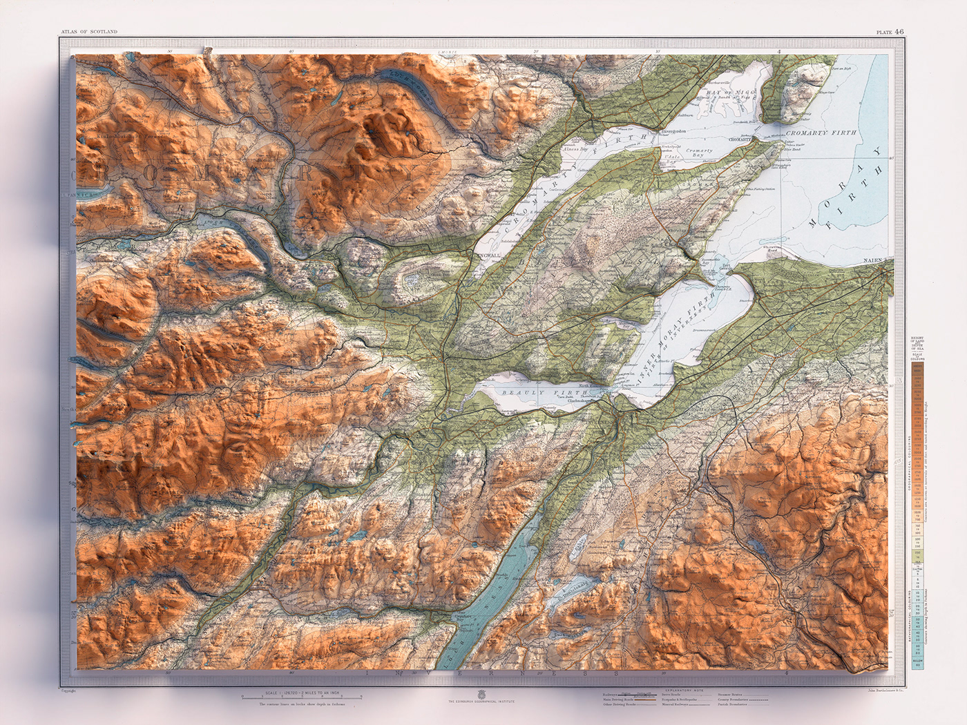
Inverness, 1912
Topographic map


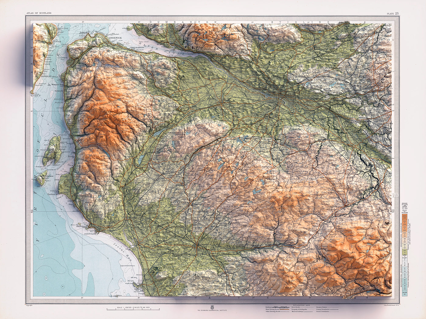
Glasgow, 1912
Topographic map


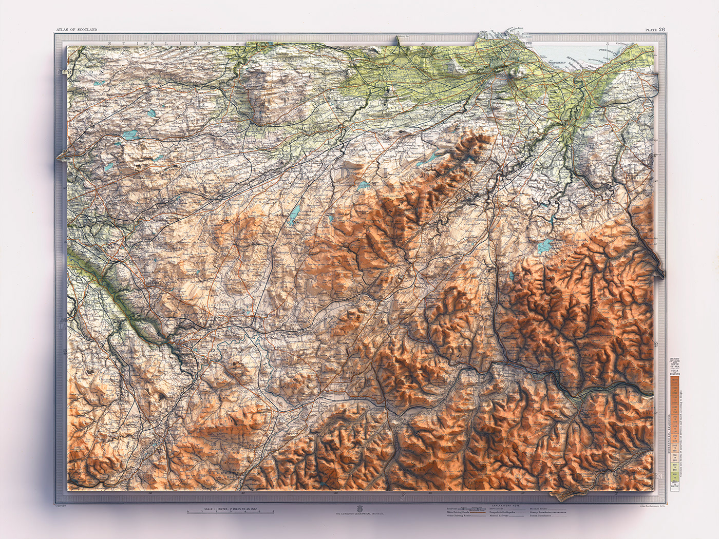
Edinburgh, 1912
Topographic map