British Isles and Ireland
This heterogeneous collection shows our progressive graphic exploration of the British Isles and Ireland. Later it could be expanded with a series dedicated to Ireland, or perhaps it would deserve a proper space in another project. For the time being, therefore, in addition to general maps of different dates, there are specific maps of England, Wales and Scotland.
If you want to see our daily work or want to say hello to our studio, you can find us on Instagram and Twitter.
Otherwise if you are interested in our fine art prints check our shop vizcart.io
Otherwise if you are interested in our fine art prints check our shop vizcart.io
For inqueries or custom commission, feel free to contact us at hello@vizart.io


Geological map of the British Islands. Based on the work of the Geological Survey, by the Director General, Ordnance Survey, J.J. H. Teall, M.A., D. Sc, F.R.S, Ordnance Survey Office, Southampton, 1906.
Source: National Library of Scotland
Source: National Library of Scotland


British Isles – bathy-orographical, Bartholomew, John George, Times Survey Atlas of the World, London, The Times, 1920.
Source: National Library of Scotland
Source: National Library of Scotland


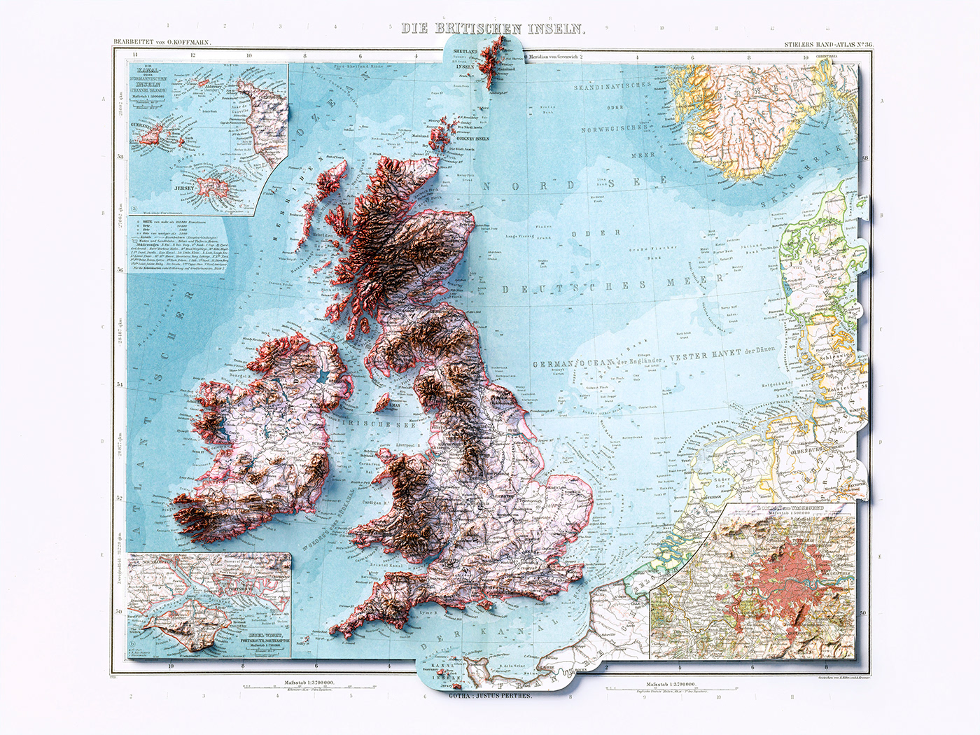
Nr. 36. Die Britischen Inseln. (inset) London. Die Kanal oder Normannischen Inselen. Stieler's Hand-Atlas, A. Stieler, C. Vogel, O. Koffmahn; 1911.
Source: David Rumsey Collection
Source: David Rumsey Collection


