
3D Cartography of Spain
A journey through Spain using maps of its wide and complex territory.
This print is a combination of vintage maps and 3D models digitally rendered to show the relief of the territory, through the elaboration of Digital Elevation Model.
If you like our work, want to see our daily work or want to say hello to our studio, consider to follow our Instagram account.
Otherwise if are interested in our prints or have a custom request check our shop Vizcart.io
Otherwise if are interested in our prints or have a custom request check our shop Vizcart.io
For inqueries or commission, feel free to contact us at hello @ vizart . io


Mapa de suelos de España: Península y Baleares, Instituto Nacional de Edafología y Agrobiología, Madrid, 1966.
Source: European Soil Data Centre (ESDAC)
Source: European Soil Data Centre (ESDAC)


Iberian Peninsula 1:250,000: Alicante, sheet 65. Series A.M.S. M581
Source: University of Texas.
Source: University of Texas.


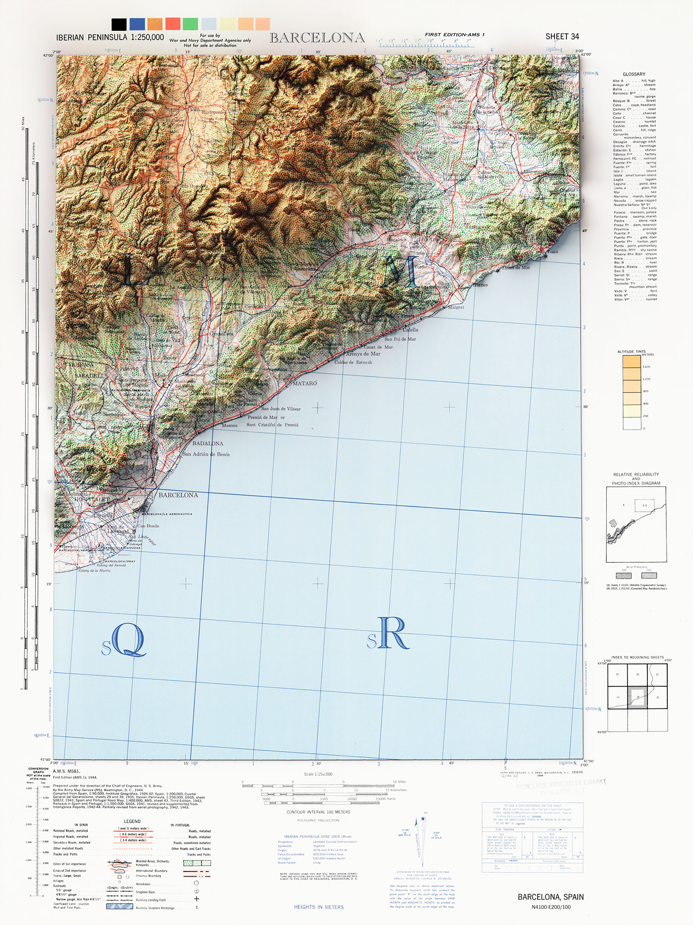
Iberian Peninsula 1:250,000. Barcelona, sheet 34. Series A.M.S. M581. 1944
Source: University of Texas.
Source: University of Texas.


Iberian Peninsula 1:250,000. Burgos, sheet 15. Series A.M.S. M581. 1944
Source: University of Texas.
Source: University of Texas.


Iberian Peninsula 1:250,000. Burgos, sheet 15. Series A.M.S. M581. 1944
Source: University of Texas.
Source: University of Texas.


Iberian Peninsula 1:250,000: Toledo, sheet 51. Series A.M.S. M581
Source: University of Texas.
Source: University of Texas.


