
3D Geologic Cartography of USA by States
This collection is about geologic maps of United States.
The maps featured are mainly realized between '40s and '90s by USGS.
The maps featured are mainly realized between '40s and '90s by USGS.
Our images are a combination of restored vintage map and 3D model, digitally rendered to show the relief of the territory, through the elaboration of Digital Elevation Model.
If you like our work, want to see our daily work or want to say hello to our studio, consider to follow our Instagram account.
Otherwise if are interested in our prints or have a custom request check our shop Vizcart.io
Otherwise if are interested in our prints or have a custom request check our shop Vizcart.io
For inqueries or commission, feel free to contact us at hello @ vizart . io


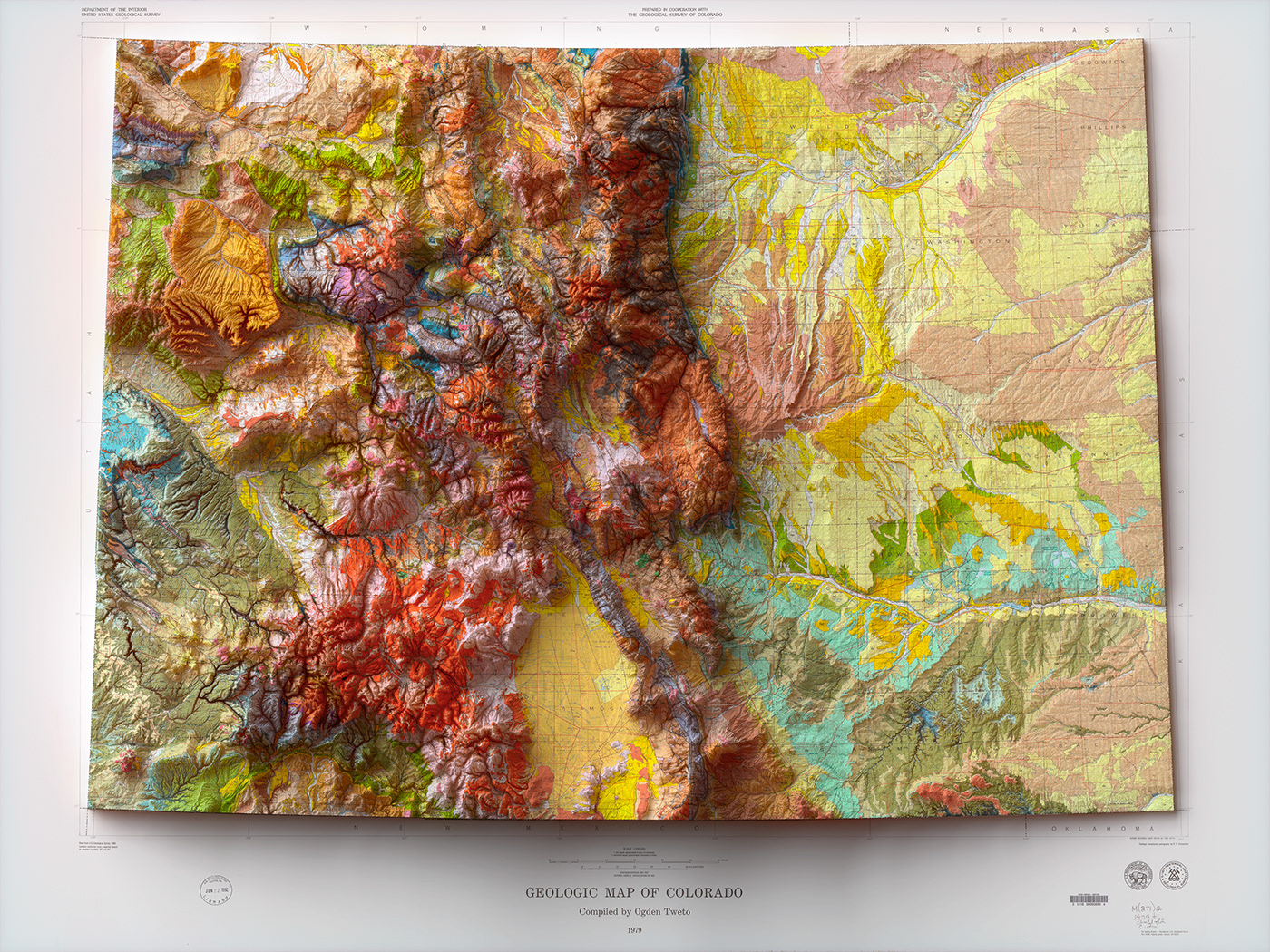
Geologic map of Colorado, U.S. Geological Survey, Tweto, Ogden, 1979.
Source: USGS.
Source: USGS.


Geologic Map of the State of Idaho, U.S. Geological Survey, Clyde P. Ross,J. Donald Forrester; 1947.
Source: idahogeology.
Source: idahogeology.


Geologic map of Oregon, U.S. Geological Survey, Walker, G.W., and MacLeod, N.S., 1991.
Source: USGS.
Source: USGS.


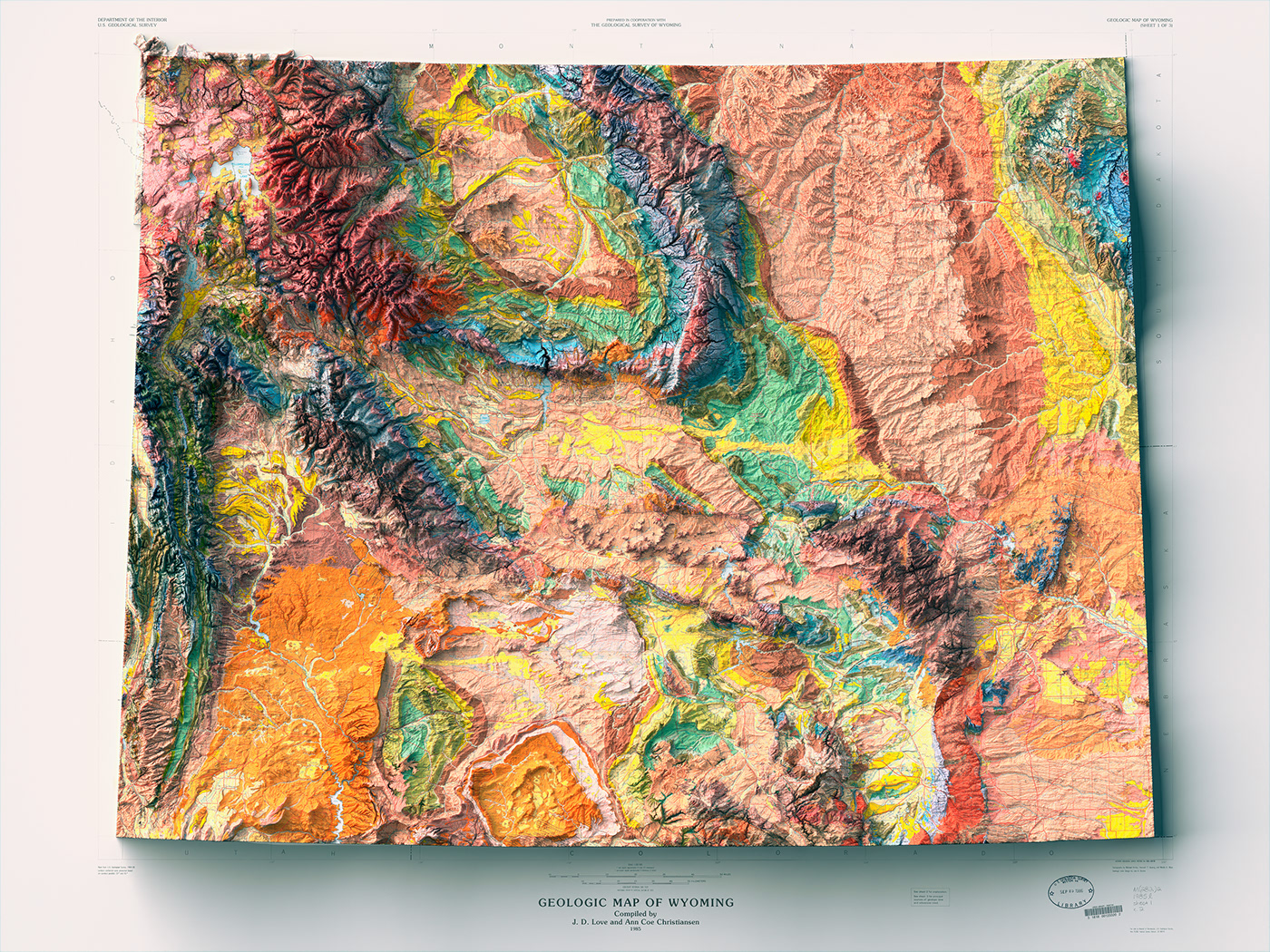
Geologic map of Wyoming, U.S. Geological Survey, Love, J.D., and Christiansen, A.C., 1985.
Source: USGS.
Source: USGS.


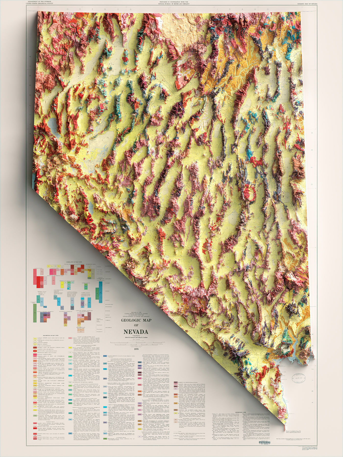
Geologic map of Nevada. Stewart, J.H., and Carlson, J.E.,U.S. Geological Survey; 1978.
Source: USGS
Source: USGS


