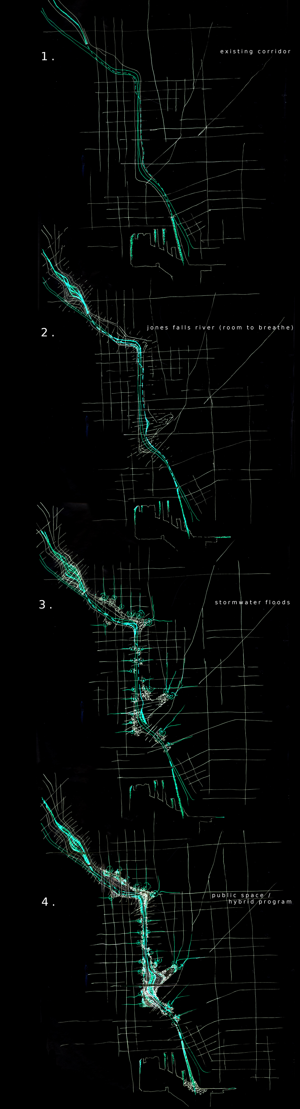
concept diagram sequence
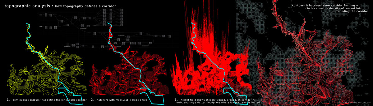
topographic analysis : contours, hatchers, slope-based height field, and composite mappings show how an erroded river corridor fans out to become the ground of Baltimore city
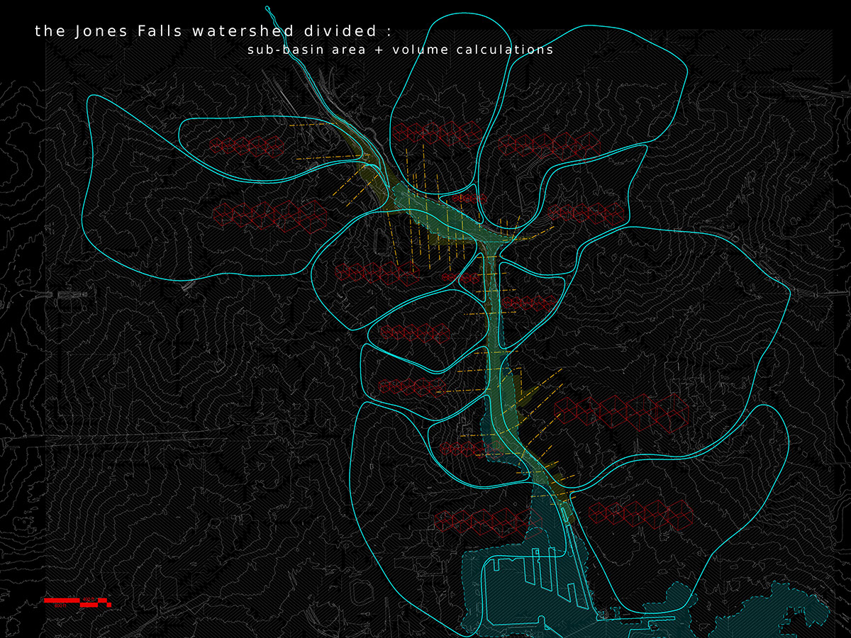
parametric analysis of the urban topography identifies watershed sub-basins that drain into the Jones Falls corridor, and calculates their precise areas

sub-basin areas yield volumes for the various design floods conservatively assuming 100% impermeability. these volumes are imagined populating the edges of the corridor site

how to construct a voronoi area diagram

manipulating grids of dots to conform to site traces and geometires generates adaptive voronoi field strategies with calculable area divisions
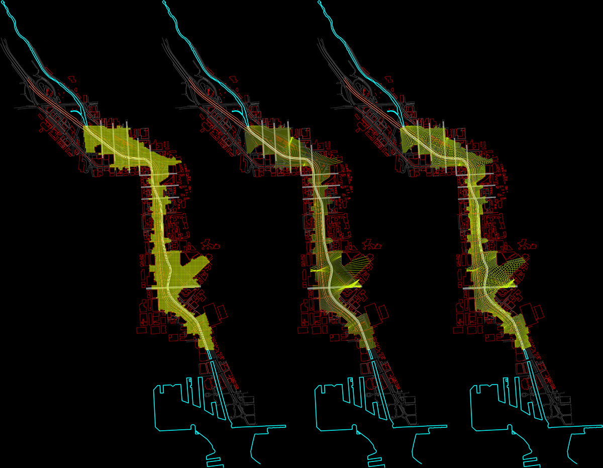
this strategy is adopted along the entire site

creating a field pattern that is a direct repsonse to site geometries and lines of motion
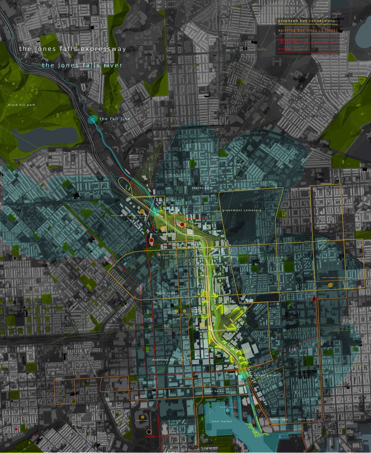
Baltimore city drains to the newly unearthed Jones Falls corridor, which doubles as a public circulation line that bridges gaps in the existing transport networks and connects important cultural nodes throughout the city

prototypical plan : articulated stormwater basin landscapes, unearthed Jones Falls River, and intensified public transport infrastructure along the Jones Falls Expressway
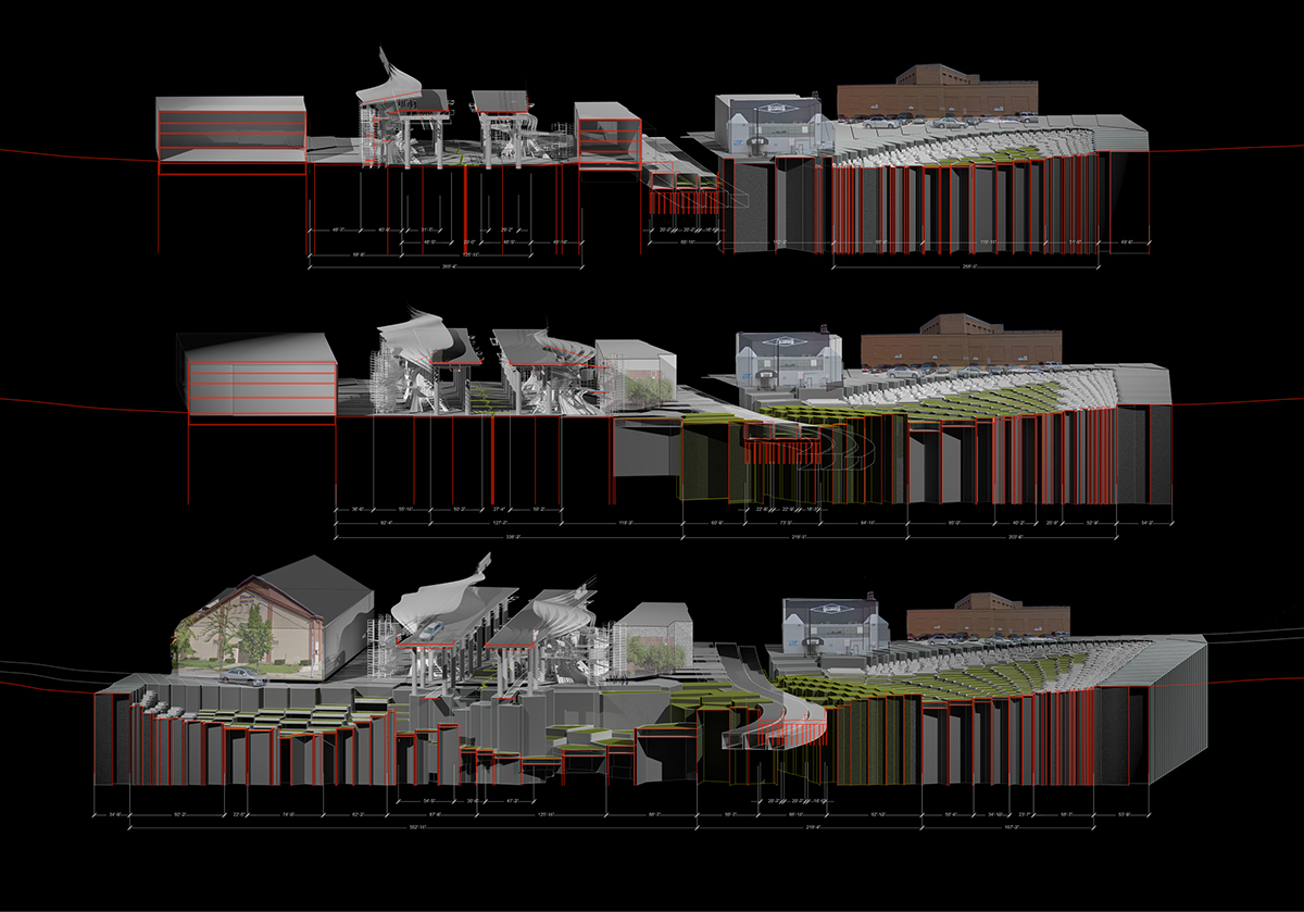
section / perpectives
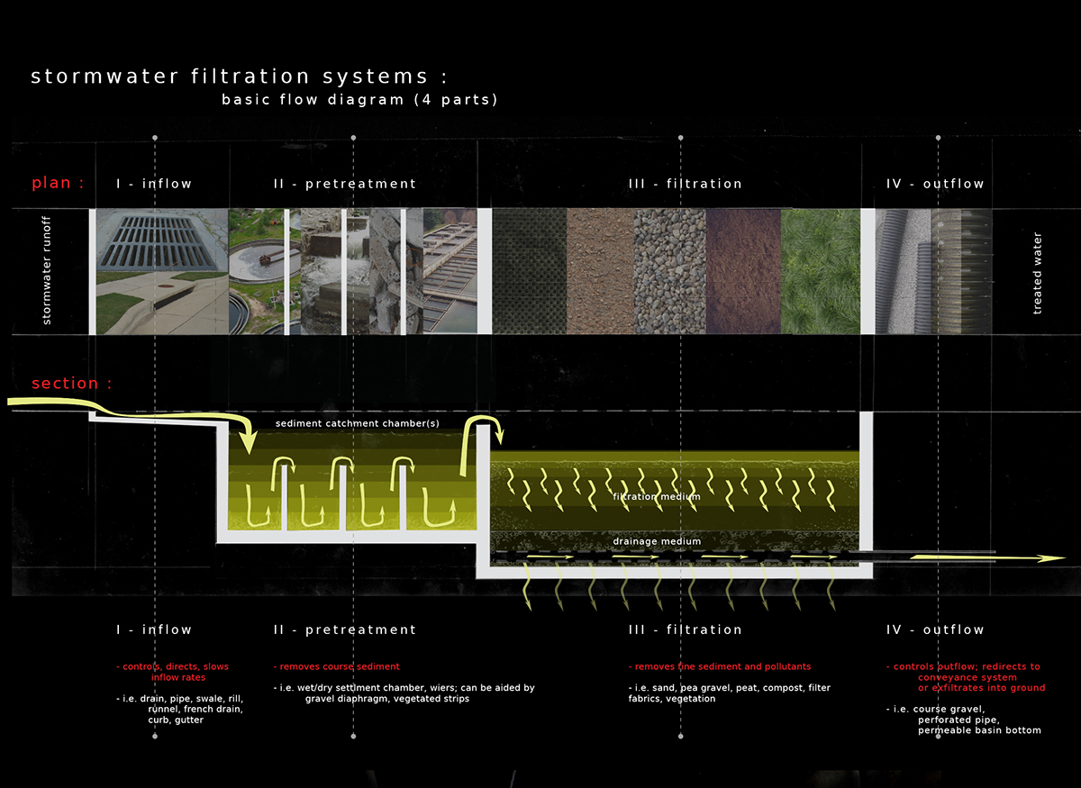
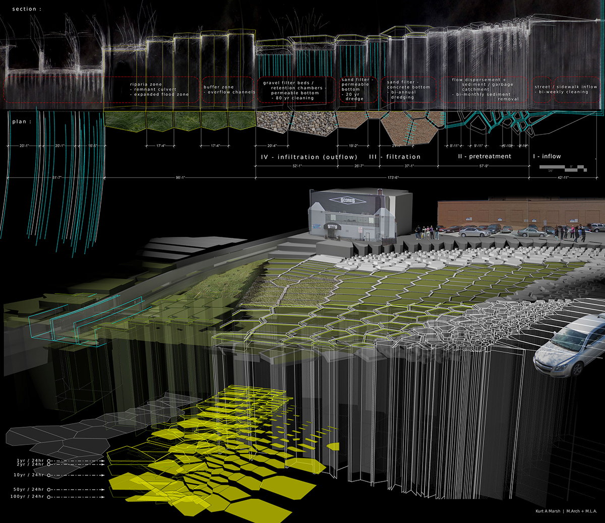
section through stormwater filtration landscape showing stages of filtration on site; diagram showing necessary depths for different design storm (100yr/24hr used in design)

public stormwater filtration landscape

infrastructural scaffolds envelope and run along the Jones Falls Expressway, generating and conducting power and connecting the JRX to the ground below


alongside the JFX

underneath the JFX

