A fun project to recreate the latest iteration of the official Washington Metro system map at geographic scale, while retaining its look and feel.
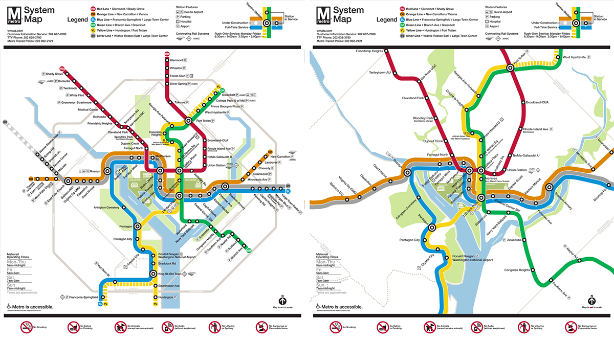
Fitting the to-scale map in the same space used on the official map (left).
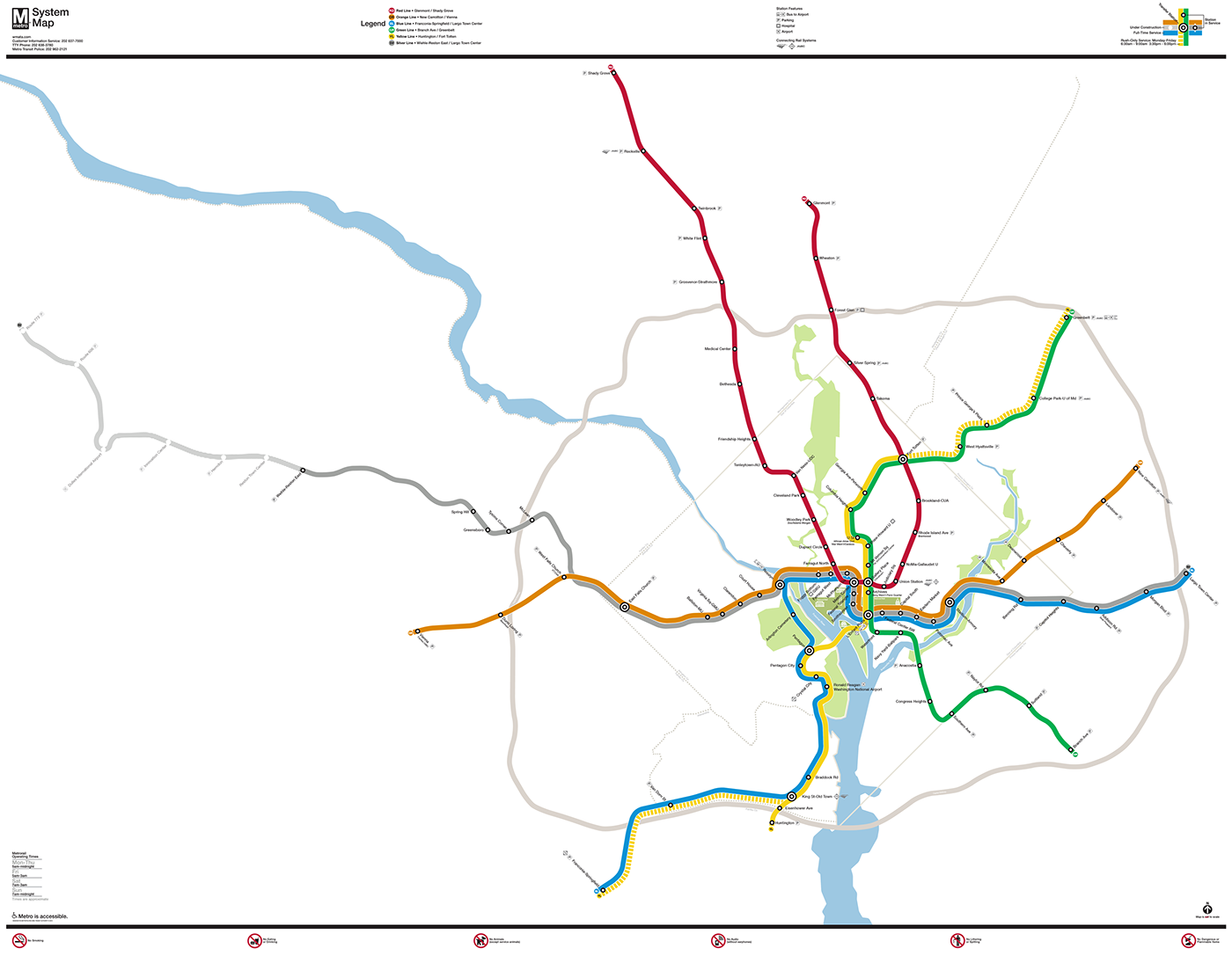
Full to-scale map. The system lines and geographic details were hand-traced from Google Maps and imported to Illustrator.
View a full-size version here.
View a full-size version here.
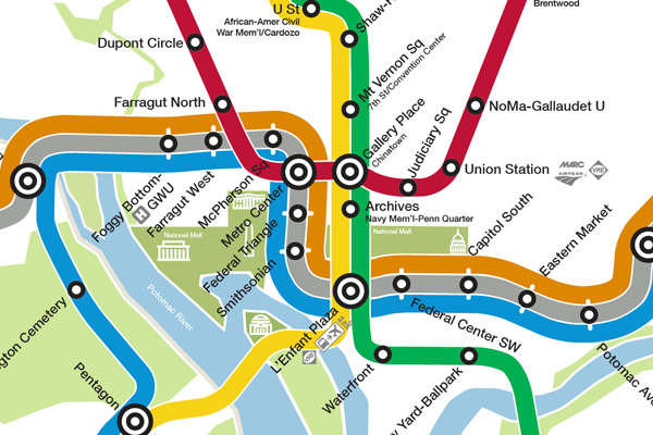
Detail of downtown core.
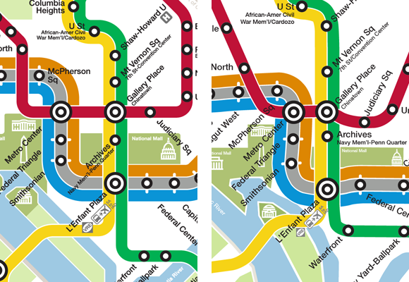
Downtown core comparison.