Trinity Metro ZIPZONE Flyers
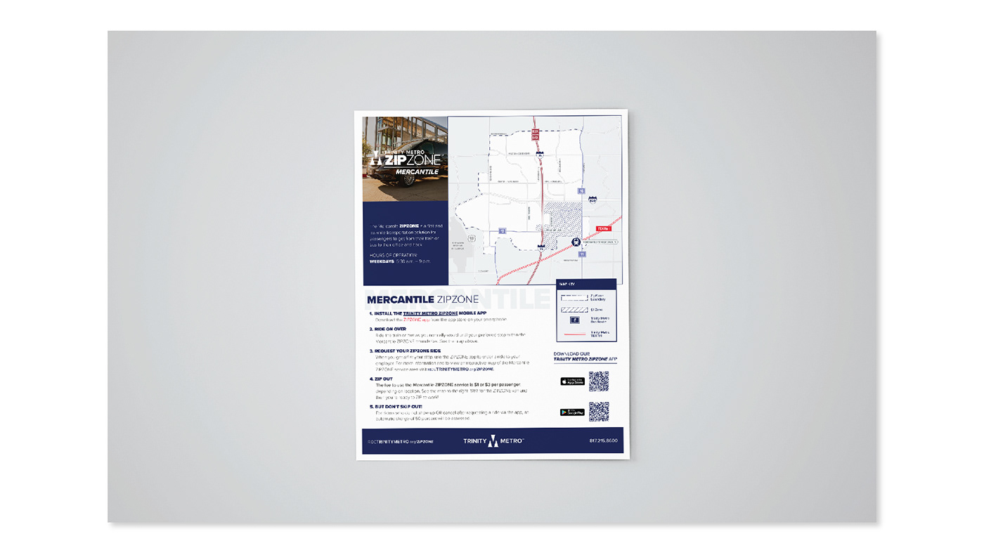
Trinity Metro ZIPZONEs are rideshare assisted services ares that transport customers of Trinity Metro to business organizations that can't be reached by fixed route bus services. Using the ArcGIS Illustrator Plugin produced by ESRI, I was able to import GIS files to outline service areas and stylize roadways and regions for clear and concise, but aesthetically pleasing illustrative maps.