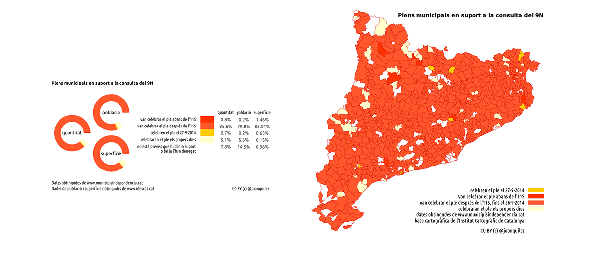
Joan Quílez made the maps of municipalities wich supported the vote for the independence of Catalonia in november 9, 2014 (A.K.A. 9N, or catalan independence referendum 2014)
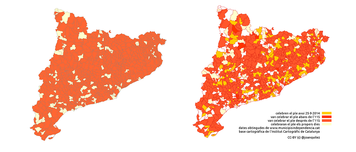
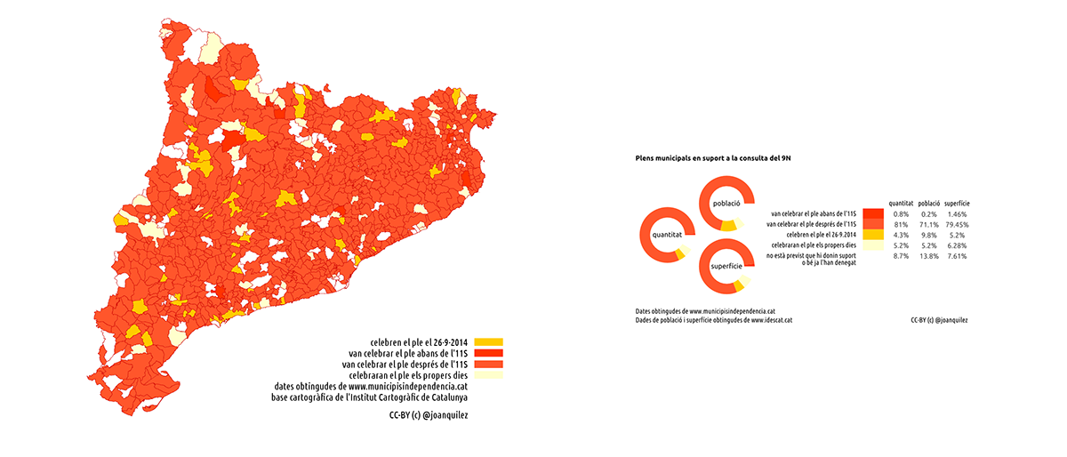
The maps sequence shows the evolution of town hall's support during the few days before voting. It were made with data from AMI (association of municipalities for the independence of Catalonia) and Idescat. Cartographic data were from ICC (Cartographic Institute of Catalonia).
All analysis were done with LibreOffice and gvSIG and maps were done with gvSIG. Although data were not consistent, the maps were published while data were evolving, thanks to ad-hoc link tables.