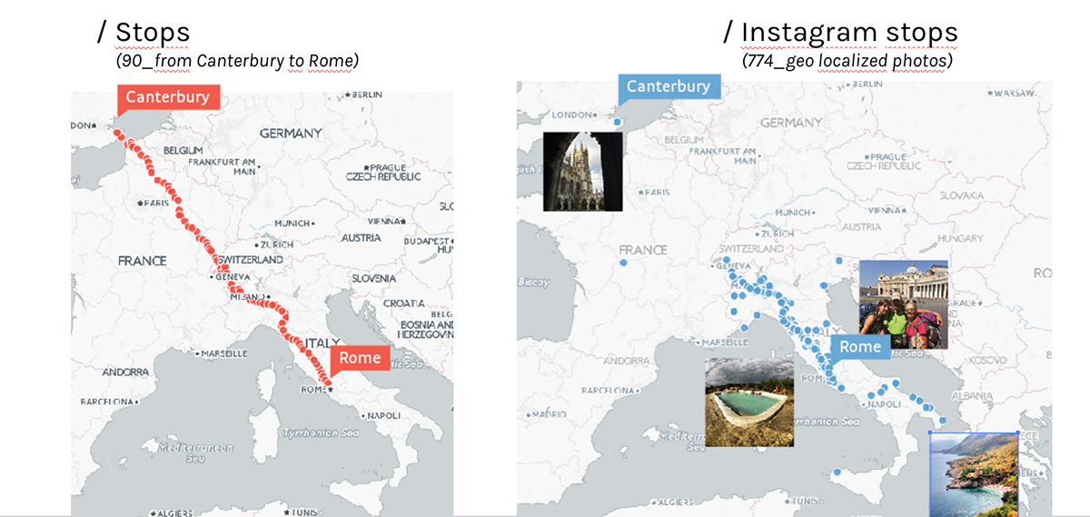
This project studies the Via Francigena, a 1800 km itinerary stretching from Canterbury to Rome across Italy, Switzerland, France and UK, taken by more than 50,000 pilgrims in 2014.

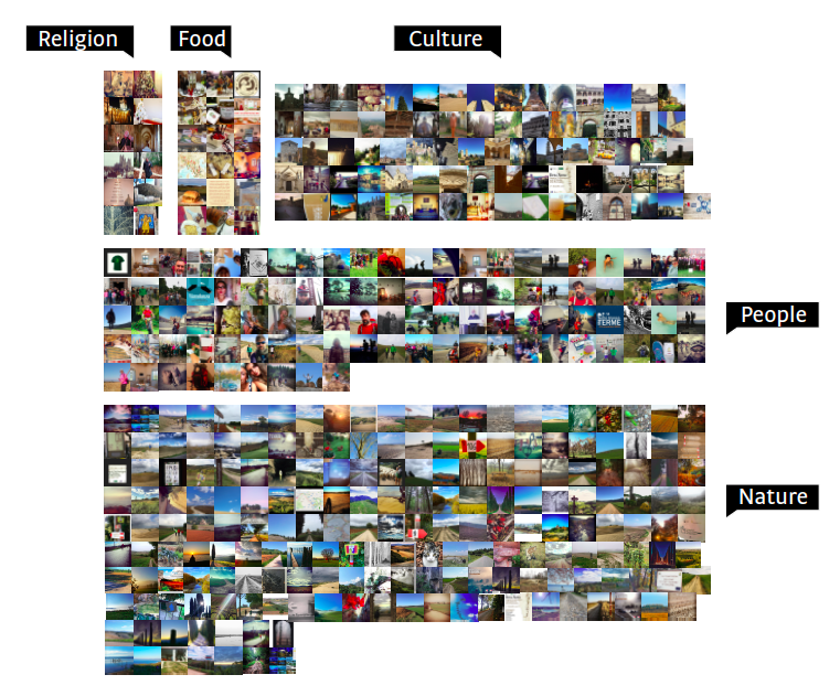
The last 400 photos posted on Instagram with the hashtag #francigena (13 January 2016) were manually classified.
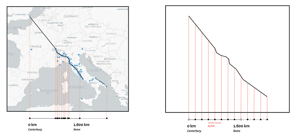
774 geo localised photos with the hashtag #francigena were plotted on a map, and comparet to the 90 official stops of the route.
The route stops were projected on a linear path with an approximation of 25 km
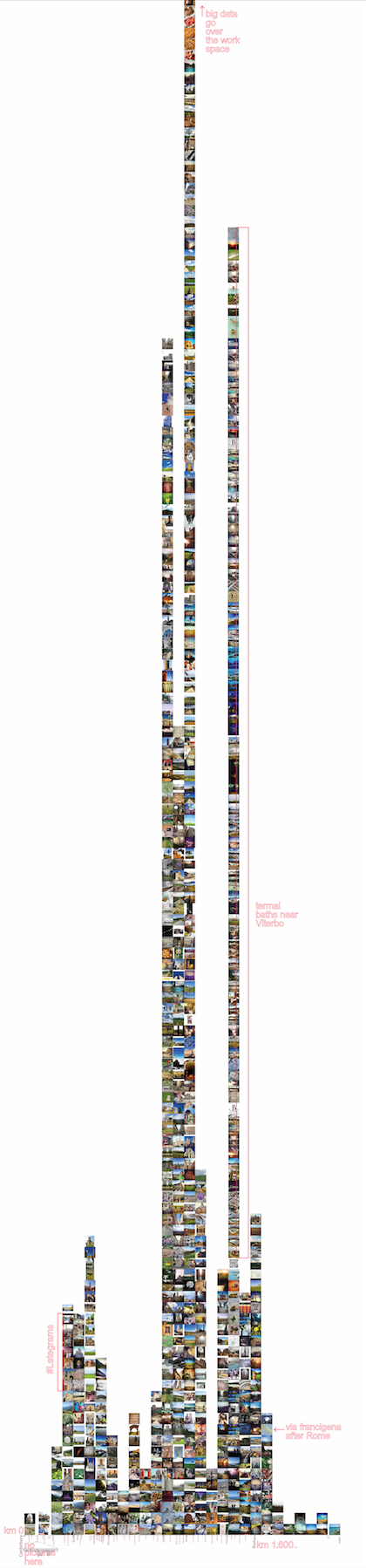
to quantify Instagram users engagement with each stop, all the photos were plotted on the approximated path, which was then analysed in its visual content and manually annotated.


to perceive the engagement (represented by the amount of pictures per stop) in a more straight forward and quick way, a composite animated gif was created: each stop is represented by an animated gif, which is created with all the photos geo localised in that stop; the flickering speed of the gif is proportional to the number of photos.

