SILVER MEDAL at European Design Awards 2017
VISUAL COMMUNICATION HONOREE – Runner Up at Core77 Design Awards 2017
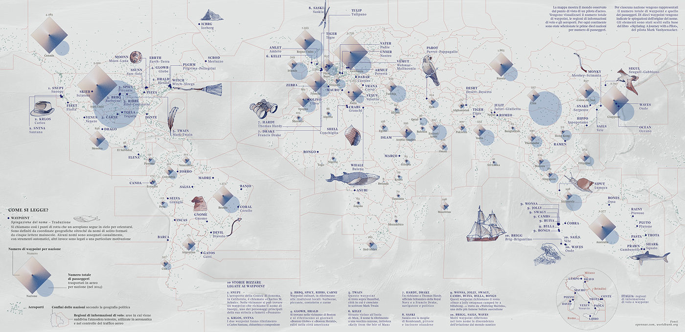
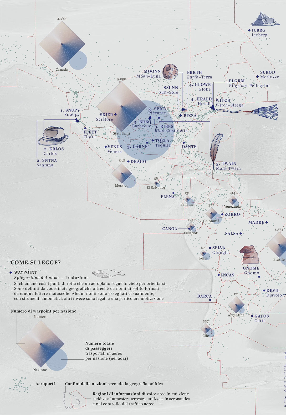
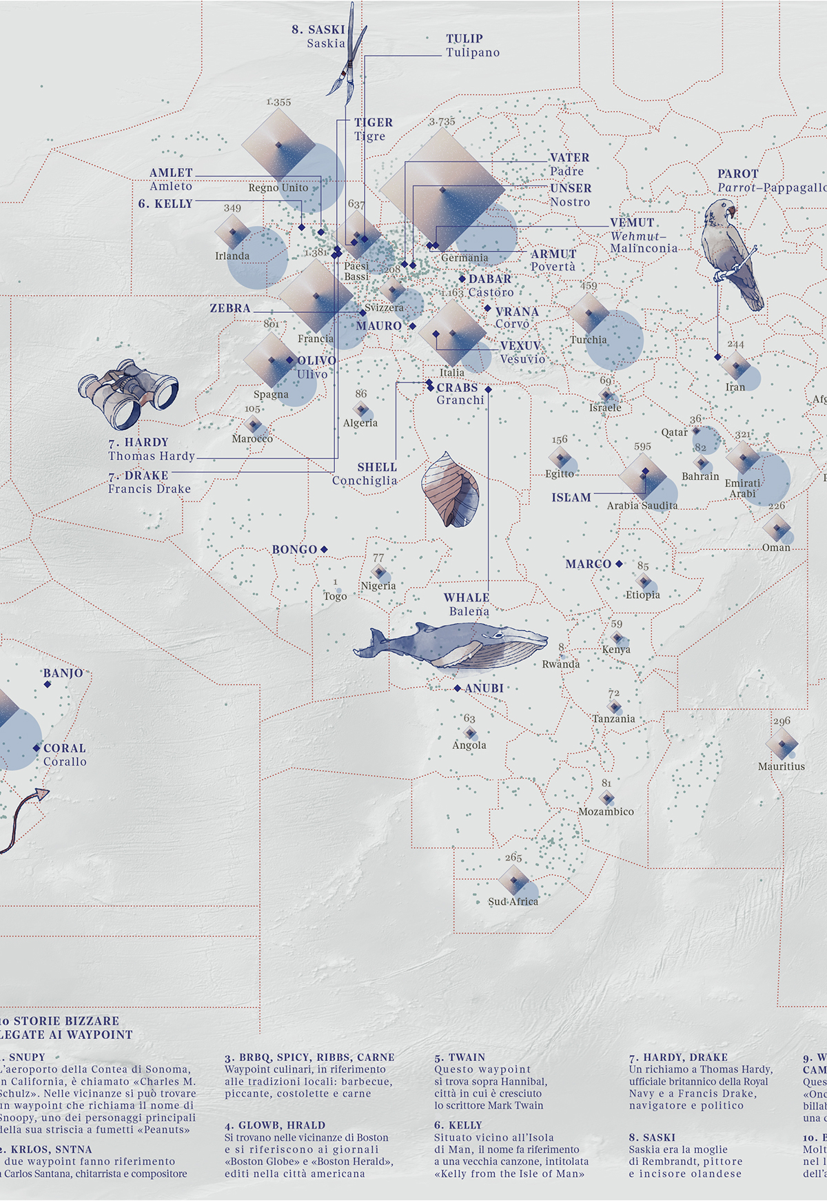
Sky Map
The world as seen by a pilot
Artwork for Visual Data, the column on "La Lettura" and Corriere.it
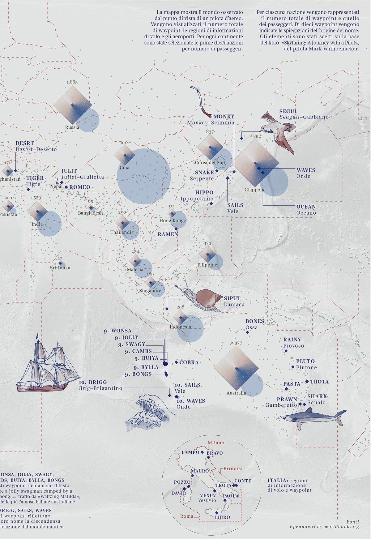
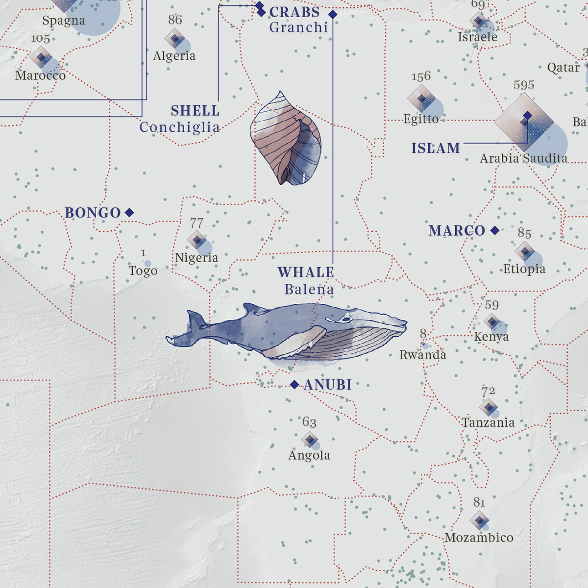
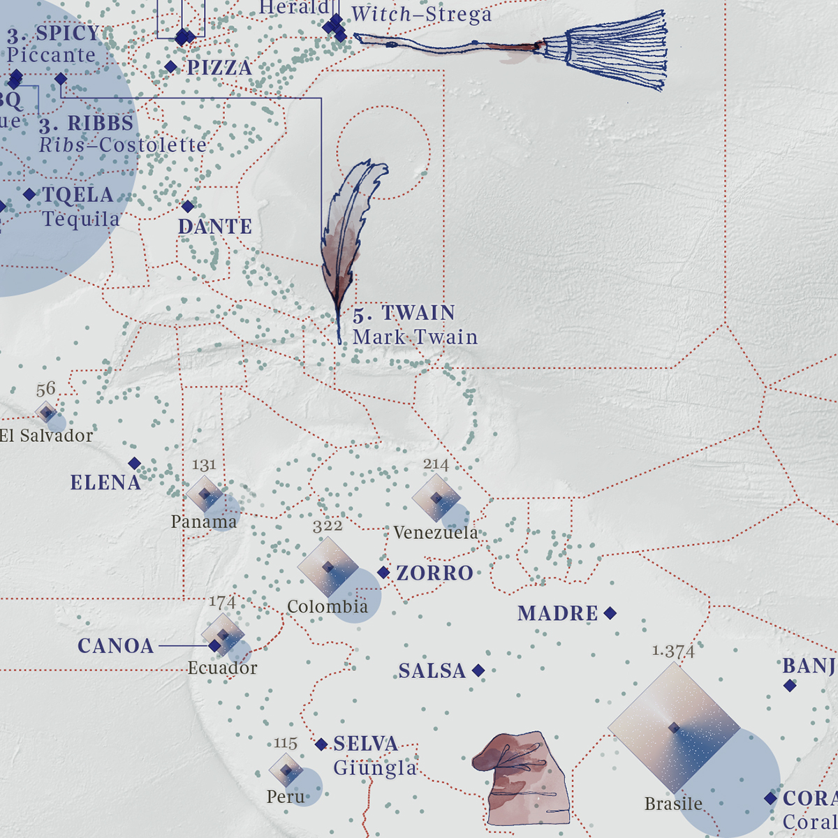
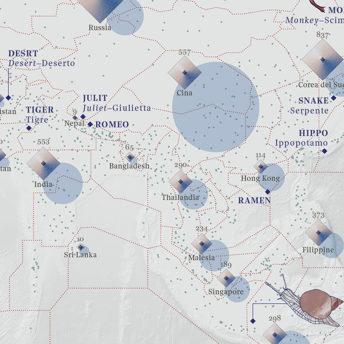
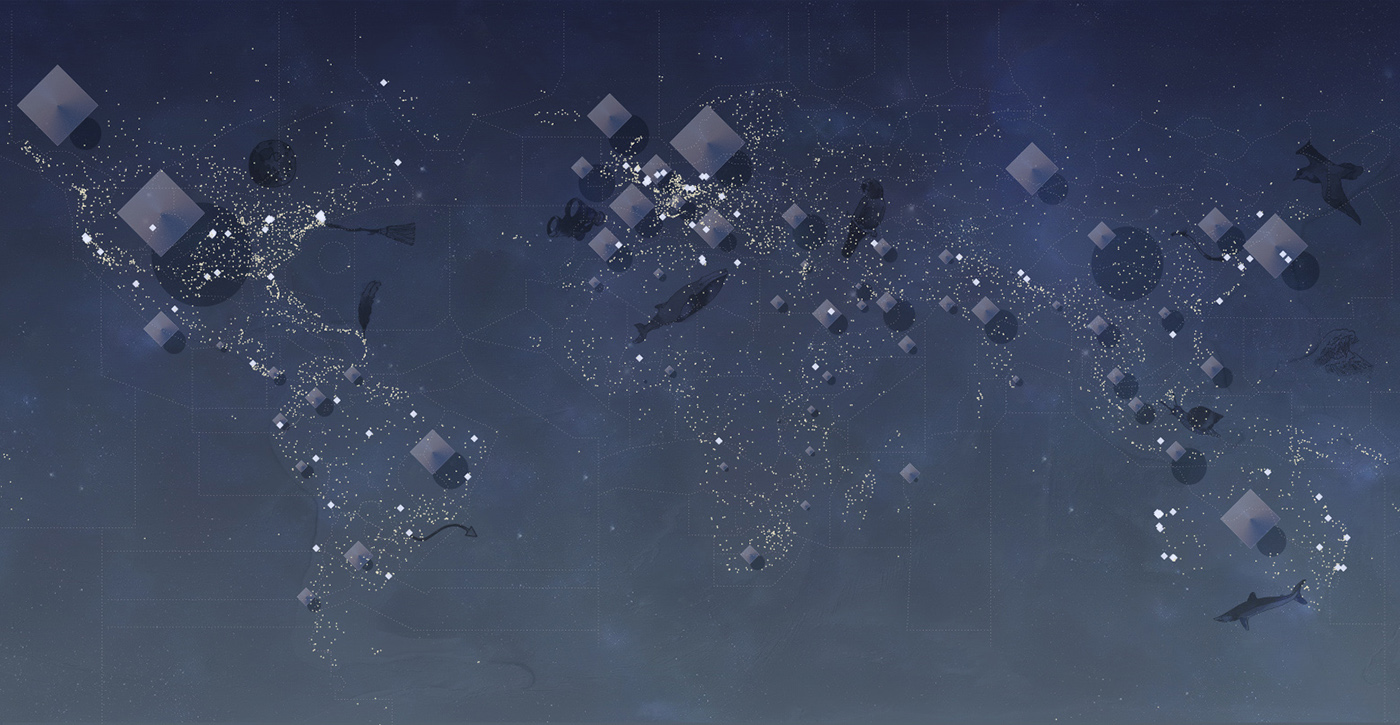
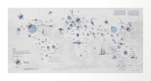
The project is a visual representation of the world, seen through the eyes of a pilot. The map has been inspired by Mark Vanhoenacker's book Skyfaring. A Journey with a Pilot.
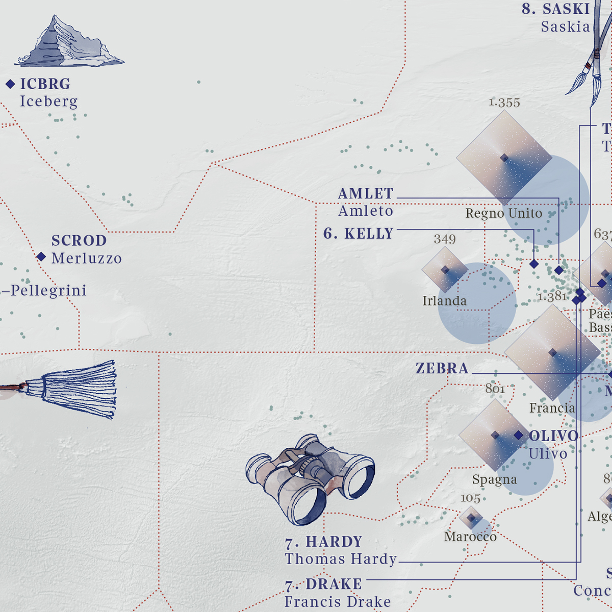
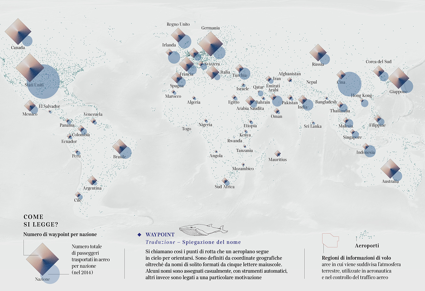
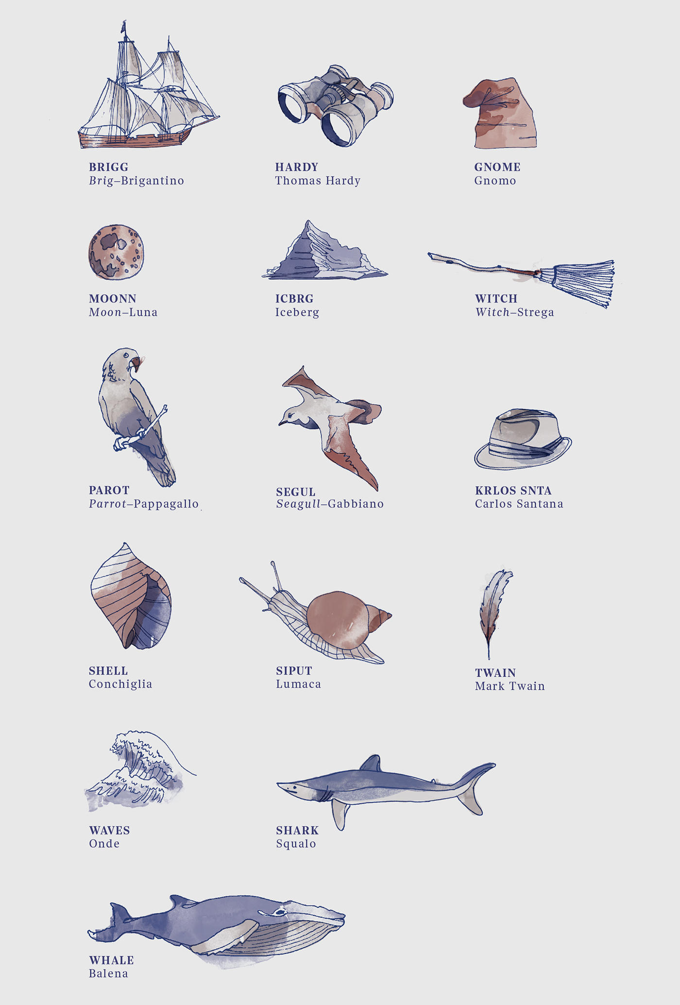
On the map the airports and the FIR (the regions of airspace) are indicated. For each continent, the 10 countries with the highest number of airline passengers have been selected. For each country are indicated: the total number of passenger and the number of waypoints (the reference points used by pilots to create the routs). Each waypoint is defined by a name. The most interesting waypoints' names have been visualized and illustrated.
Data analysis, data visualization and illustrations by Federica Fragapane.
🎐 Instagram: federicafragapane
🔖 Twitter: fedfragapane
The map
You can now buy the map on Society6!

Details
The interactive version
Explore it on Corriere.it!
The illustrations
Night Sky Map
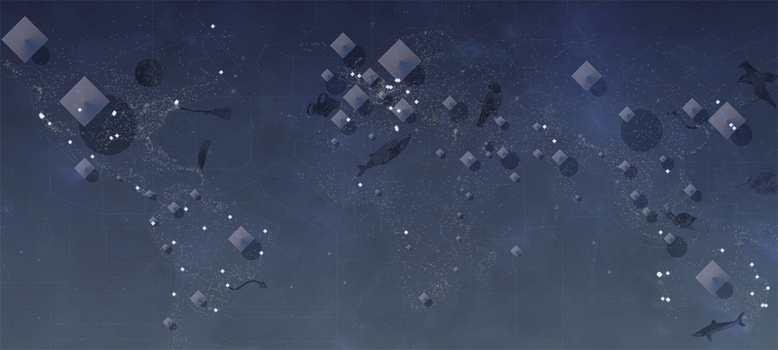


On sale on Society6!
🎐 Instagram: federicafragapane
🔖 Twitter: fedfragapane