Background
Today majority of the world’s population lives in the cities. Public spaces of every shape and form make cities livable and sustainable. The success and failure of a public space depends upon how people use it. Though urban planners understand the importance of public opinion and data collection through the actual users, but often lacks to translate this into tangible information for future policies and plans. A successful planning process requires a bottom up approach and community engagement.

User Research
Interviews : Since the stakeholders of this app is urban planner/policy makers, I interviewed 2 urban planners who specialize in platemaking to know about challenges in planning process. I also interviewed 5 citizens who use public places for various purposes to understand their motivations and behavior. These citizens could be potential users of this app.
Literature Review: I used other reference material provided by urban planners to understand different variables that come into play while designing public places and understanding citizen’s perceptions.
Key Findings
- A lot of quantitative data is available such as traffic, demographics, and civic amenities. But it is
difficult to get unbiased perceptive data from the citizens such as sociability, comfort, image, sense
of place, etc. for public places.
- There are a lot of successful community engagement tools and apps that collect traffic data, civic
complaints or information about public places, but none of them collect qualitative data from the
users.
- Demographics and land use are not enough to identify different user groups and stakeholders of a
public place. It is important to understand that Citizens have different levels of involvement in
public places depending on time available and mindset.
App Idea Overview
Design an iPhone app that creates a collage of information about the public space use which would serve as a great data collection tool for decision makers like planners, landscape architects and authorities. This data would be used by the government agencies to get a real picture of the public spaces in the city and how people would like to use them.
Today 65% adults own a smartphone in United States and 60% use it to take photos or videos. This idea would effectively use smartphone camera and GPS capability to share credible information.
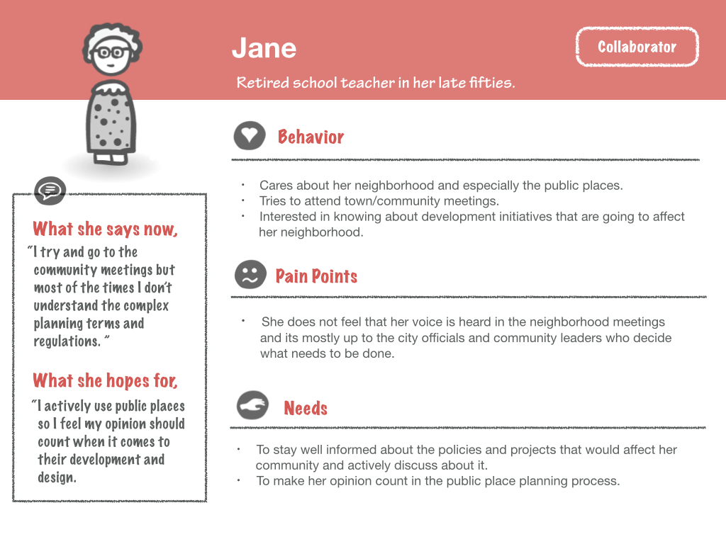
User Persona
The user persona are based on citizens with different levels of involvements within the community they live in and not just based on the demographics. While the stakeholder of this app would be a planner/policy maker, 4 types citizens would represent the user personas that would be engaged through this app.


Goals
- To create an effective community engagement tool to collect information about public place use.
- To collect and view data in real time to see what works and what doesn’t in public places.
- To keep a diverse user group motivated to contribute to the crowdsourced data in a variety of
formats based on their involvement in public places.
- To create a platform where citizen’s can express their opinions and engage into a meaningful
dialogue about development.
Context Scenario


Concept
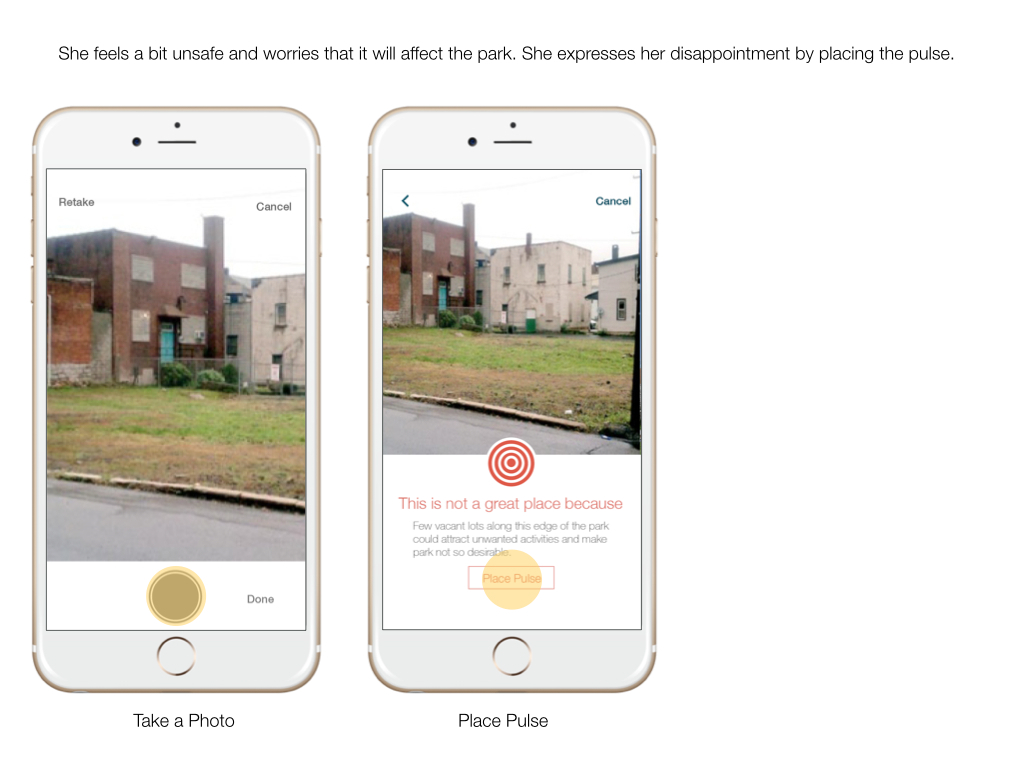
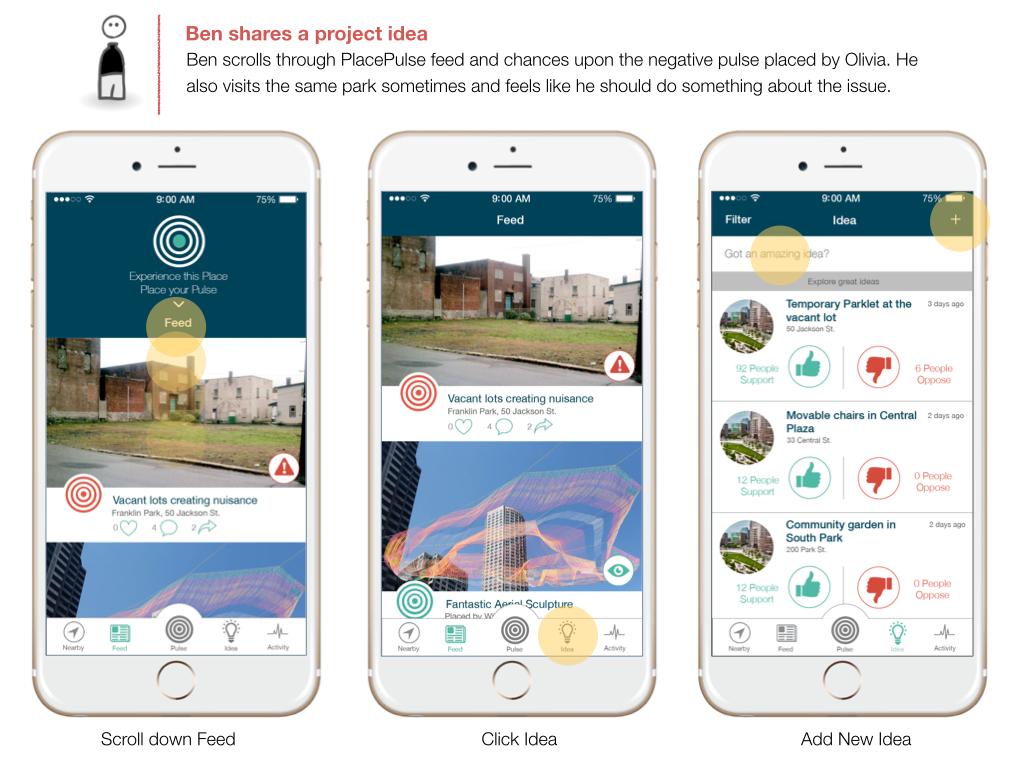
To record the perception of a place in real time, the user will be asked to choose the pulse of a place - how they feel about the place at that time. Their pulse will be added to collective pulse of the place. The pulse will be noted as a positive or negative based on the quality of the place and would also determine high or low based on the number of people visiting a place at a particular time.

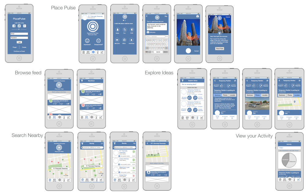
Wireframes
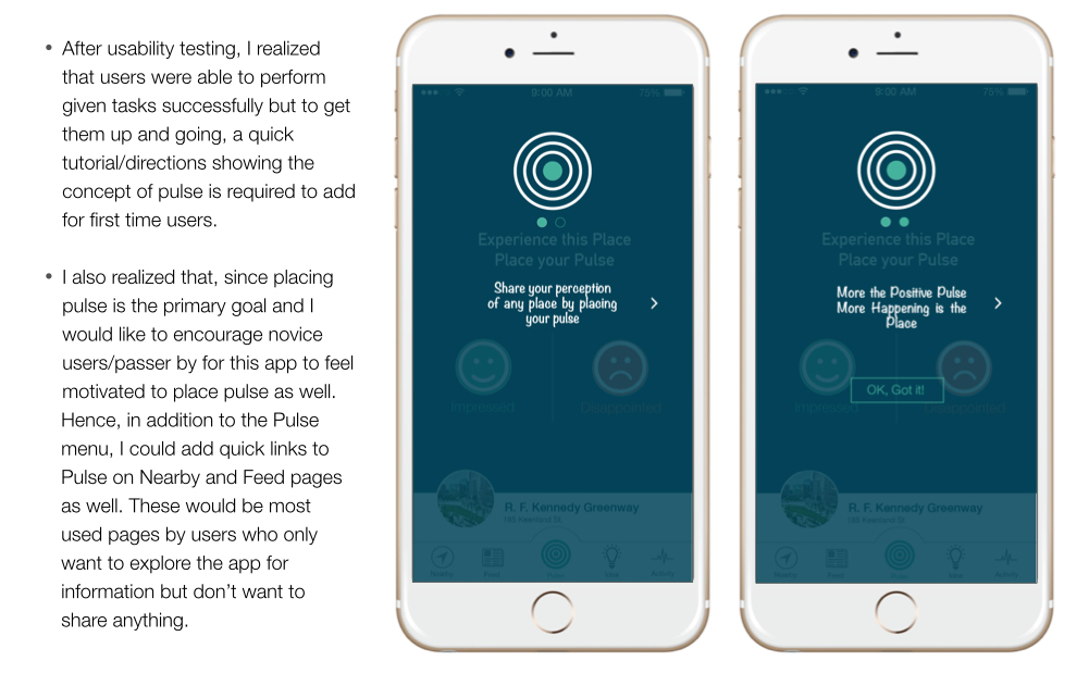
Usability Testing
Conducted usability testing of the wireframes with 5 users and did iterations based on findings.
Walkthrough