Chris Brannin's profile

Mapping Milwaukee Neighborhood Deprivation Indicators

Mapping Milwaukee Neighborhood Sexual Assaults
      Using Weighted Deprivation Indicators
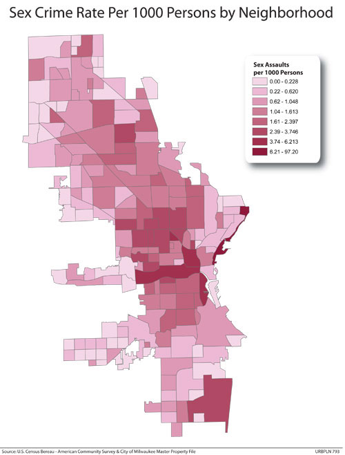
This project used GIS to measure neighborhood deprivation,neighborhood residential mobility, and neighborhood sexual assault rates usingdifferent geographic definitions for the term “neighborhood” to determine whatgeographic definition of “neighborhood” best correlates the rate ofneighborhood sexual assault with neighborhood deprivation and neighborhoodresidential mobility in Milwaukee, WI.
Mapping Milwaukee Neighborhood Deprivation Indicators
Published:

Mapping Milwaukee Neighborhood Deprivation Indicators

This was a group project where myself and two other classmates worked with a doctor at The Medical College of Wisconsin to look at alternative wa Read More

Published: