Project and Target
The emergence of personal mobile phone technology and their ability to utilize the use and creation of dynamic mapping services, it is no surprise that ESRI is creating APIs to use with mobile phone Operating Systems such as Windows Mobile, Google Android and Apple iOS. The Apple iPhone running iOS is the perfect platform to create a dynamic mapping service for public use. When looking at the general demographic for iPhone users, one will see that the highest percentage is ages 18-34, which is a general college student age. So creating a campus map is a good resource for students, parents of students and anyone interested in general information about the campus to get access to that information in an intuitive manor. I have approached this project from a students perspective, wanting to create an application that was not only simple to use but also practical for students to want to use. This map would only signify the beginning of what could potentially be a one stop shop for students campus information needs. By creating a base that was sturdy enough to build off of, I will be able to expand the usability of the application to be more than a mapping service while keeping the map at the center of it.
Data & Construction
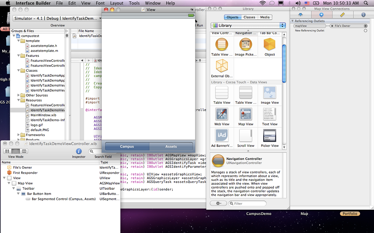
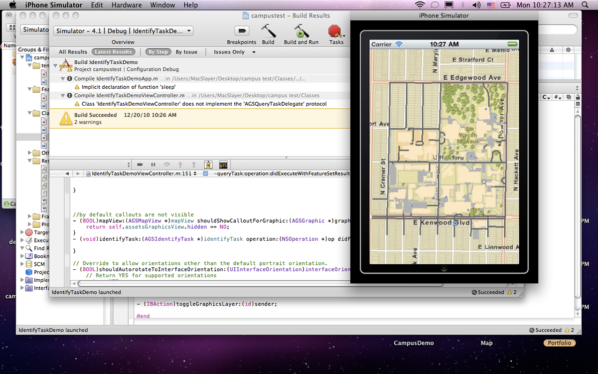
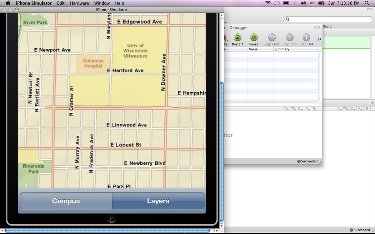
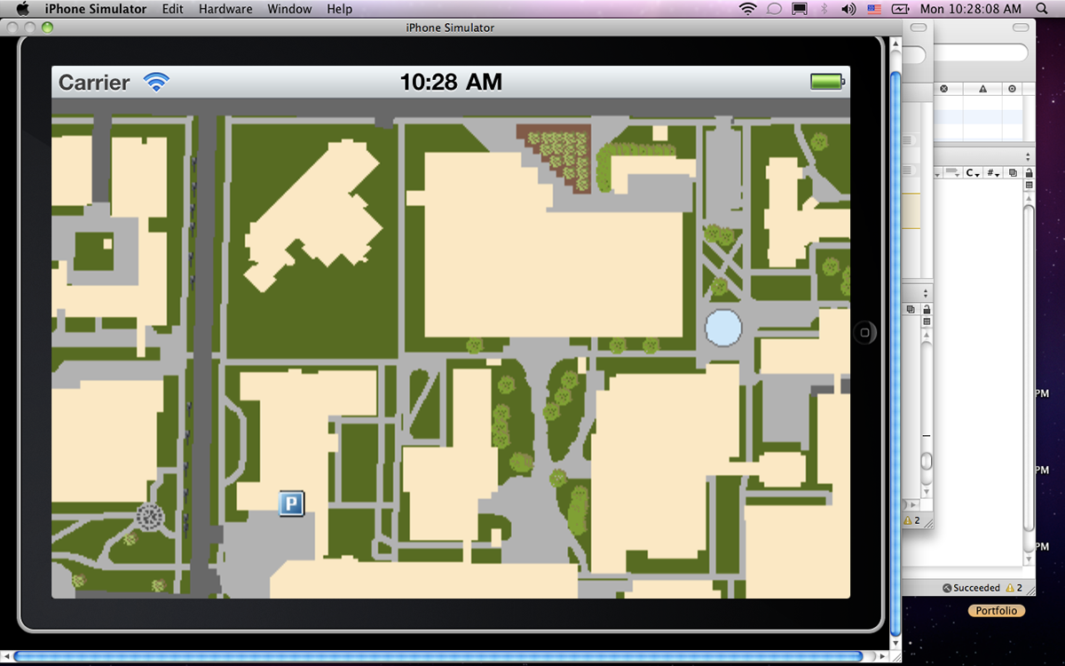
To take this project from the drawing stages and move towards an end user, I had to learn the basics of programming in native Objective-C language, and Xcode SDE. ESRI had just released an API for iOS that is implemented into the iOS SDK to add powerful ESRI capabilities into any iPhone or iPad application. I wanted to create a more visually pleasing map of the UW-Milwaukee campus, rather than using a Google maps Ariel view or the plain campus area outlines on the ESRI base maps. I decided to use the 2005 & 2010 SEWRPC Orthophoto of Milwaukee as a means of digitizing the campus features. Features such as walk ways, grass patches, parking lots,roads and assets. Having vivid aesthetics will help users that are not map savvy to identify with locations around campus. This increases the usability of the map and spatial awareness of the user. Points can then be added to the map so users can simply tap on a point and see the attributes associated with the selected attributes. These attributes will vary from phone numbers to hours of operation, to websites associated with them.
The emergence of personal mobile phone technology and their ability to utilize the use and creation of dynamic mapping services, it is no surprise that ESRI is creating APIs to use with mobile phone Operating Systems such as Windows Mobile, Google Android and Apple iOS. The Apple iPhone running iOS is the perfect platform to create a dynamic mapping service for public use. When looking at the general demographic for iPhone users, one will see that the highest percentage is ages 18-34, which is a general college student age. So creating a campus map is a good resource for students, parents of students and anyone interested in general information about the campus to get access to that information in an intuitive manor. I have approached this project from a students perspective, wanting to create an application that was not only simple to use but also practical for students to want to use. This map would only signify the beginning of what could potentially be a one stop shop for students campus information needs. By creating a base that was sturdy enough to build off of, I will be able to expand the usability of the application to be more than a mapping service while keeping the map at the center of it.
Data & Construction
To take this project from the drawing stages and move towards an end user, I had to learn the basics of programming in native Objective-C language, and Xcode SDE. ESRI had just released an API for iOS that is implemented into the iOS SDK to add powerful ESRI capabilities into any iPhone or iPad application. I wanted to create a more visually pleasing map of the UW-Milwaukee campus, rather than using a Google maps Ariel view or the plain campus area outlines on the ESRI base maps. I decided to use the 2005 & 2010 SEWRPC Orthophoto of Milwaukee as a means of digitizing the campus features. Features such as walk ways, grass patches, parking lots,roads and assets. Having vivid aesthetics will help users that are not map savvy to identify with locations around campus. This increases the usability of the map and spatial awareness of the user. Points can then be added to the map so users can simply tap on a point and see the attributes associated with the selected attributes. These attributes will vary from phone numbers to hours of operation, to websites associated with them.