Roads have numerous properties and attribute types that overlap each other and can span many miles. Currently, properties are defined as linework annotations. With InfraWorks, I had the opportunity to reenvision how properties would be added, editing, and removed from roadways. Through participatory research and design, I created an interaction platform that allows roadway designers to define various property types along roadways.
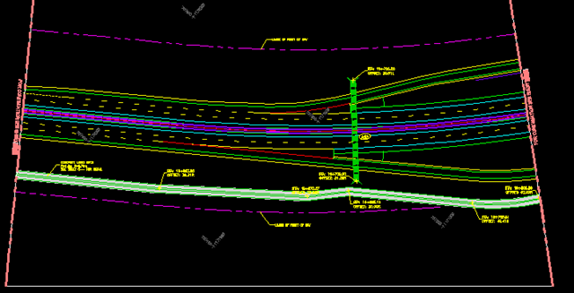
An example of how road properties are visualized and annotated using CAD programs.
Problem
When designing a road, roadway designers need to be able to define various prosperities of a road at certain segments along a road's length. Roadway designers need to be able to control where these property types exist along a roadway. Properties like superelevation zones, grading zones, speed zones, environmental zones, passing zones, merging zones, number of lanes, bridges, tunnels, road types and classifications, intersections.
When designing a road, roadway designers need to be able to define various prosperities of a road at certain segments along a road's length. Roadway designers need to be able to control where these property types exist along a roadway. Properties like superelevation zones, grading zones, speed zones, environmental zones, passing zones, merging zones, number of lanes, bridges, tunnels, road types and classifications, intersections.
Object
For this project, my design objective was to create an interaction paradigm that allowed users to define regions along roads and the attribute and value of that region so that they could better describe the road.
Contribution
For this design, I worked with scrum Team Pavo, UXD team members working on other infrastructure components, and key customers to establish the workflow of how to add, edit, define, and remove regions from a road. This involved defining how regions interacted with each other, how are they selected, how regions behaved when editing, and how to handle bulk actions such as delete, replace, and move. This project spanned about a year as more region types were added to the list.

Roads are made up of three categories of regions: the physical, the virtual, and analytical results. These regions stack upon each other to define every single aspect of a road and its design.
Preliminary Interaction Sketches


Higher Fidelity Interaction Mockups and Workflows

Adding a region from a library of components

If you are working with the road as a whole, how do you focus on a specific region type or attribute? Subselection and selecting view controls was a significant challenge for Team Pavo. We ended up overcoming it with a temporary radio button list to help the user select which attribute they are editing.


A concept animation to convey how the user would draw a road from the library interface and then add regions.
Another application workflow concept on how a user would enter a draw workflow and then layout a road.
Concept workflow animation demonstrating how a user would add components such as terminations to a roadway.

High fidelity mock of what the region grips could look like on a road.

High fidelity mockup exploring how to display multiple region types along a single roadway.These concepts were inspired by stacked bar graphs as well as objects like a laddered tackle box.
Implemented Designs
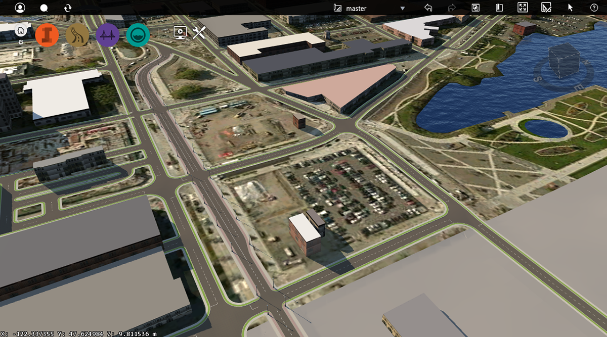
At this point, roadway designers are able to definte the number of lanes, types of grading, and where bridges exist along a road. The following images show regions being added to Mercer Street in Seattle, WA.

Here the forward lane zone is selected. Right now there is only one lane spanning the entire length of the road. The user is going to add a lane zone to increase the number of lanes on the forward side.

Here we can see a lane zone being introduced to the forward side of the road. The lane count is increased from 2 to 3 lanes in that zone.
Here is the final product after that lane zone is added.

