A stylised diagram of America's system of U.S. Highways – that's the older network of roads that predates the Interstate Highway System – using the familiar colour-coded route lines and iconography of a subway map.
Created entirely in Adobe Illustrator, and designed and fully researched over the course of a full year, the map was featured in the North American Cartographic Information Society's (NACIS) inaugural Atlas of Design in 2012, a volume which feautured 27 of the best maps from around the world.
On the map, major U.S. Highways (as defined by AASHTO) are shown as brightly coloured route lines, while minor routes are shown in grey. Historical routes that no longer exist are shown as thinner lines, while Route 66 – the most famous highway of all – is shown as a thin black line from Chicago to Los Angeles.
Year: 2011–2012
Role: Research, design, production, vendor liaison
Software: Adobe Illustrator CS5
Role: Research, design, production, vendor liaison
Software: Adobe Illustrator CS5

U.S. Numbered Highways as a Subway Map
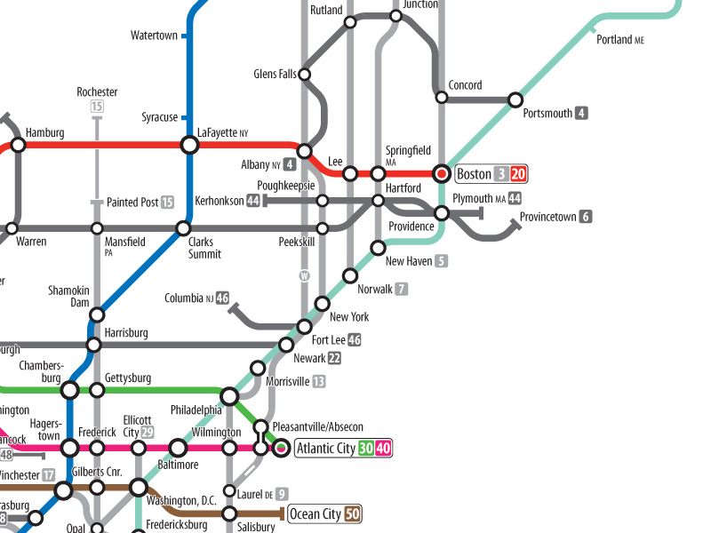
Detail: Northeast

Detail: Texas

Detail: Pacific Northwest
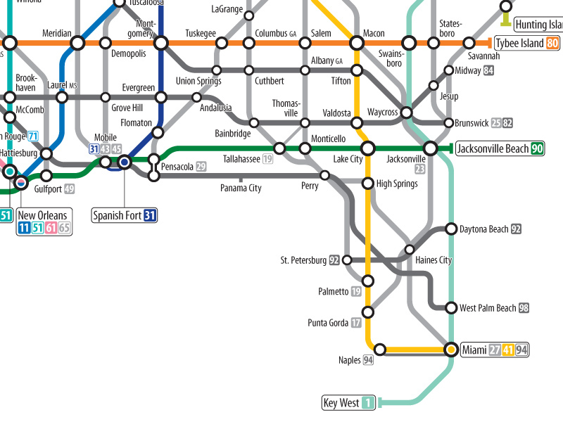
Detail: Florida
