School yard
An example of a quick project on combined mapping and three-dimensional modeling.
One of the volunteer projects is the creation of posters for mapathons of the Ukrainian OpenStreetMap community.
Scheme of the school yard for the thematic task of the mapaton of the OpenStreetMap Ukrainian community. You can view the covers of all tasks on my GitHub. The real yard of school number 30 in Cherkasy was chosen for the scheme, the data were taken in OSM, then converted and adapted for Blender. The school building is typical of the mid-1980s in Ukraine.
We worked together on sets of OSM-tags, which will denote buildings and territories, the scheme serves as a better explanation of the structure of OSM tags for the school marathon. The same principle can be used to demonstrate small areas of museums, industrial facilities or shopping malls.
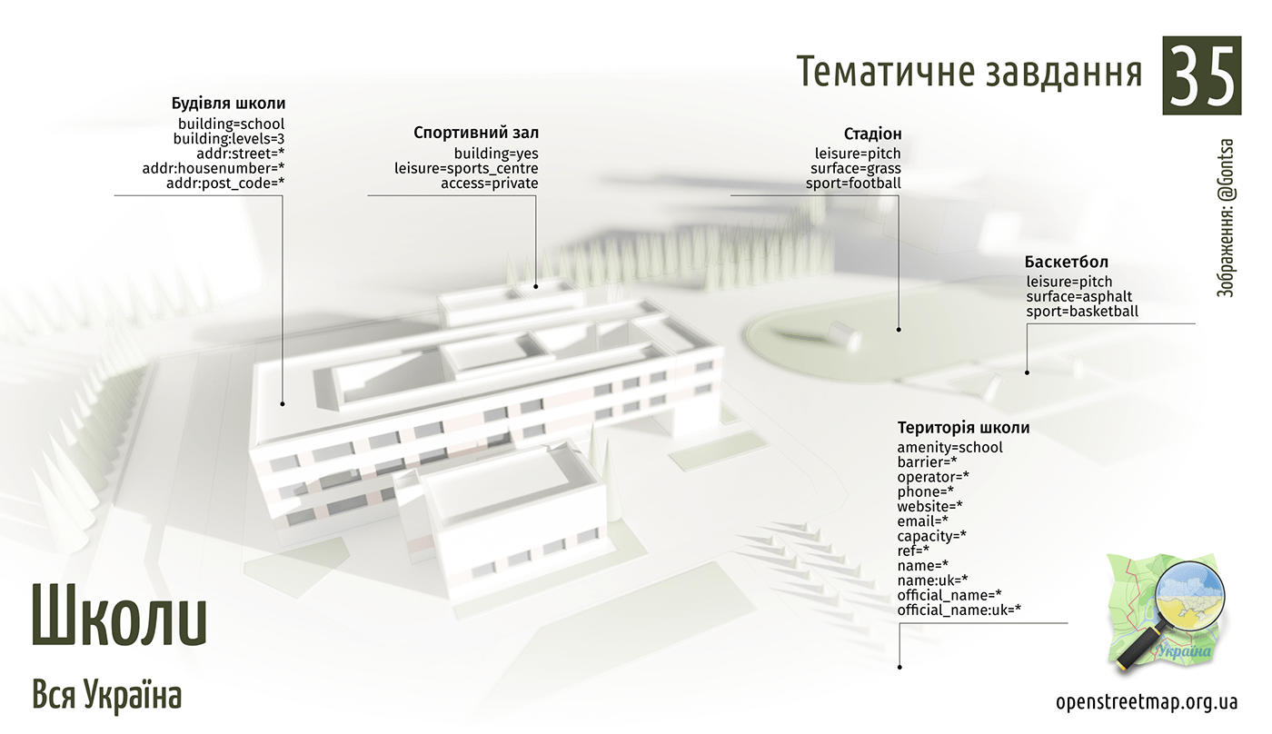
QGIS - creation of a planning situation, Blender - modeling and visualization, Inkscape - final design and styling.
Final poster


Blender part of project


Draft render
Thank you for watching!
