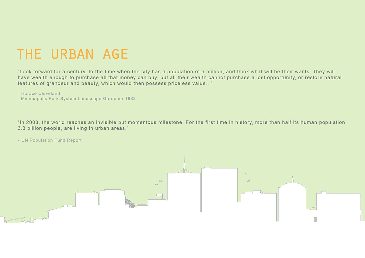
Places In Between
Preserving the Porosity of Milwaukee
As our world expands, space becomes an increasingly valuable commodity. This project looks specifically at the city of Milwaukee and its unique porous city fabric. Empty lots are often considered to be leftover, undefined, and undesirable in an urban landscape. In Milwaukee, most of these places are typically simply not valuable enough to build upon yet - and will remain vacant until property values change. However, this project asks that we consider these spaces in a new light - to appreciate what space provides to a city, and when treated properly, how it can give back to an urban landscape.

Almost a quarter of downtown Milwaukee is unbuilt land. Of this percentage, 43% is public park, 32% is surface parking, and the rest is residual land.

These spaces look something like this.
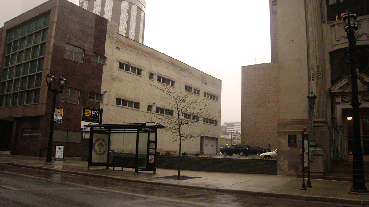
Despite their appearances, these empty lots do bring benefits to a populated city like Milwaukee.
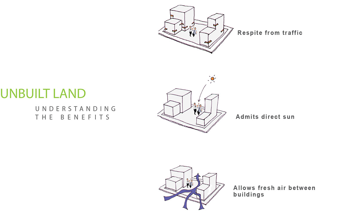
This project took great interest in a 'green link' that permeates east and west through downtown. A scattering of public parks, over sized medians, and empty lots are clustered around Kilbourn Avenue - a street connecting the civic headquarters of the city on one end, and the beaches of Lake Michigan on the other. We saw a potential in capturing these under used spaces, connecting them in a more formalized way, and leveraging them into having a greater purpose.

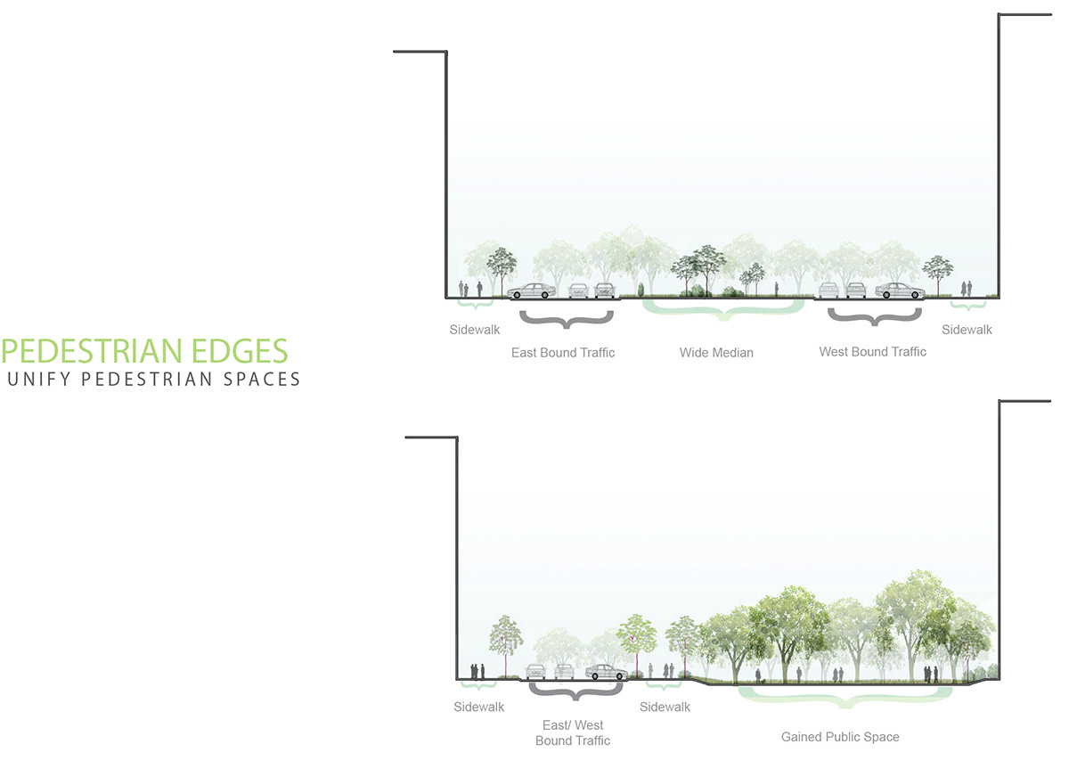
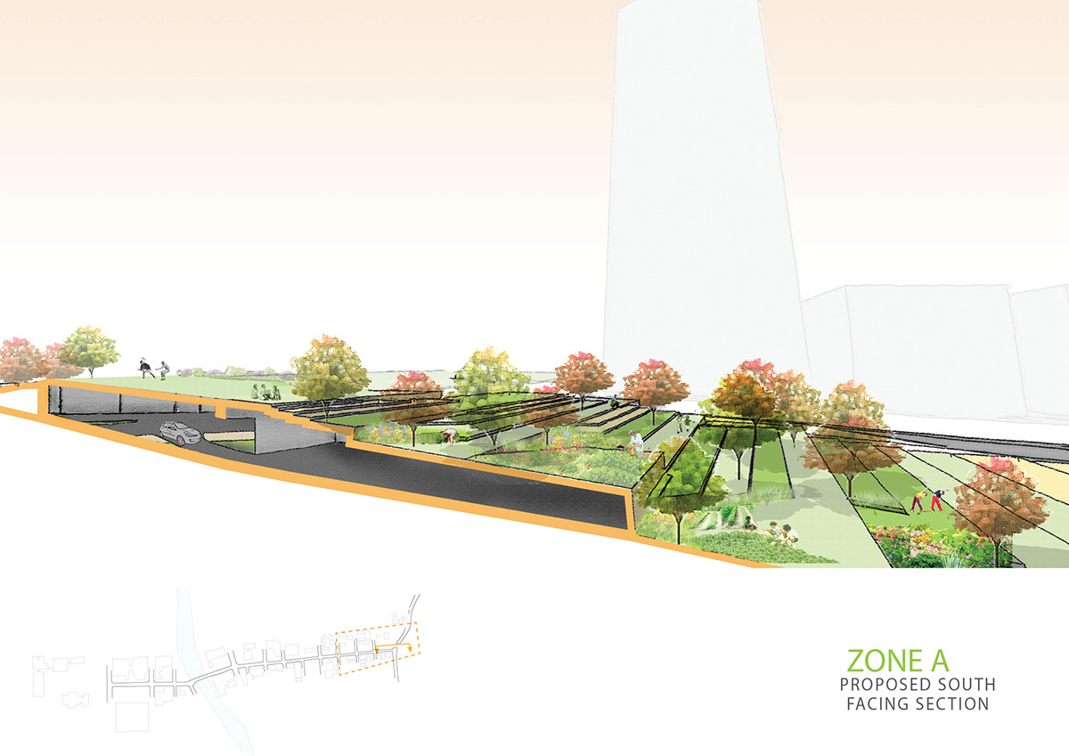
To achieve this connection, this project proposes some important changes to the Kilbourn streetscape. Its current configuration (2 lanes each way, divided by a large median) encourages fast driving (commonly 40mph) and discourages pedestrian movement. To achieve slower moving traffic, this project subordinates its east side access, and removes its west side highway access ramps. These ramps are underutilized, and two other highway access points are located a quarter mile north and south of Kilbourn.

By consolidating traffic lanes to one side of the street, the project eliminates the large median space, and creates a new public park space which can be used by the residents of this street.
As mentioned earlier, Kilbourn is a long street connecting many different parts of Milwaukee. A uniform treatment of the streetscape might not benefit such diverse users. This diagram shows how this project identified 4 major zones along Kilbourn Avenue and how these zones might benefit from places of different scales.
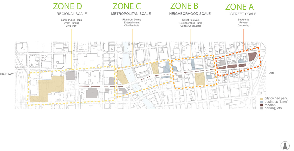
Zone A is a largely residential area with views and access to the lakefront. This project envisioned the reclaimed spaces in this zone to be a backyard for these residents, all of which are in mid century, small apartment complexes. This could be a place for gathering around the BBQ or playing catch.
[BELOW: Existing Kilbourn street plan and Proposed Kilbourn Street plan]


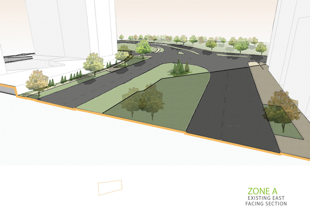
[BELOW: Existing Kilbourn East Facing Street Section, and Proposed Kilbourn Street Section]

[BELOW: Kilbourn Ave east access from Prospect Ave - existing and proposed. Proposed intersection includes pedestrian bridge spanning Prospect Ave]

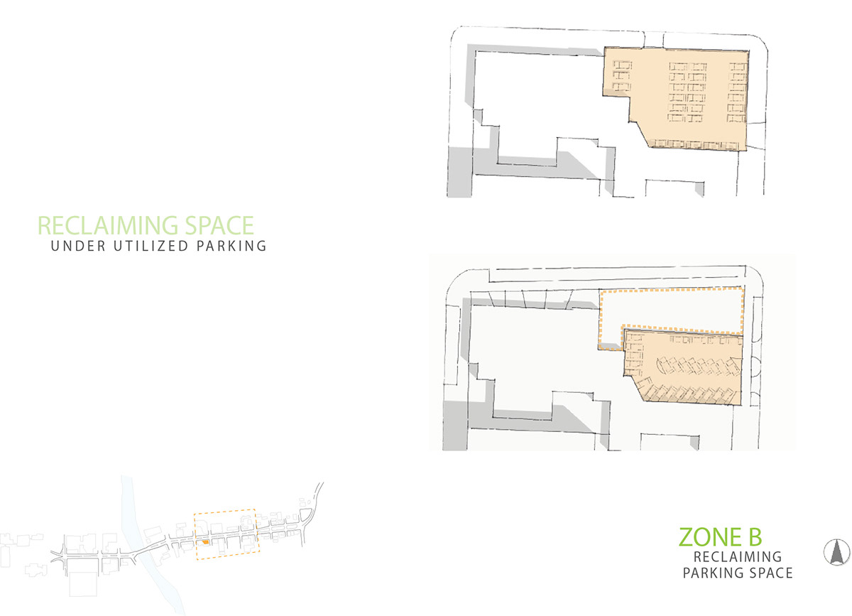
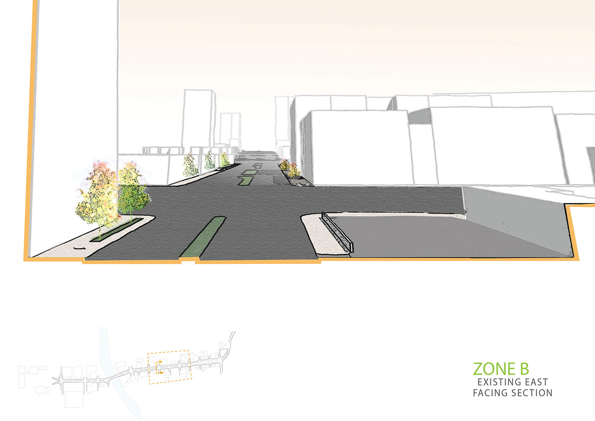
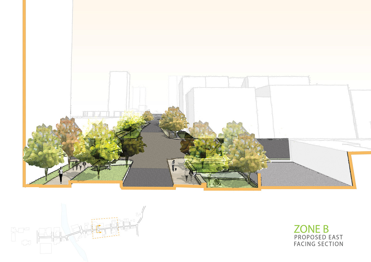
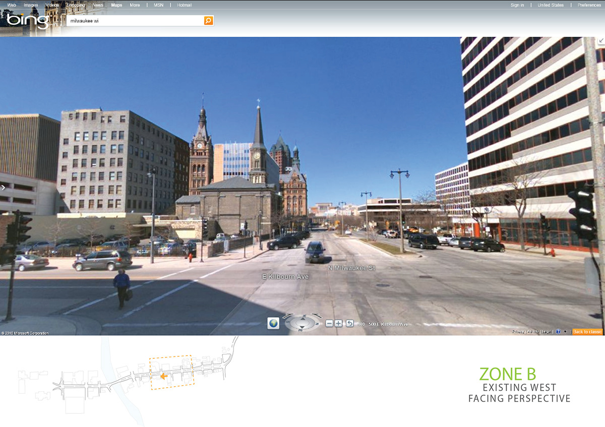
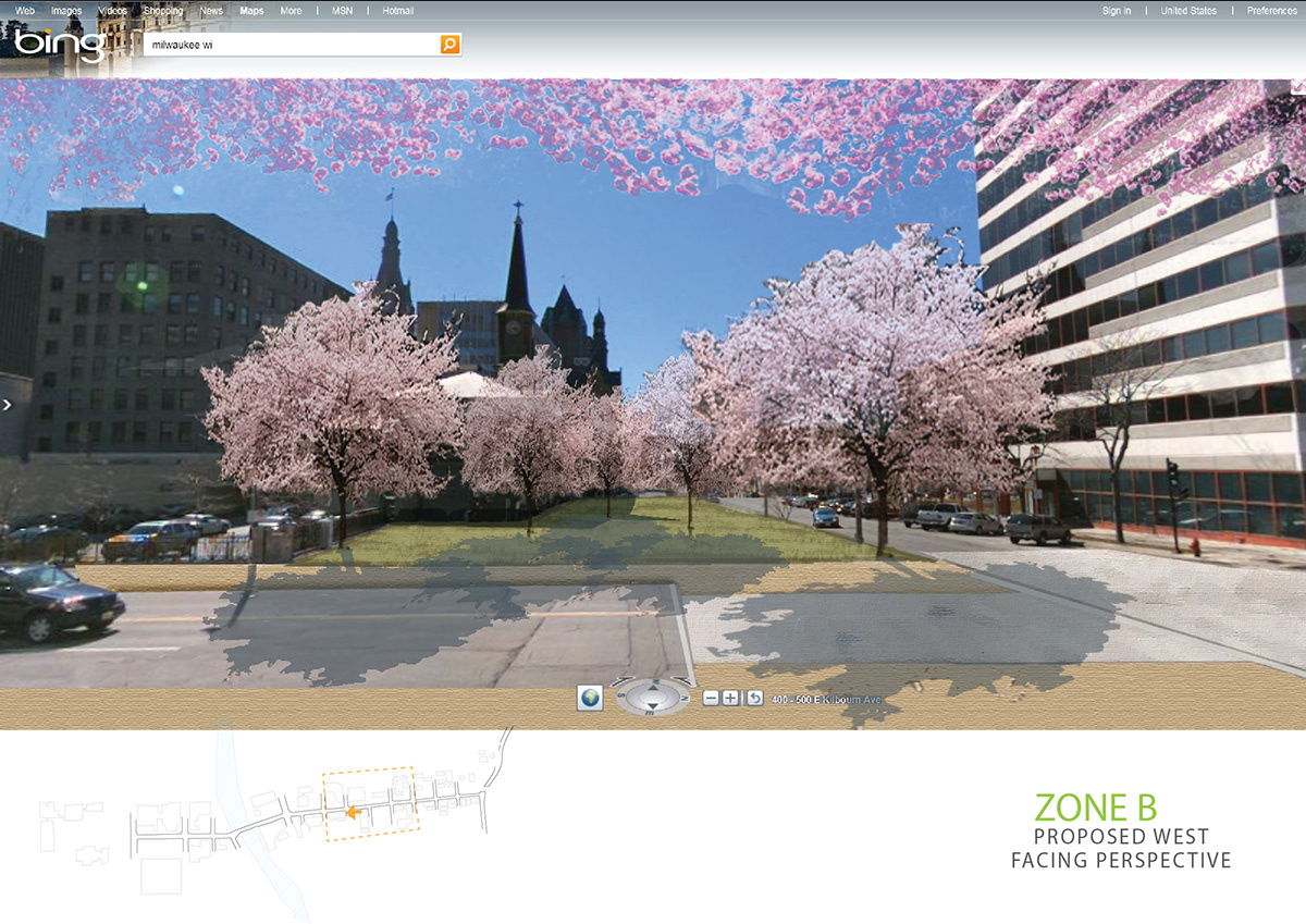
In Zone B, Kilbourn serves an increasingly commercial population. A small church, a portion of the Milwaukee School of Engineering's campus, and some restaurants face Kilbourn Ave in this area. In this zone, this project aims to reclaim under utilized surface parking to create neighborhood parks and areas for outdoor seating.
[BELOW: East facing section of Kilbourn Ave, existing and proposed]
[BELOW: West facing perspective of Kilbourn Ave, existing and proposed]
The spaces in between the developed city fabric provide opportunities for valuable city amenities. Instead of understanding them as undesirable 'left over' space, this project dreams them into a beautiful green link connecting four major districts within downtown Milwaukee to its prized lakefront.


