Union Pier Master Plan
Counter-proposal
Counter-proposal
Video introduction to our plan. You also may view the original plan here.

The site today, as a working port soon to be decommissioned. Charleston's tourist district is visible at the top left.

Our proposed redesign, showing our new canals, wetlands, parks and plenty of new buildings and public spaces.

Our three-part sequence for reconstruction. By digging canals, we propose to fill the remaining land to avoid hurricane flood-zone designation. Restoring the wetland edge condition will help mitigate ecological impacts.

Our proposed master plan. Red buildings indicate prominent locations, suitable for civic structures or maritime functions. A continuous waterfront promenade would line the harbor, and canals link city neighborhoods with the sea. City blocks include rear alleys, but not large parking structures for cars.
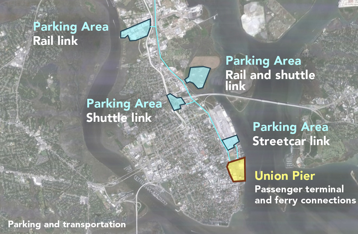
In dense, historic cities across the world, parking is handled off-site. To take a ferry or passenger ship, travelers park their cars in a designated location then take a train, streetcar, shuttle, cab or simply walk to the ship terminal. This technique is time tested and would work just fine in Charleston.
