
Jack Reports: a unidirectional navigator for the truck driver community
Over the decades, innovators continued to come up with interesting ways for users to track their movements on a map. For example, in the 1920s, drivers wore wrist maps like a watch. A small map was embedded where the watch dial would normally be found. In 1909, an ad described a scrolled map attached to the steering wheel. An Italian company Touring Club took this step further in the early 1930s by tethering the map scroll to the speedometer. In fact, this was the first device that attempted to show a person’s position in real-time.
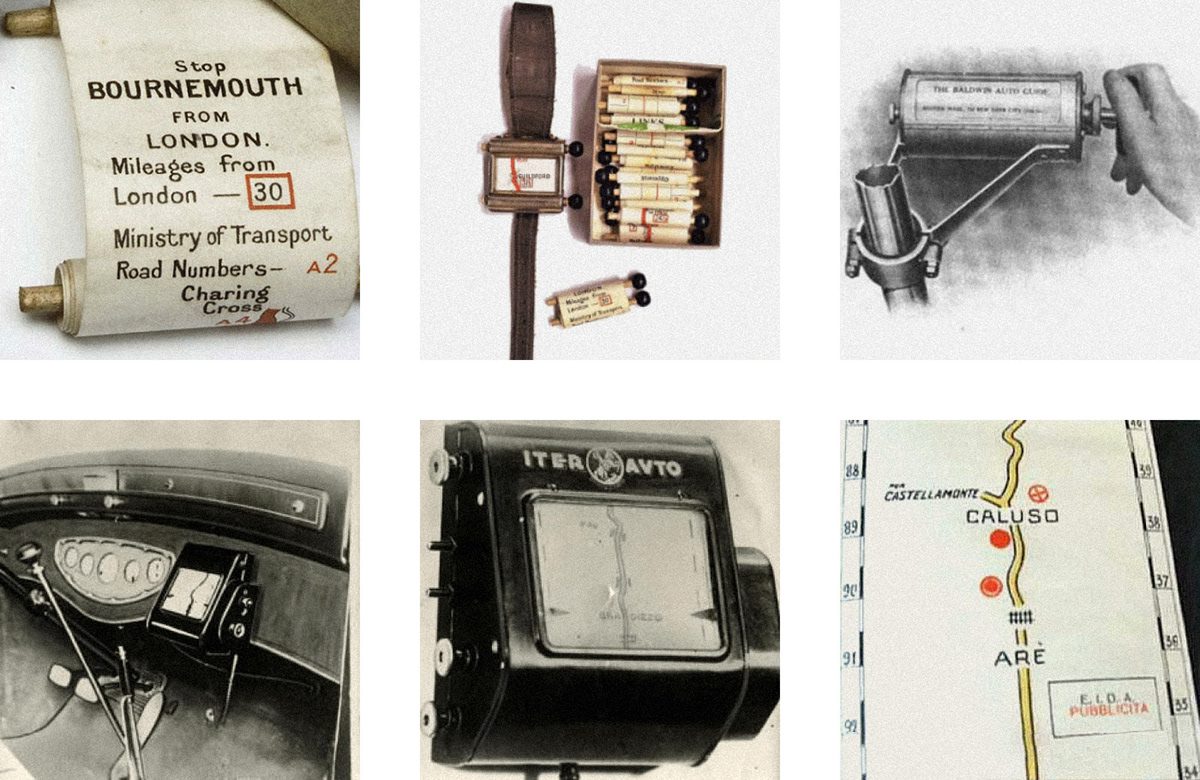
These are the first devices for automobile navigation: a wrist map by Plus Fours Routfinder, Baldwin Auto Guide, and Iter-Auto
Inspired by the history of navigation devices, we tried to reevaluate the way truck drivers move around today.
Jack Reports is an app designed for truck drivers in the US, a very specific audience with their own needs and preferences. A series of user interviews helped us better understand their mental model as well as their main intent—to get to their destination with no distractions. Unlike ordinary drivers, truckers cannot park or turn wherever they want. And they don’t care what happens to the left of the road, because they can’t get there fast enough anyway.

Highway is a new app mode that represents any route as a straight line
Jack Reports was originally launched as an ai-driven and community-supported database of truck-related places. Drivers used the app while planning their trips and then switched to a conventional navigation app.
By introducing the Highway mode, we want to help truckers focus on exactly what they need most while driving:
🚚 the shortest way to the destination
⛔️ road features like bridge clearance, dangerous sections and accidents
🚔 police inspections on the way
📦 weigh station schedules and cargo requirements
🚧 state borders with estimated waiting time
➡️ highway exits and rest areas available on the right
All data is constantly updated based on the reports of drivers and officials.

Jack Reports wireframes and navigation between screens


