The whole map, measuring 43 x 38 cm (10 7/8 x 17 inches), depicting North Jersey (orange background) and New York (pink background). The client stipulated that the three main airports of Newark, LaGuardia and John F. Kennedy should be shown on or just off the edge of the map, hence the map's scale.
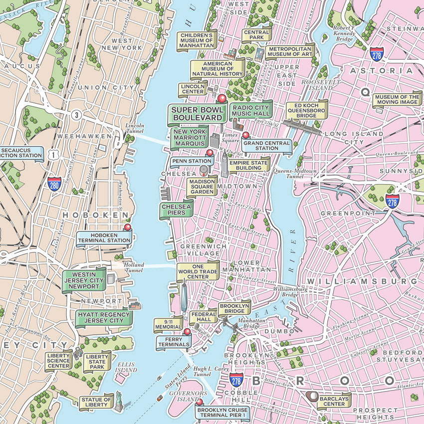
Detail of the most detailed part of the map, around Manhattan and along the Hudson River. All landmarks drawn here were requested by the client. I chose to use three types of coloured 'banner' labels: green for Super Bowl related event venues, yellow for other major landmarks, and blue (with pins) for transport hubs.
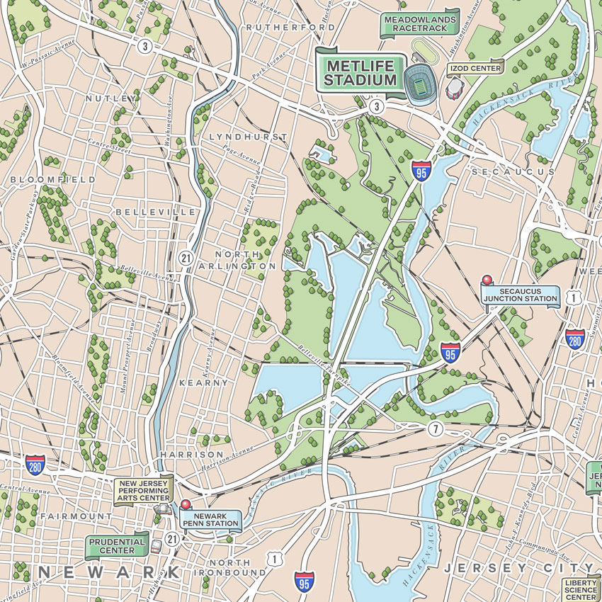
Detail of the North Jersey area, showing Newark and the Metlife Stadium in East Rutherford (venue for the Super Bowl XLVIII on February 2nd 2014). All landmarks drawn here were requested by the client. I chose to use three types of coloured 'banner' labels: green for Super Bowl related event venues, yellow for other major landmarks, and blue (with pins) for transport hubs.

Detail of the southern part of The Bronx and the north-western part of Queens, either side of the East River. All landmarks drawn here were requested by the client. I chose to use three types of coloured 'banner' labels: green for Super Bowl related event venues, yellow for other major landmarks, and blue (with pins) for transport hubs.
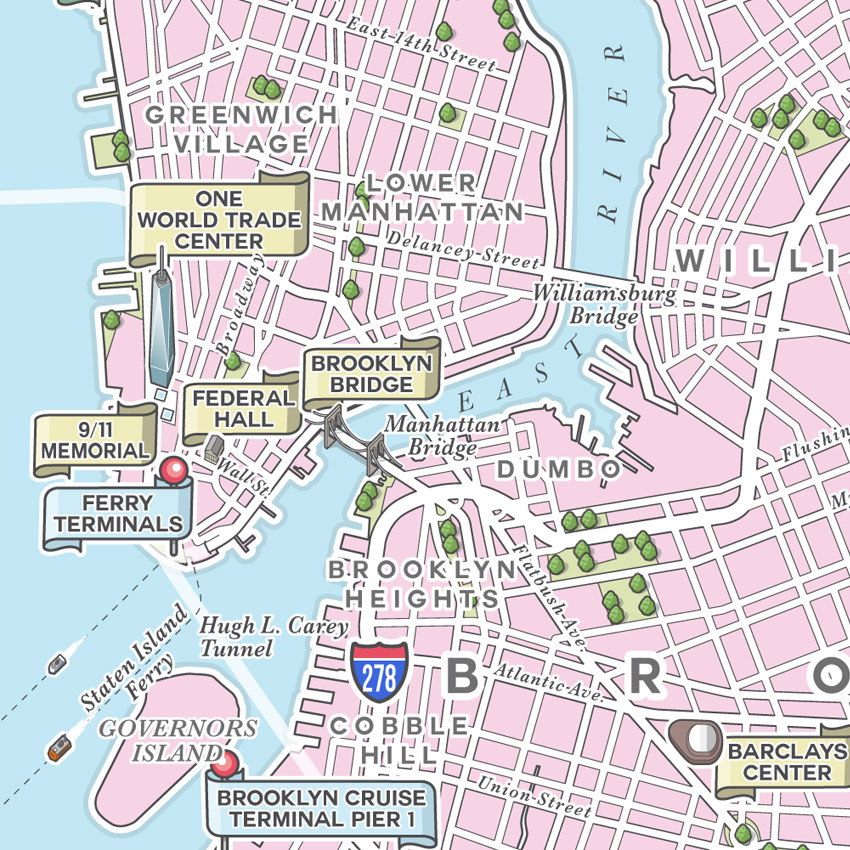
Close-up detail of Lower Manhattan and downtown Brooklyn, including the Brooklyn Bridge and the new One World Trade Center (aka. the Freedom Tower). All landmarks drawn here were requested by the client. I chose to use three types of coloured 'banner' labels: green for Super Bowl related event venues, yellow for other major landmarks, and blue (with pins) for transport hubs.
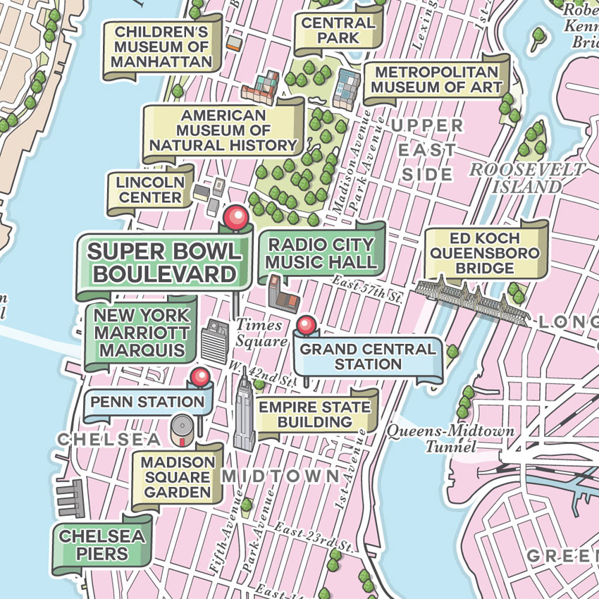
Close-up detail of Midtown, Chelsea and Upper East Side. All landmarks drawn here were requested by the client. I chose to use three types of coloured 'banner' labels: green for Super Bowl related event venues, yellow for other major landmarks, and blue (with pins) for transport hubs.
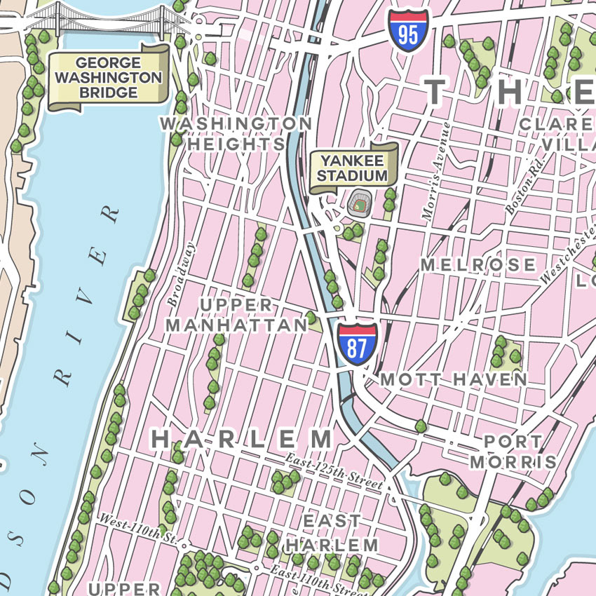
Close-up detail of Harlem, Upper Manhattan and Washington Heights, also showing the George Washington Bridge and the Yankee Stadium.
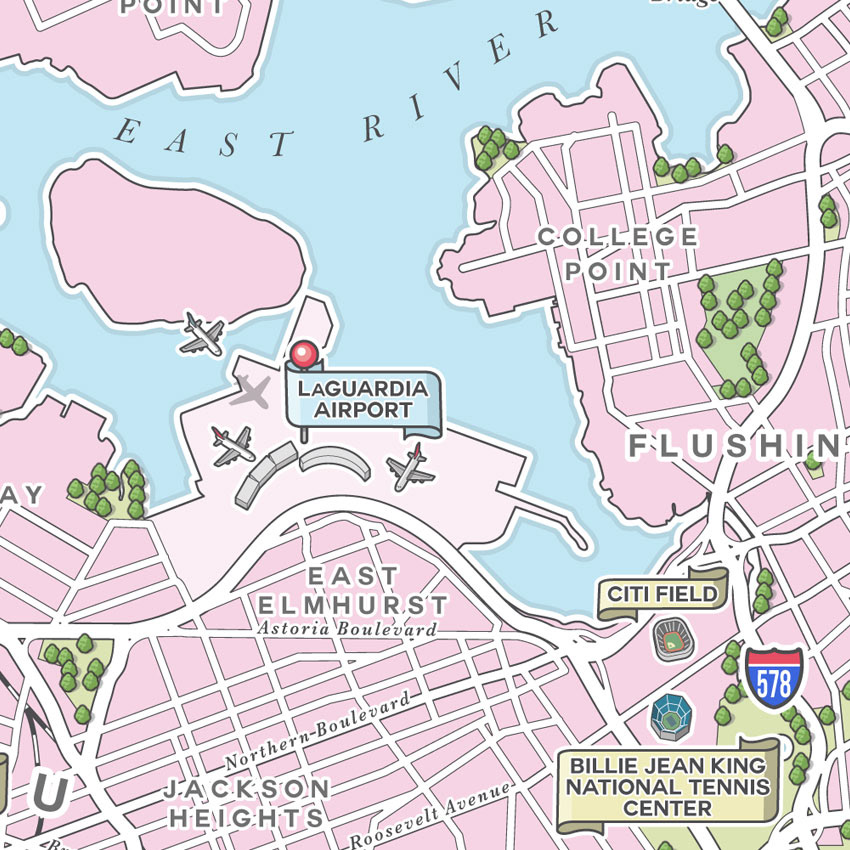
Close-up detail of the area around LaGuardia Airport in Queens.
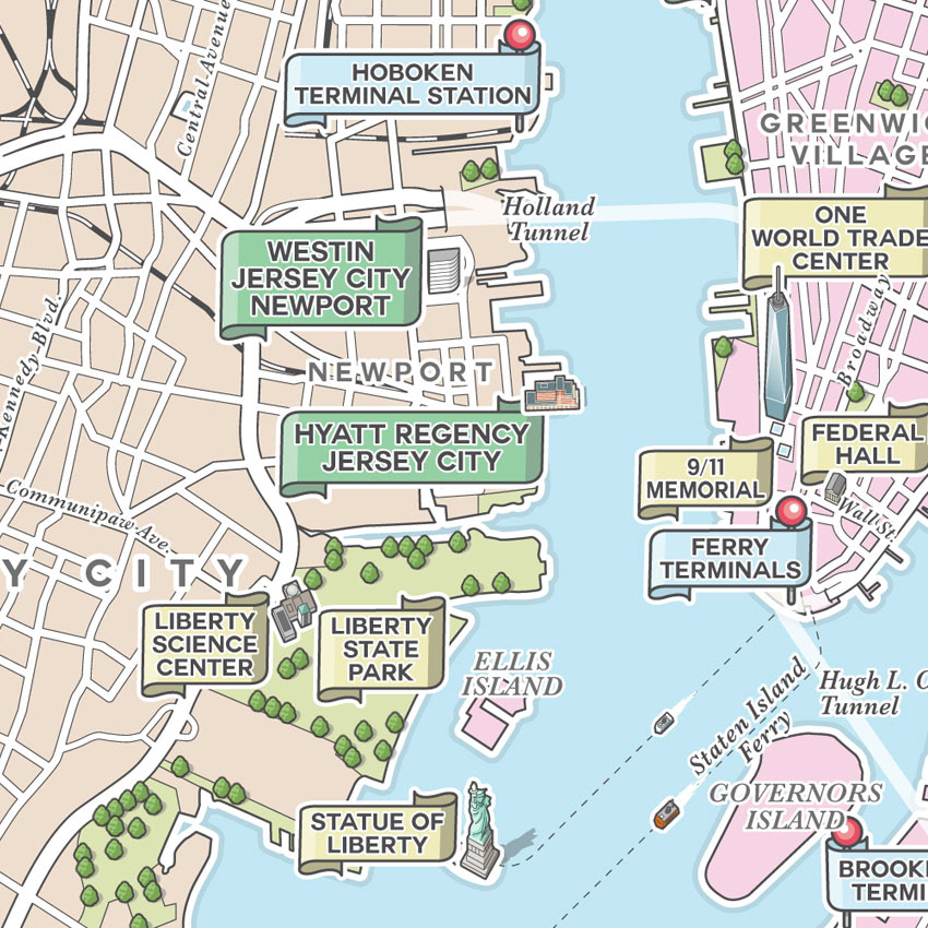
Close-up detail of the area to the west of Hudson River in North Jersey: Newport, part of Jersey City and Hoboken. All landmarks drawn here were requested by the client. I chose to use three types of coloured 'banner' labels: green for Super Bowl related event venues, yellow for other major landmarks, and blue (with pins) for transport hubs.
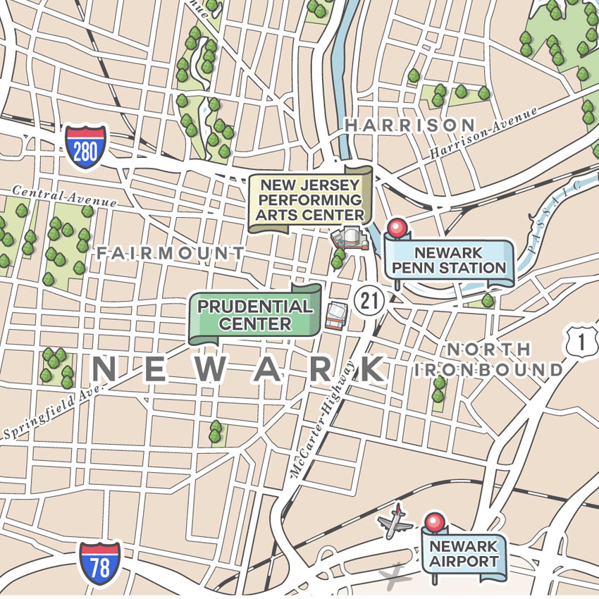
Detail of downtown Newark. All landmarks drawn here were requested by the client. I chose to use three types of coloured 'banner' labels: green for Super Bowl related event venues, yellow for other major landmarks, and blue (with pins) for transport hubs.

Close-up detail of the area around the MetLife Stadium, the venue for the Super Bowl XLVIII on February 2nd 2014.