淡蘭古道—北路 | 精裝指南
Tamsui-Kavalan Trails - Northern Trails Guidebook 【Limited Edition】
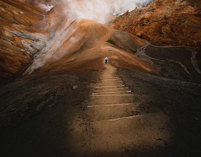
這次與新北市政府觀光局合作「淡蘭古道系列導覽手冊」製作的專案 淡蘭古道是橫跨新北、宜蘭以及基隆的百年山徑, 山徑系統中包含了許多條超過百年的古道, 更有許多珍貴的人文、歷史、自然資源, 近幾年來越來越多人前往探索。 我們很開心有機會能為淡蘭古道製作系列導覽手冊, 這次先跟大家分享的是「淡蘭古道北路精裝指南」, 手冊結構包含:書衣及腰封、資訊視覺化手冊、集章卡 內容則涵蓋:淡蘭古道北路主視覺、健行地圖、資訊視覺化的歷史/生態/人文介紹、路線資訊及景點介紹⋯等內容。
This project is in cooperation with the Tourism and Travel Department of New Taipei City Government, we organize and visualize information, design a series of key visions and surrounding goods of the Tamsui-Kavalan Trail. The Tamsui-Kavalan Trail is a historic road that crosses three counties, including, New Taipei City, Keelung, and Yilan. In the Tamsui-Kavalan Trails, there are many different routes that hide precious humanities, history and natural resources. Hoping that through this project the characteristics of this ancient trail will be more prominent and more people will come to discover the beauty of this trail.
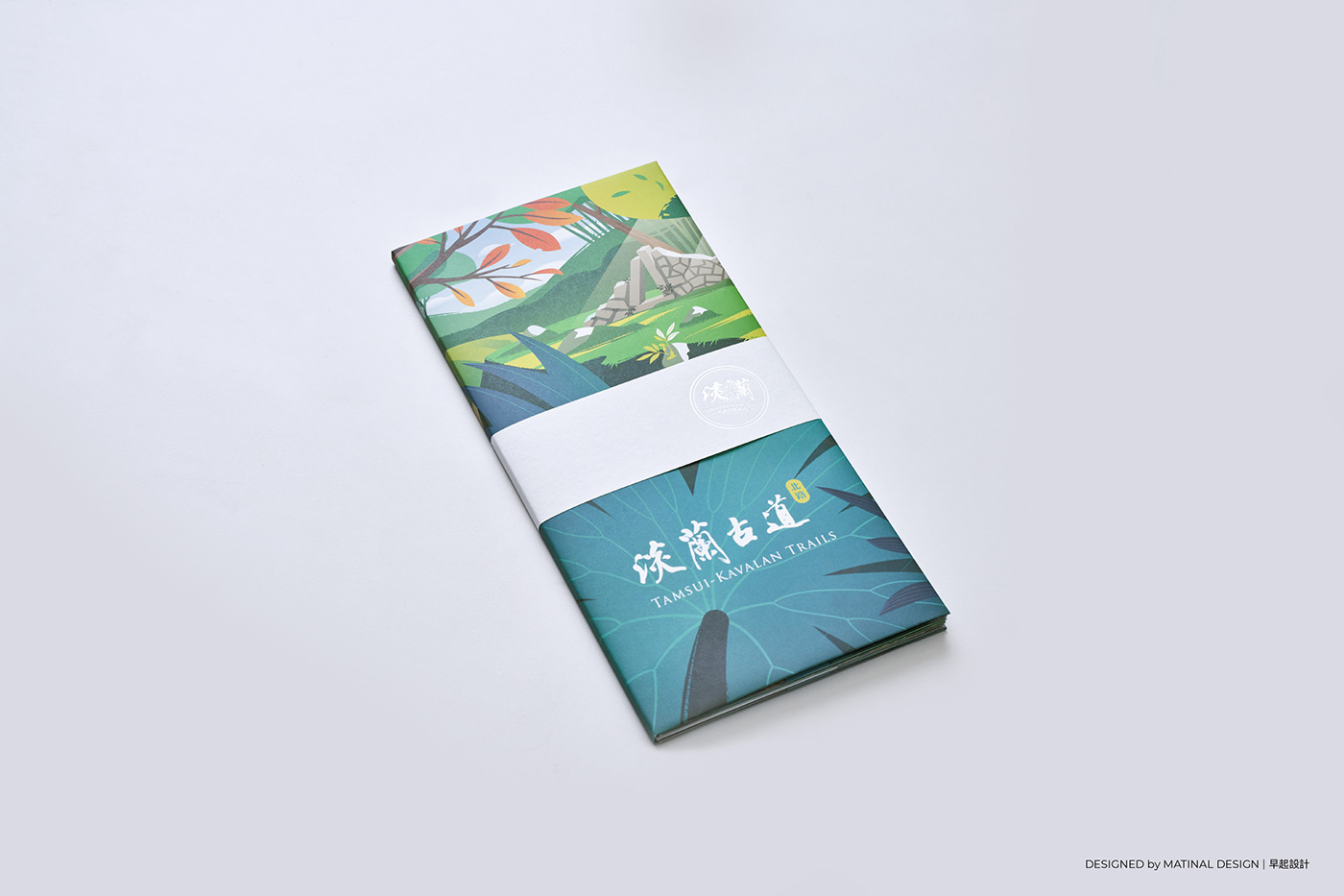
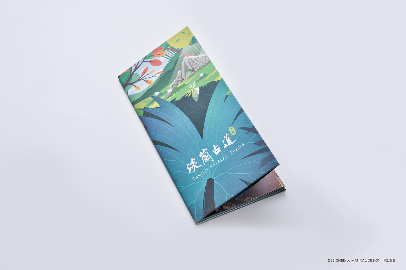
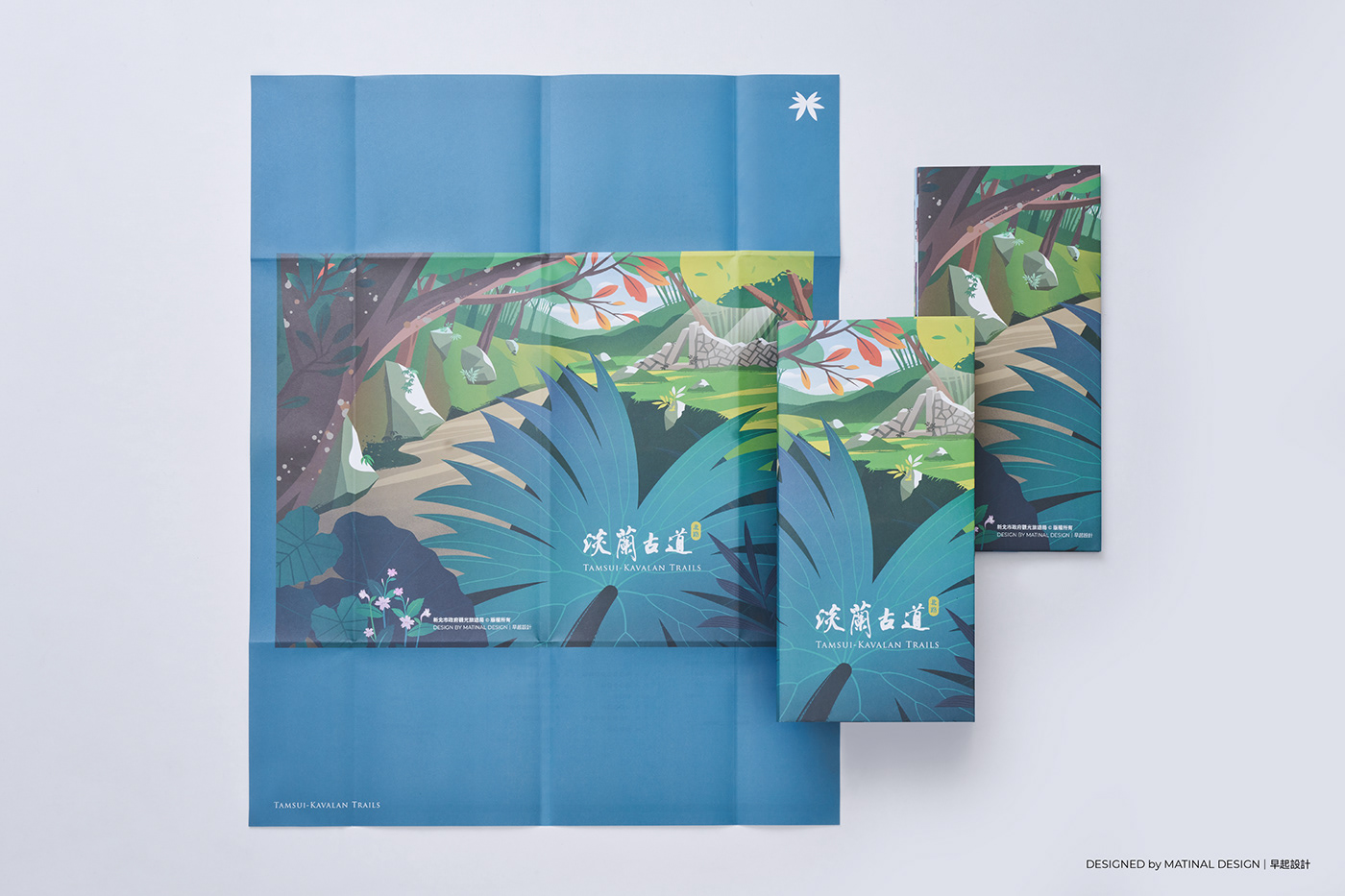
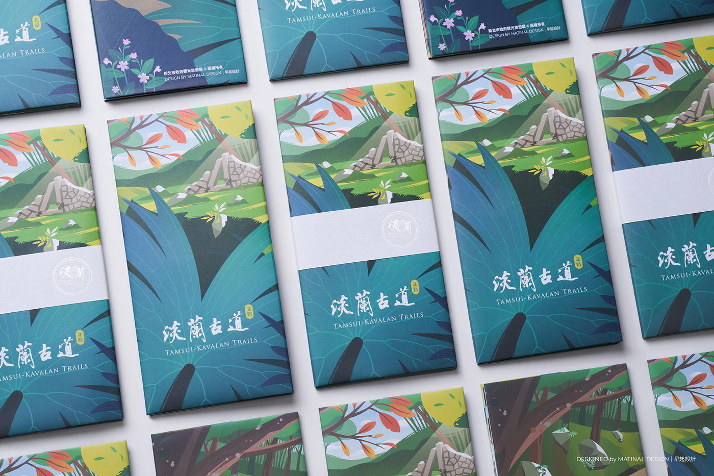
書衣
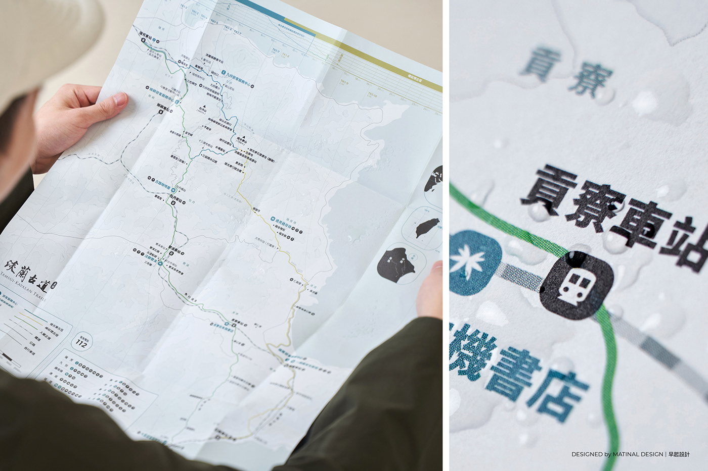
1. 防水紙張:考量淡蘭山徑系統潮濕多雨,因此選用防水紙張,淋濕後完全不會破掉,可以擦乾再繼續使用!
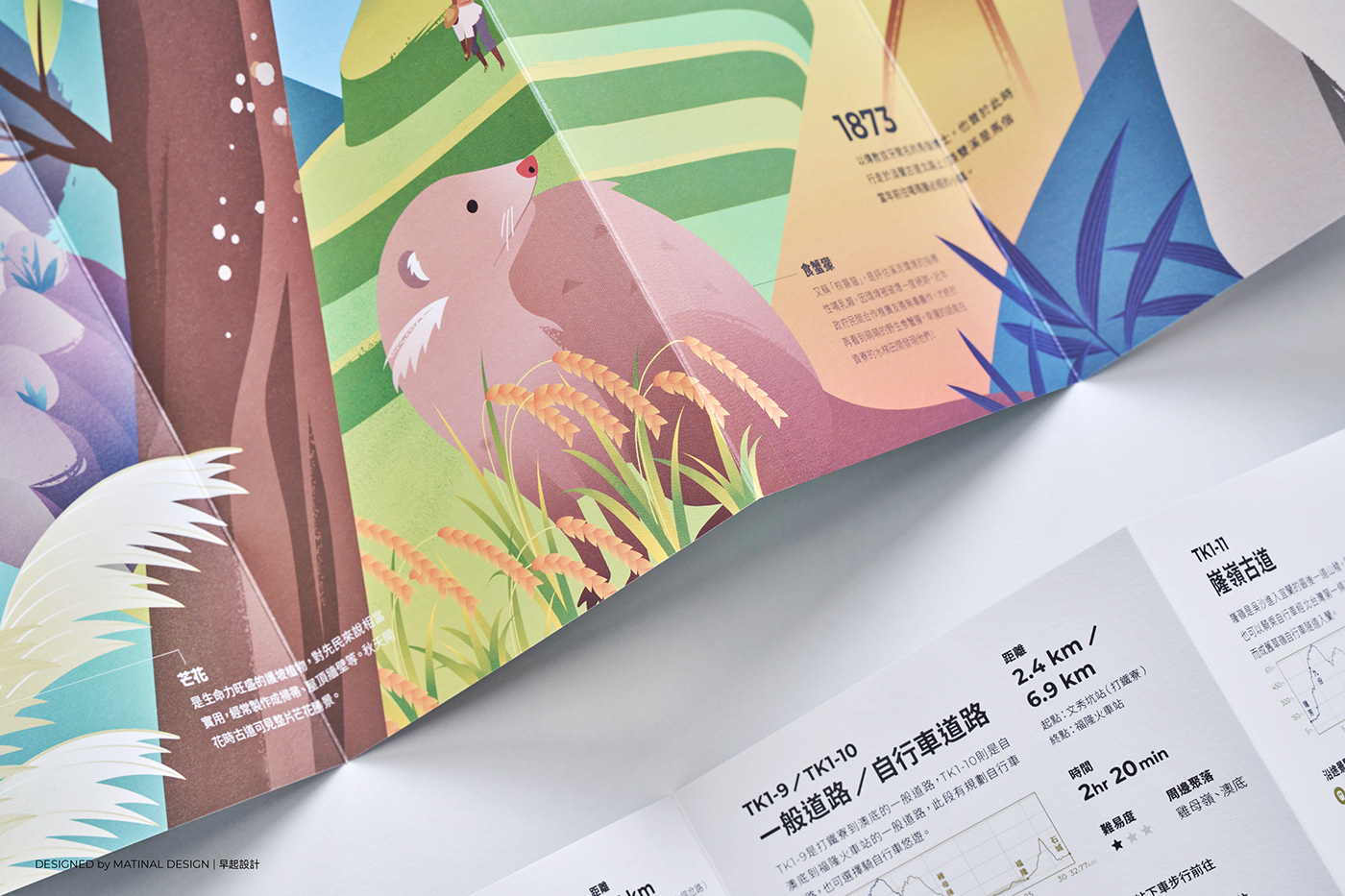
2. 主視覺:書衣的正面是淡蘭北路的主視覺,我們以淡蘭古道的代表元素之一「雙扇蕨」作為前景,後面看到的風景是淡蘭北路珍貴的歷史遺跡「舖跡」,四周則是最典型的淡蘭山徑風景-綠意盎然的樹林、常見的植物、被青苔附著的石頭以及蜿蜒的山徑。
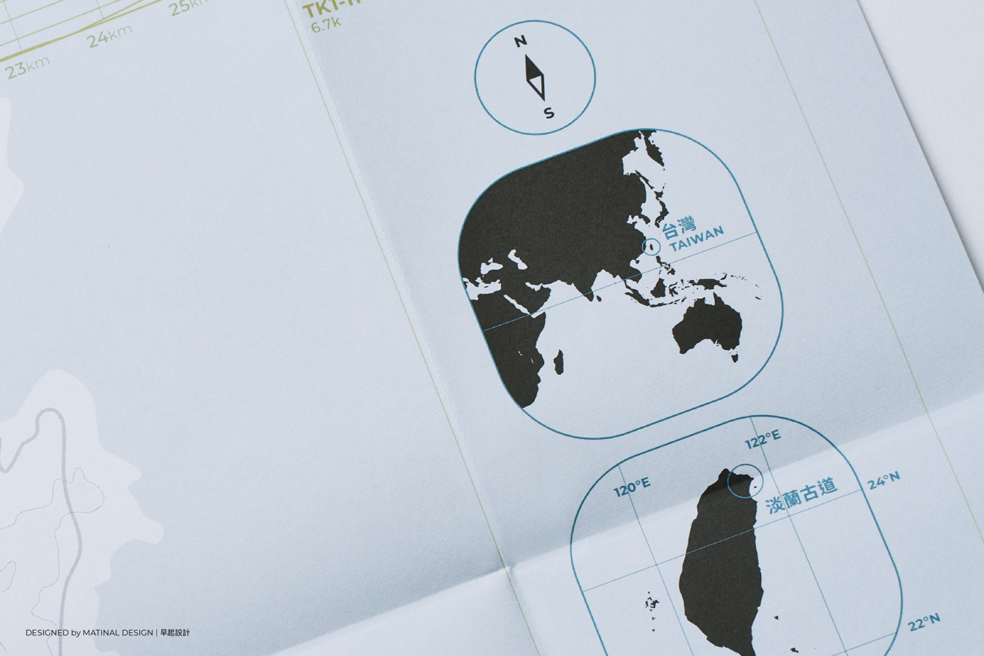
3. 健行地圖:紙張材質輕薄容易攜帶,正反面分別是主視覺及淡蘭古道北路的健行地圖,健行地圖中有詳細標示每一個路段的坡度及長度、經過的景點/聚落以及他們的功能性⋯等路途中需要的資訊。
Book Cover:
1. Waterproof Paper: Considering that the northern part of Taiwan’s weather is moist and rainy, we choose waterproof paper, so that you can wipe it and continue to use it even if it gets wet.
2. Key Vision: The book cover is the key vision of the Tamsui-Kavalan Trail. In the front is the most representative elements-Coupled Dipteris At the back is the precious historical remains-Post Ruins, surrounded by forests, plants, moss-attached stones and winding mountain, typical scenery of the Tamsui-Kavalan Trail.
3. Hiking Map: The paper is thin and easy to carry. The front and back are the key vision and hiking map of Tamsui-Kavalan Trail-Northern Trails. In the hiking map, there is much information, including the slope and length of each section in detail and the introduction of attractions/settlements.

資訊視覺化手冊
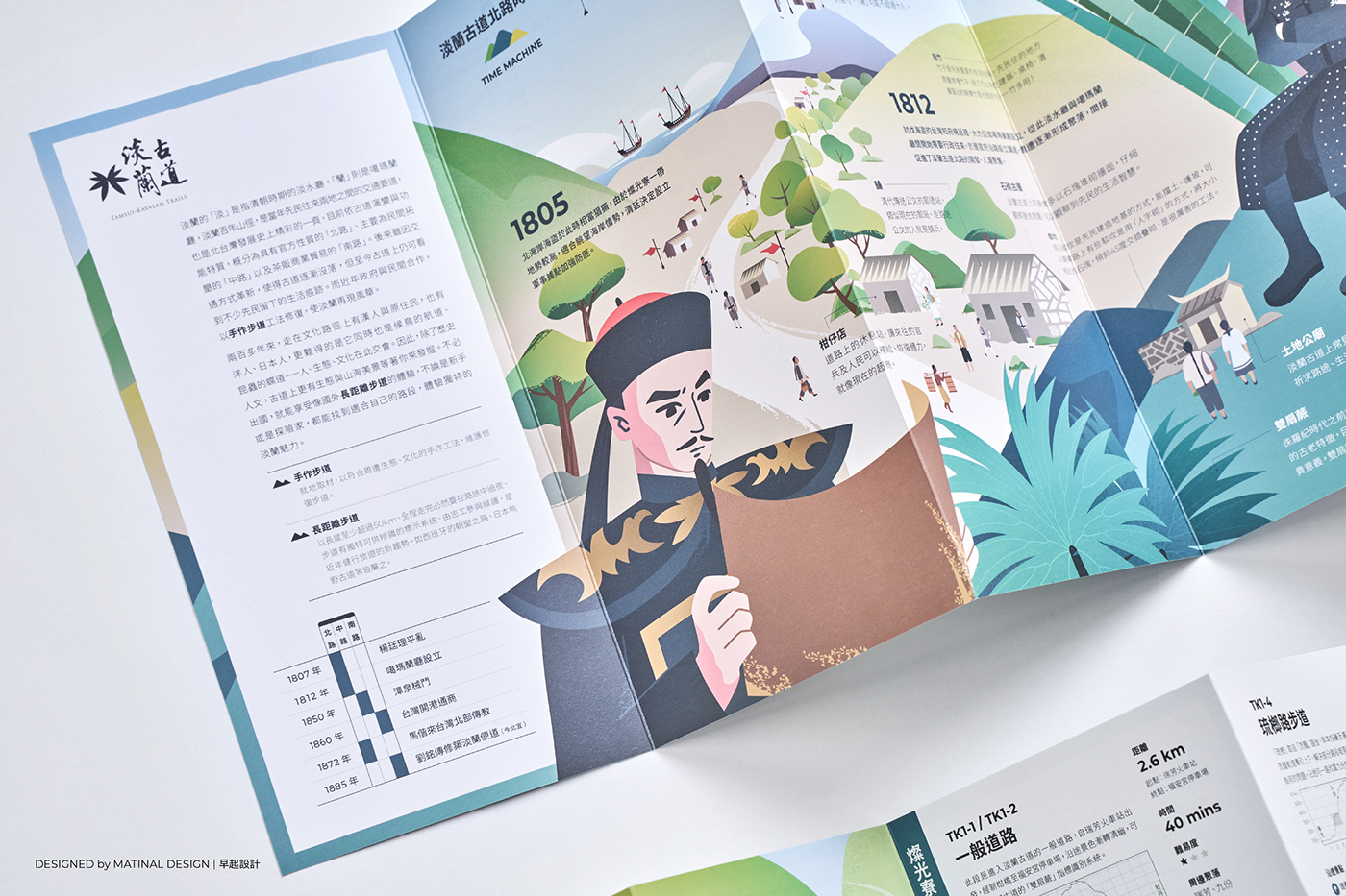
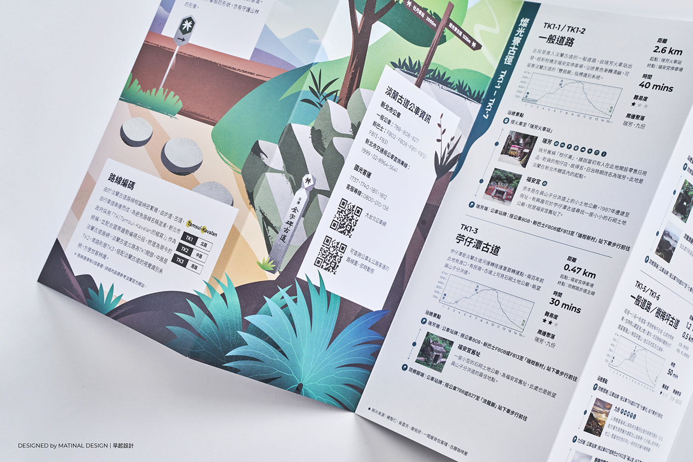
1. 風琴書:為了呈現淡蘭北路的重要歷史、特色人文及自然資源,我們用大篇幅且連續性的情境圖來呈現。因應連續性情境圖的特色,我們選用了風琴書作為載體,它的延續性高、不受篇幅限制,能充分地展現情境圖,在閱讀時也方便翻閱,是相當適切的載體。
2. 資訊視覺化(Inforgraphics):除了情境圖外,手冊背面則用資訊視覺化的方式揭露健行者需要的資訊,例如:路線資訊-將每個路段的坡度圖繪製出來,大幅提升了健行者對路線難度的理解;透過資訊分級的方式將健行者普遍最在意的路線長度、所需時間及難易度凸顯出來。 除此之外,我們也提供交通方式、景點/聚落介紹、愛護山林須知、行前須知(GPX離線地圖資訊、裝備建議)⋯等行前準備常用的資訊,讓健行者能夠安心出發、安全回家,同時也善盡健行者保護環境的責任。
Manual with visualized-information
1. Concertina Fold Book: We present the history, humanities and natural resources of the Tamsui-Kavalan Trail in a large and continuous situational image. Due to the fact that the concertina fold book has the feature of high continuity and unlimited space, it is to fully display the situation image, and the readers are also convenient to read. Therefore, we chose the concertina fold book as a carrier.
2. Infographics: The back of the manual visualizes the information that hikers need. For instance, route information-The slope of each road section is drawn, which greatly improves the understanding of the difficulty of the hiker on the route. To classifying information, we highlight the length, time and difficulty of the route that hikers generally care about most. Moreover, We provide transportation methods, attractions/settlements introduction, care for the forest, pre-trip information (GPX offline map information, equipment recommendations), and other commonly used information before the trip, so that hikers can not only set off safely and return home safely but also do their part to protect the environment.
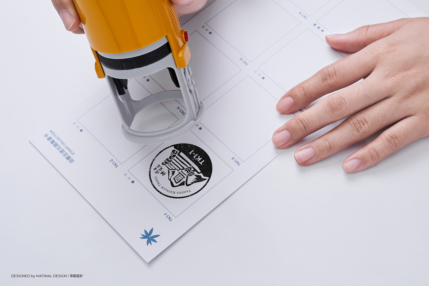
集章卡
淡蘭古道北路的路段,共分為一到三顆星三種難易度,並且用藍色章代表「親山休閒型」、黑色章代表「自然健行型」、紅色章代表「荒野冒險型」。
Stamps-collecting Card:
The section of Tamsui-Kavalan Trails - Northern Trails is divided into three difficulty levels, shown by one to three stars. Furthermore, the color of blue stamps means “Recreational Hike” trekking type, the color of black stamps represents the “Nature Hike” trekking type, and the color of red stamps indicates “Wilderness Adventure” trekking type.
客戶:新北市政府觀光局
視覺統籌:早起設計
設計:黃苡蓁、官佩萱
文案企劃:何田田
人物原型:張薰晏
攝影:楊世全
特別感謝:新北市觀光局企劃科團隊、吳雲天先生、蛙大、接受訪談的各位朋友
Client:Tourism and Travel Dept., New Taipei City
Visual coordination:Matinal Design
Design:I-Chen Huang / Pei-Hsuan Kuan
Copywriting:Tien-Tien Her
Character prototype:Tian-Tian, Ho
Photography:Yang Shih Chuan
Special Thanks:Team of Tourism and Travel Dept., New Taipei City / Yun-Tian Wu / Wa Da / Interviewers