My #30DayMapChallenge Experience, November 2019
I was one participant from Ukraine (I think so) so I chose a topic related to the territory of Ukraine. All this was created using open source software and open data created by OpenStreetMap contributors without the use of commercial software.
I used: QGiS, GRASS GIS, SAGA GIS, GDAL, Python, Blender, Inkscape, GIMP and Ubuntu 18.04.
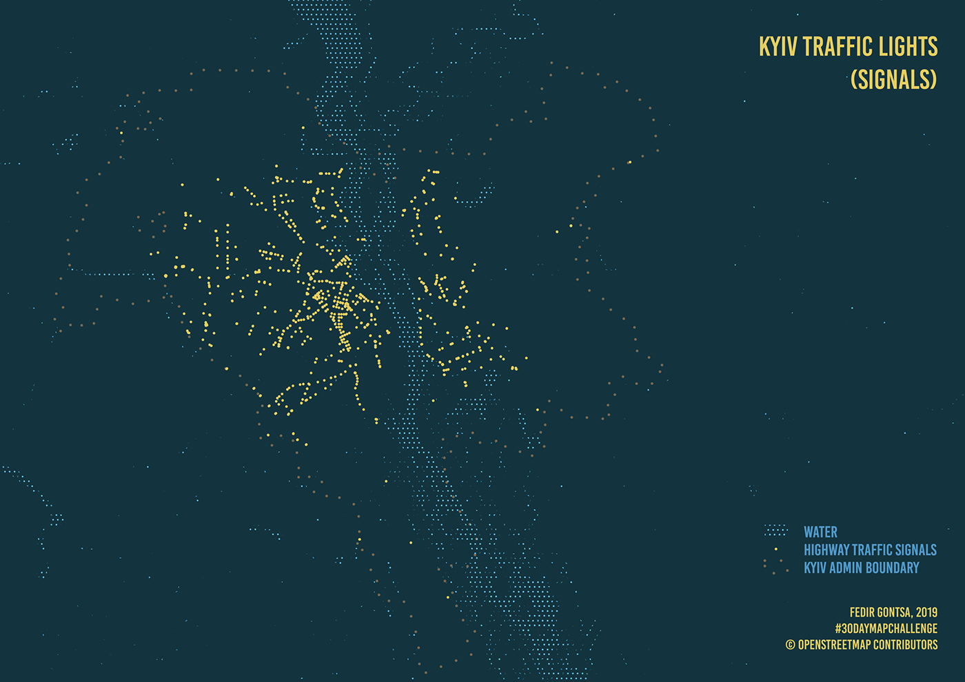
Day 01: Points
Kyiv traffic light (signals)
Data: OpenStreetMap contributors, QGIS
Data: OpenStreetMap contributors, QGIS
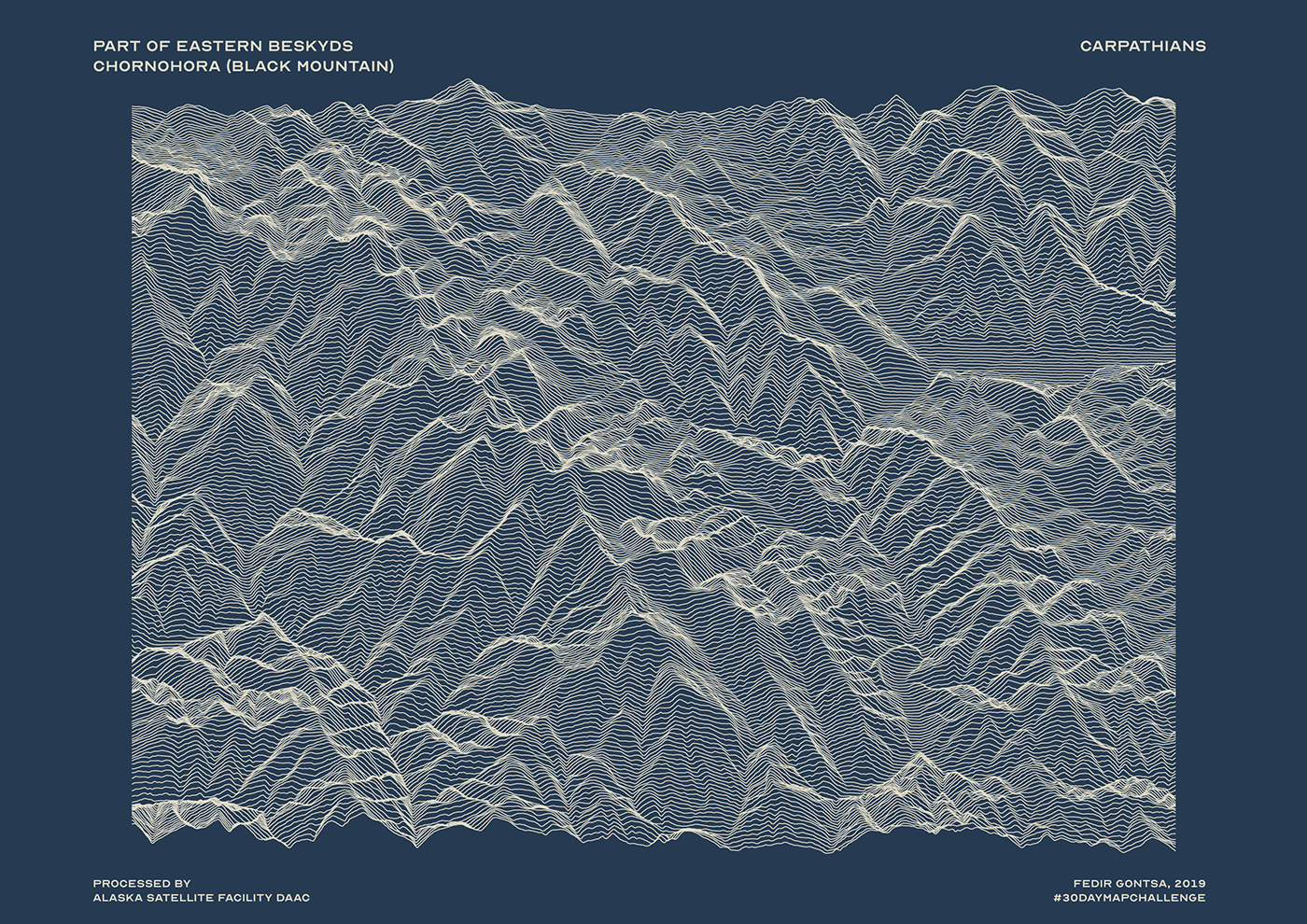
Day 02: Lines
Part of Eastern Beskyds, Chornohora (Black Mountain)
Thanks for the tutorial @imhere_asia You're great!
Data: Alaska Satellite Facility, QGIS
Thanks for the tutorial @imhere_asia You're great!
Data: Alaska Satellite Facility, QGIS
Day 03: Polygons
Isochrones map by time on cars between cities Lutsk an Rivne, Ukraine.
on the left is Lutsk - Population: 217,103
on the right is Rivne city - Population: 247,356
Data: OpenStreetMap contributors, QGIS
on the left is Lutsk - Population: 217,103
on the right is Rivne city - Population: 247,356
Data: OpenStreetMap contributors, QGIS

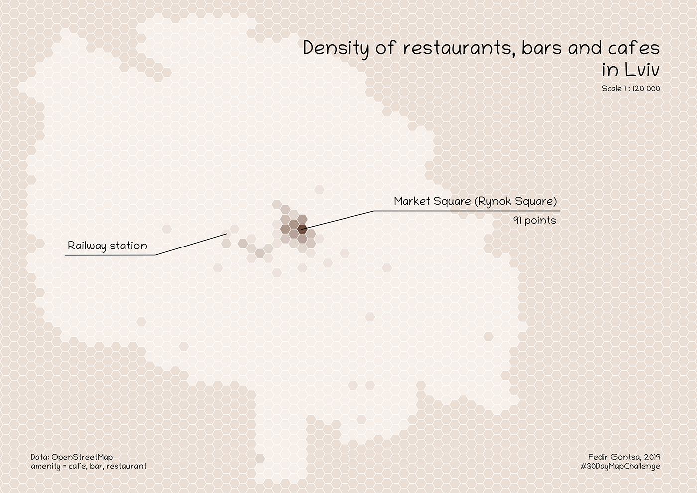
Day 04: Hexagons
Density of restaurants, bars and cafes in Lviv (Ukraine)
Data: OpenStreetMap contributors, QGIS
Data: OpenStreetMap contributors, QGIS
Day 05: Raster
The northern part of the Black Sea in winter, 2018.
Created with combination True Color Band (4+3+2) and False color IR composite (8+4+3) for land, Inverted True Color and Inverted Infrared bands for water.
Data: SENTINEL-2A European Space Agency - ESA
Created with combination True Color Band (4+3+2) and False color IR composite (8+4+3) for land, Inverted True Color and Inverted Infrared bands for water.
Data: SENTINEL-2A European Space Agency - ESA

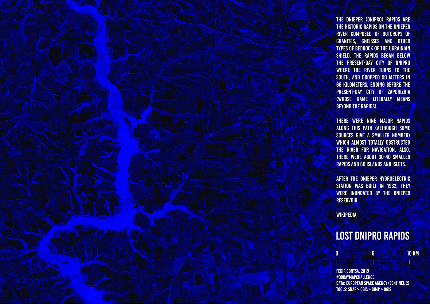
Day 06: Blue
Lost Dnipro river rapids.
Between the cities of Dnipro and Zaporizhia, Ukraine.
Data: Sentinel2
p.s. Rapids is not on the map, they are underwater ;)
Data: Sentinel2
p.s. Rapids is not on the map, they are underwater ;)
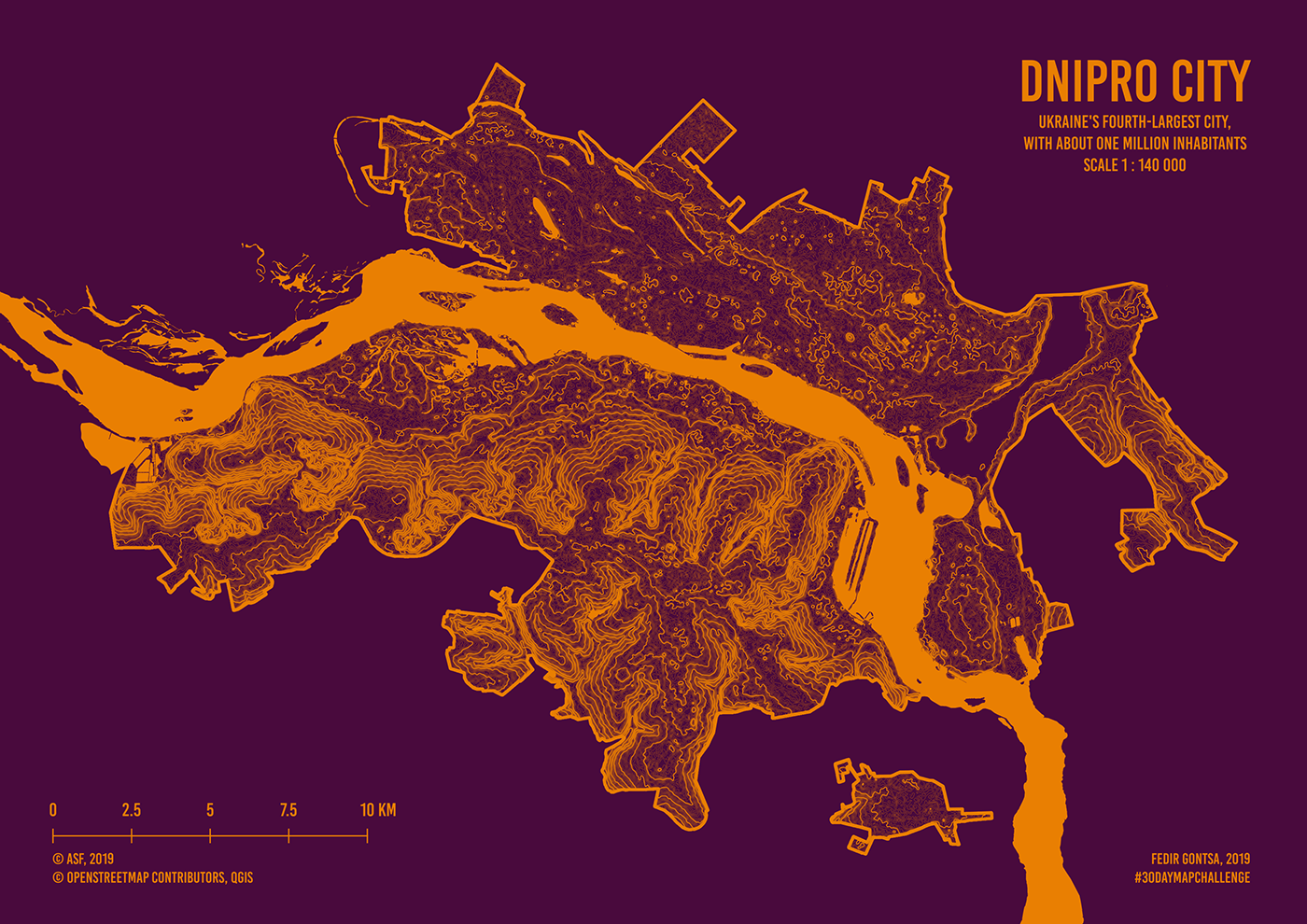
Day 07: Red
Dnipro city. Relief
Data: Alaska Satellite Facility, OpenStreetMap contributors
Data: Alaska Satellite Facility, OpenStreetMap contributors
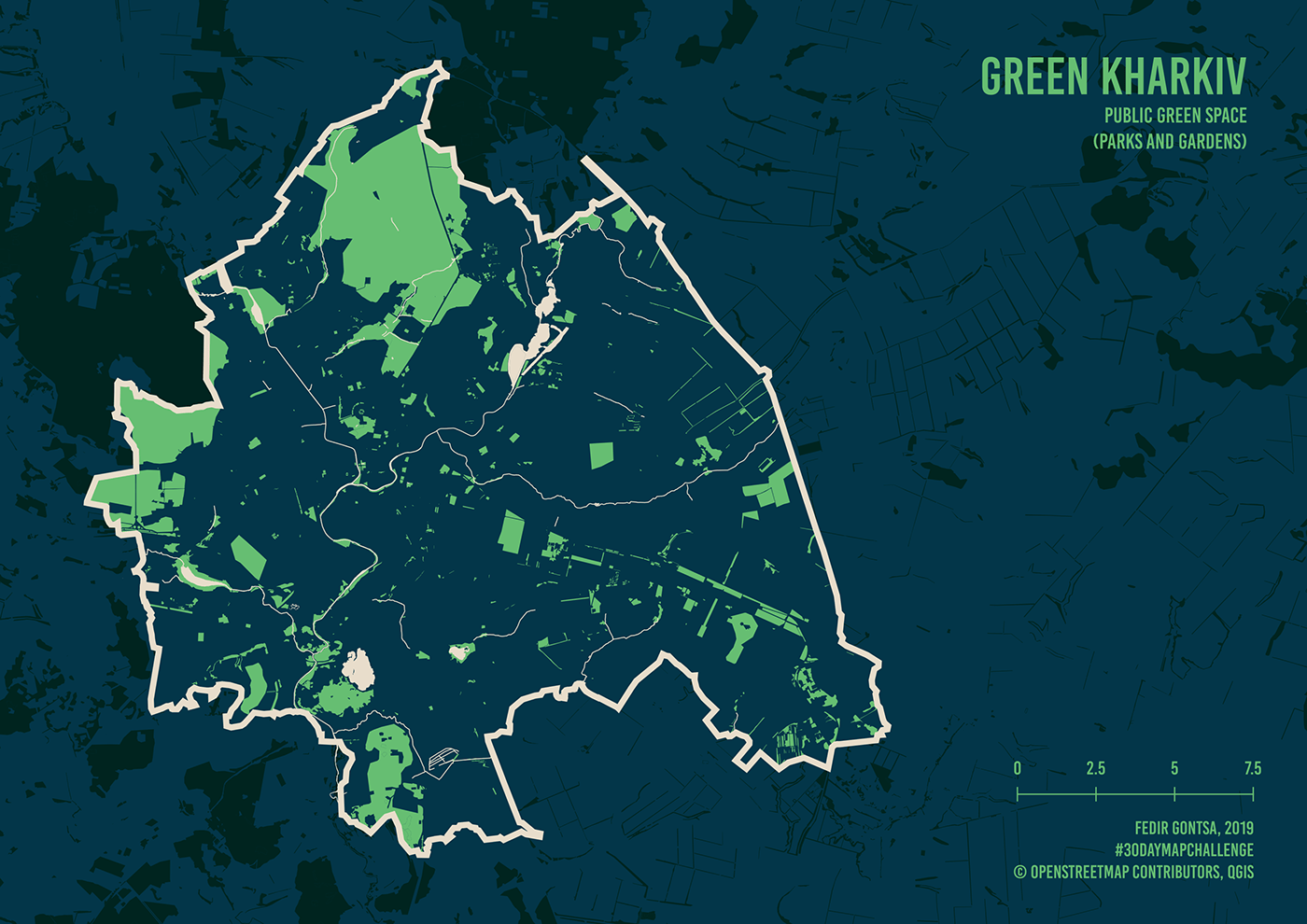
Day 08: Green
Green Kharkiv. Public green space.
Data: OpenStreetMap contributors
Data: OpenStreetMap contributors
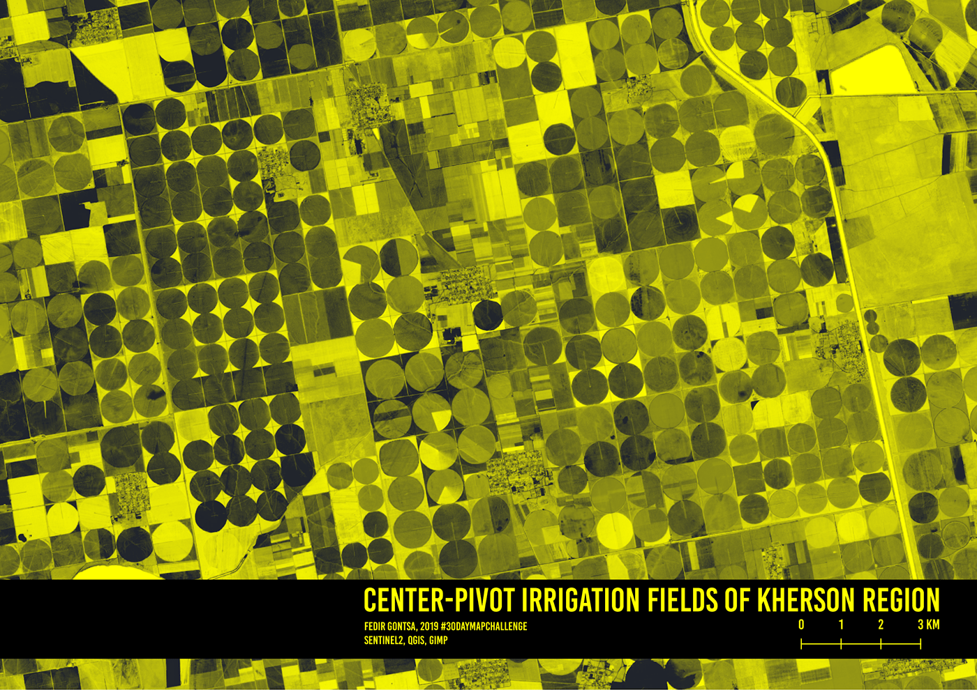
Day 09: Yellow
Center-pivot irrigation fields of Kherson region
Data: Sentinel2, qgis, gimp2
Data: Sentinel2, qgis, gimp2
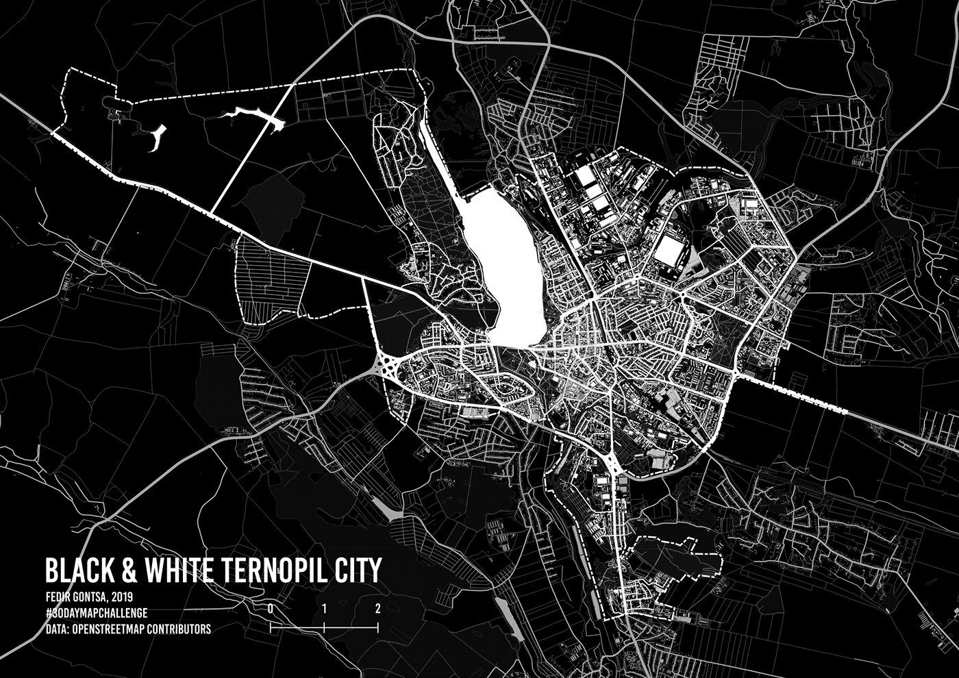
Day 10: Black and white
Black & White Ternopil city
Data: OpenStreetMap contributors, qgis
Data: OpenStreetMap contributors, qgis
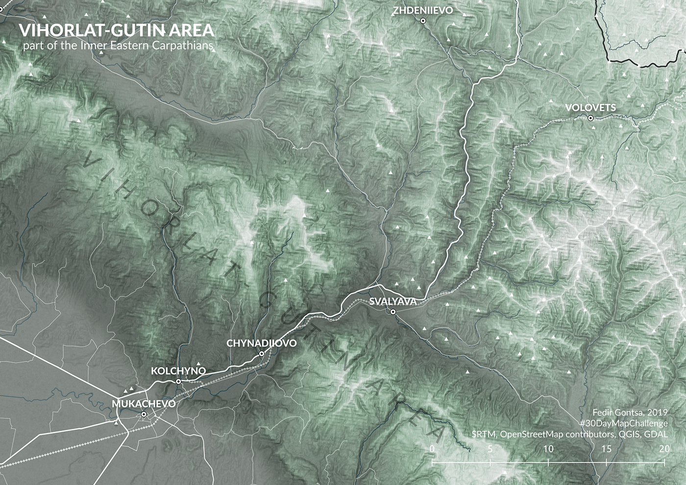
Day 11: Elevation
Vihorlat-Gutin Area part of the Inner Eastern Carpathians
Data: SRTM, OpenStreetMap contributors, qgis
Data: SRTM, OpenStreetMap contributors, qgis
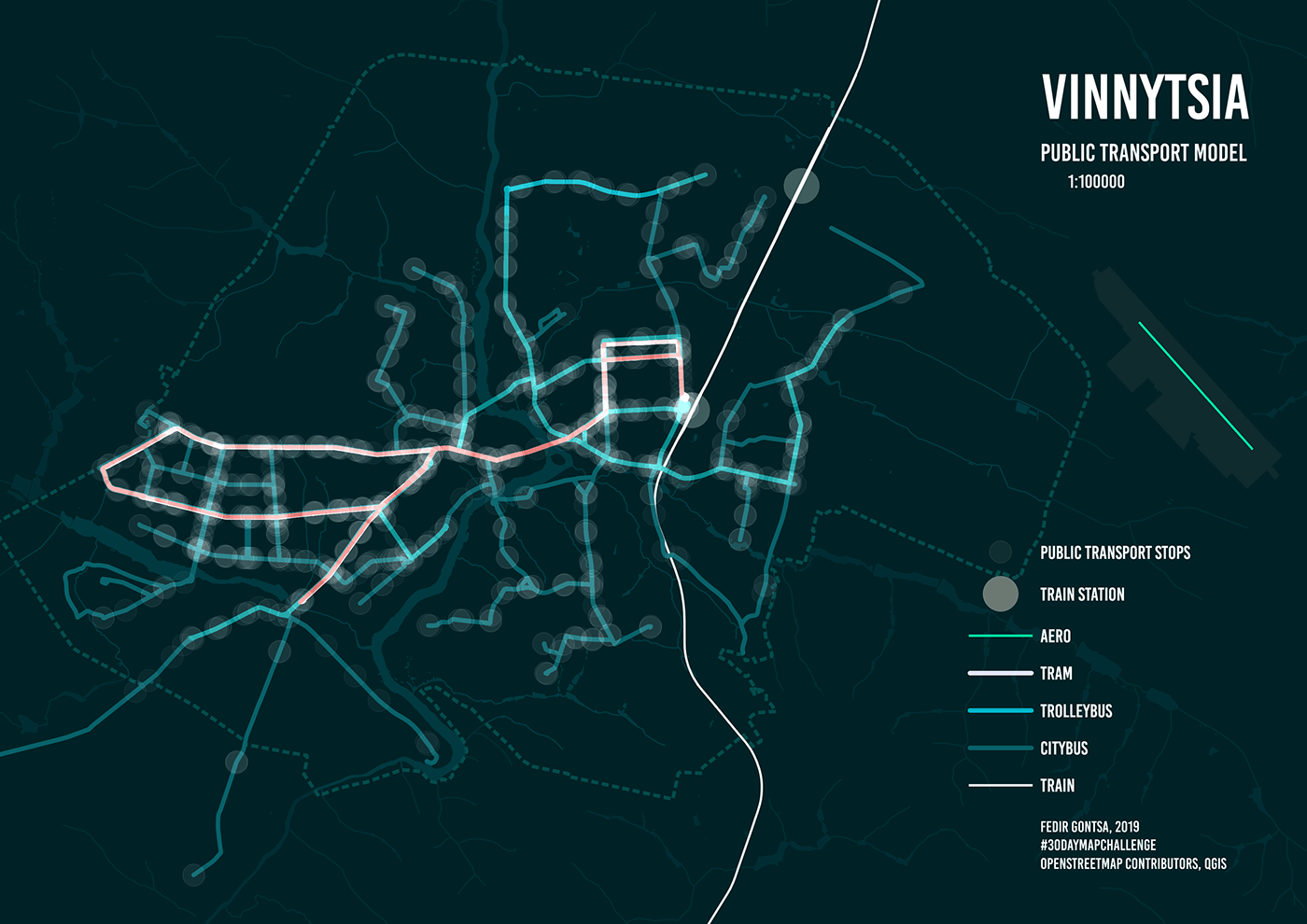
Day 12: Movement
Vinnytsia Public Transport Abstract Model
OpenStreetMap contributors, qgis
OpenStreetMap contributors, qgis
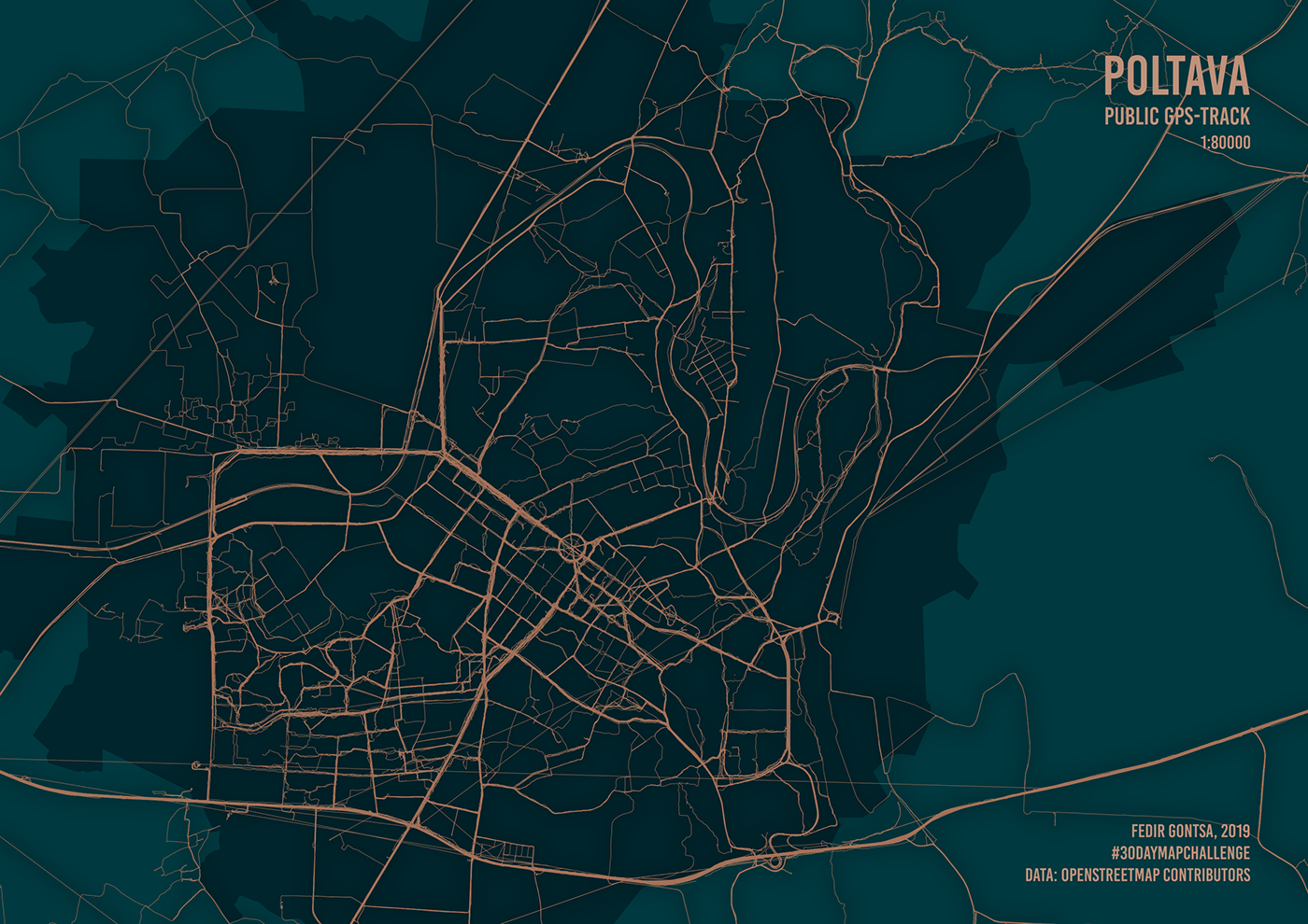
Day 13: Tracks
Poltava. Public GPS Track
Visitors and residents create their own urban fabric.
OpenStreetMap contributors, qgis
Visitors and residents create their own urban fabric.
OpenStreetMap contributors, qgis
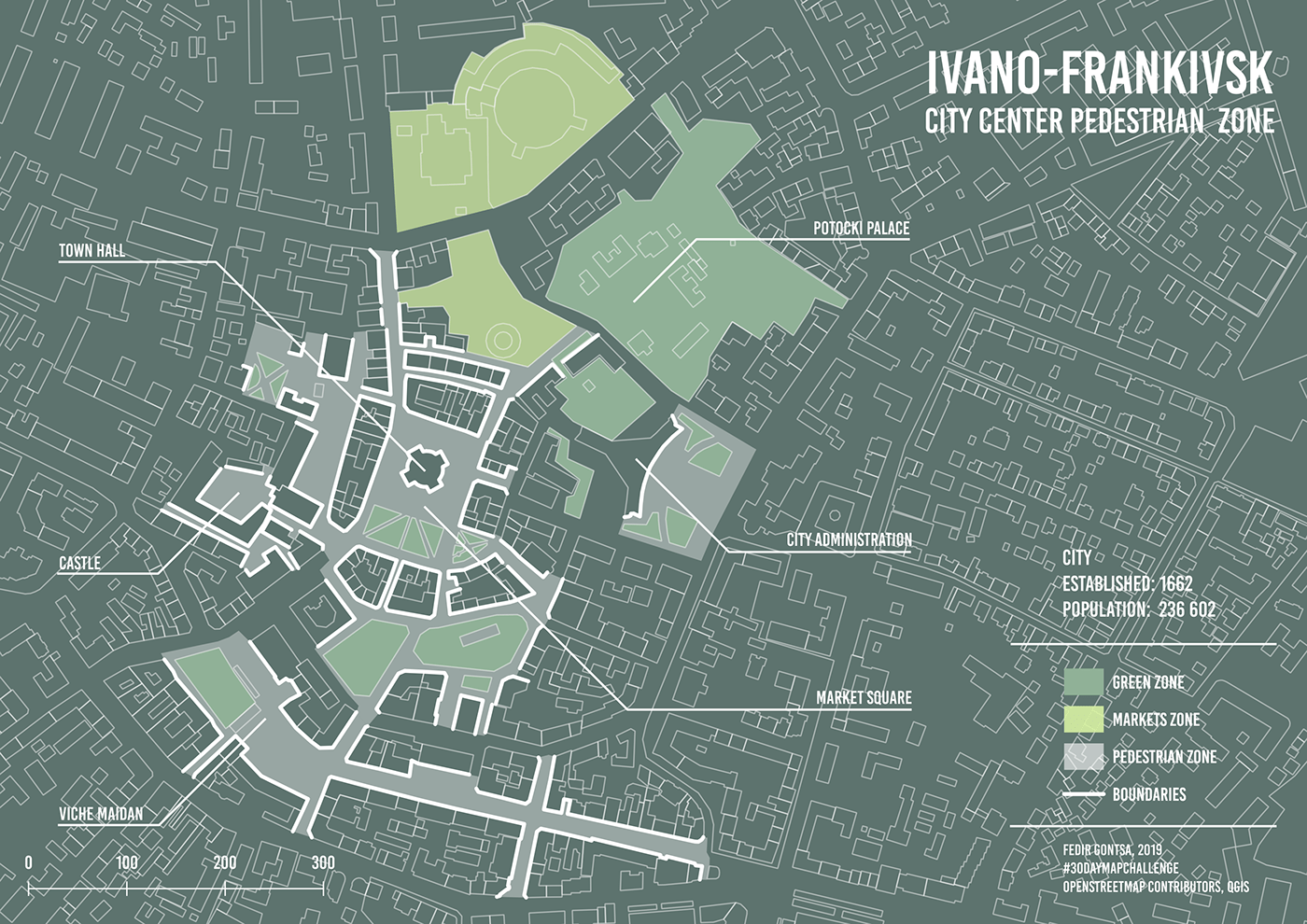
Day 14: Boundaries
Ivano-Frankivsk. City center pedestrian zone boundaries
Data: OpenStreetMap contributors qgis
Data: OpenStreetMap contributors qgis
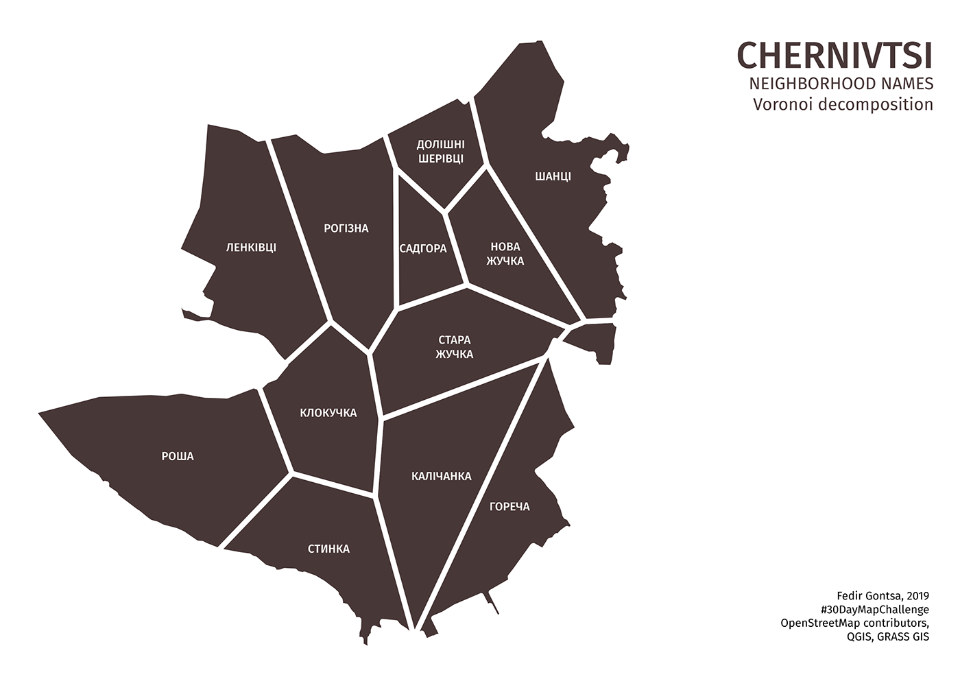
Day 15: Names
Chernivtsi. City neighborhood names (Voronoi decomposition).
OpenStreetMap contributors, qgis, grassgis
OpenStreetMap contributors, qgis, grassgis
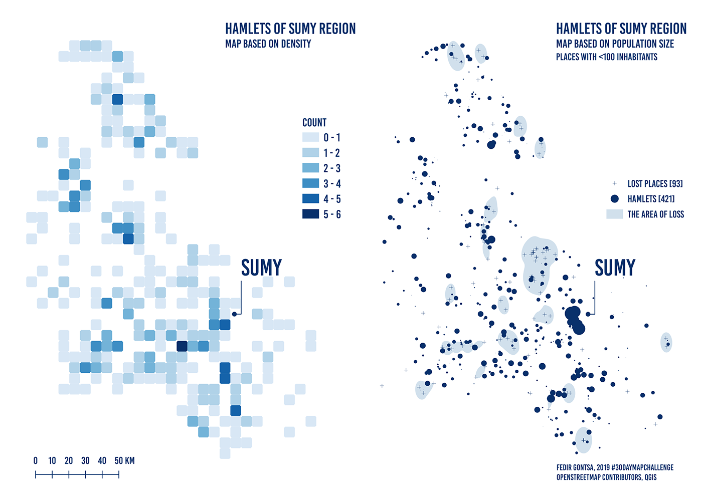
Day 16: Places
Sumy oblast (region), Northeast Ukraine. Region with the largest number of hamlets.
Map based on density and map based on population size with loss.
OpenStreetMap contributors, qgis
Map based on density and map based on population size with loss.
OpenStreetMap contributors, qgis
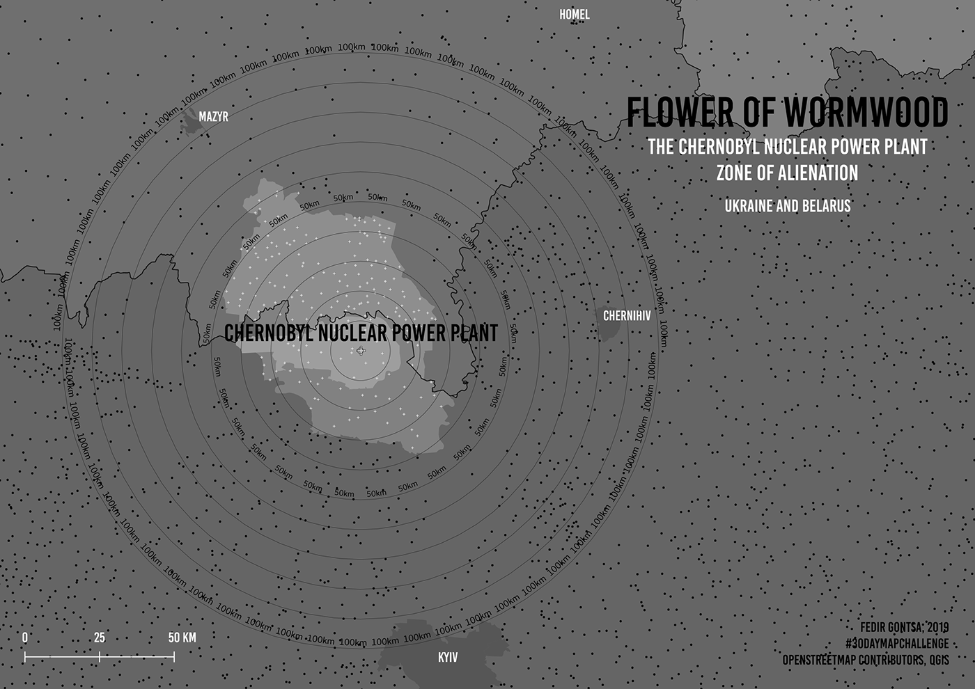
Day 17: Zones
Flower of wormwood (Artemisia vulgaris)
The Chernobyl Nuclear Power Plant Zone of Alienation
Based on my old project
Data: OpenStreetMap contributors, qgis
The Chernobyl Nuclear Power Plant Zone of Alienation
Based on my old project
Data: OpenStreetMap contributors, qgis
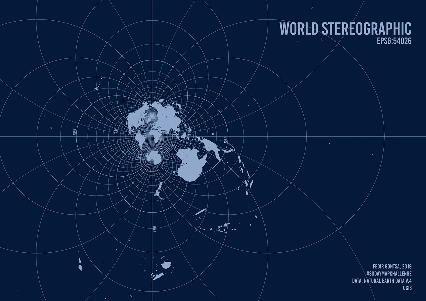
Day 18: Globe
World Stereographic. EPSG:54026
Data: Natural Earth Data v.4
Data: Natural Earth Data v.4
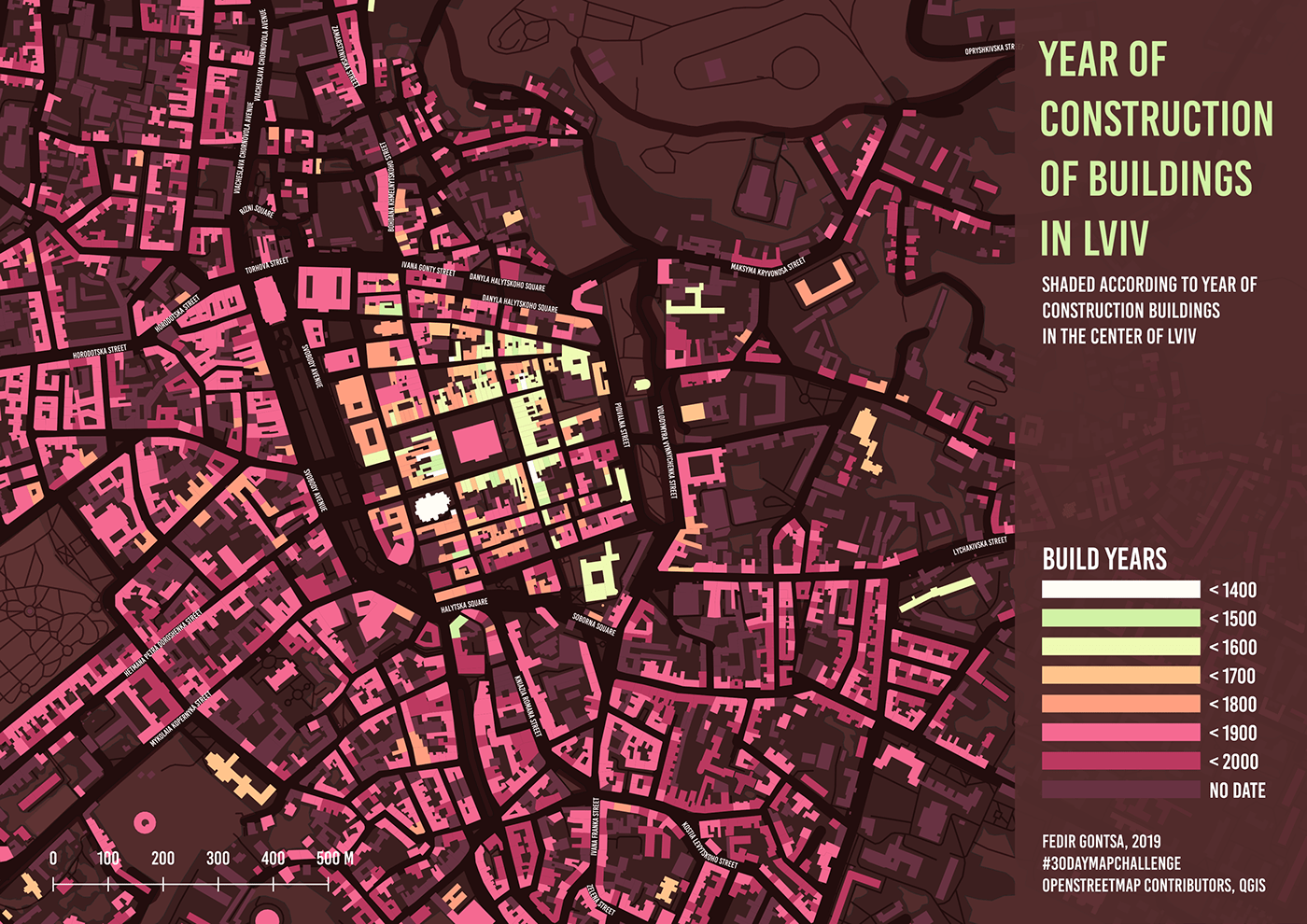
Day 19: Urban
Year of construction of buildings in Lviv, Ukraine.
Shaded according to year of construction buildings in the center of city.
Lviv was founded of the 13th century.
Data: OpenStreetMap contributors, qgis
Shaded according to year of construction buildings in the center of city.
Lviv was founded of the 13th century.
Data: OpenStreetMap contributors, qgis
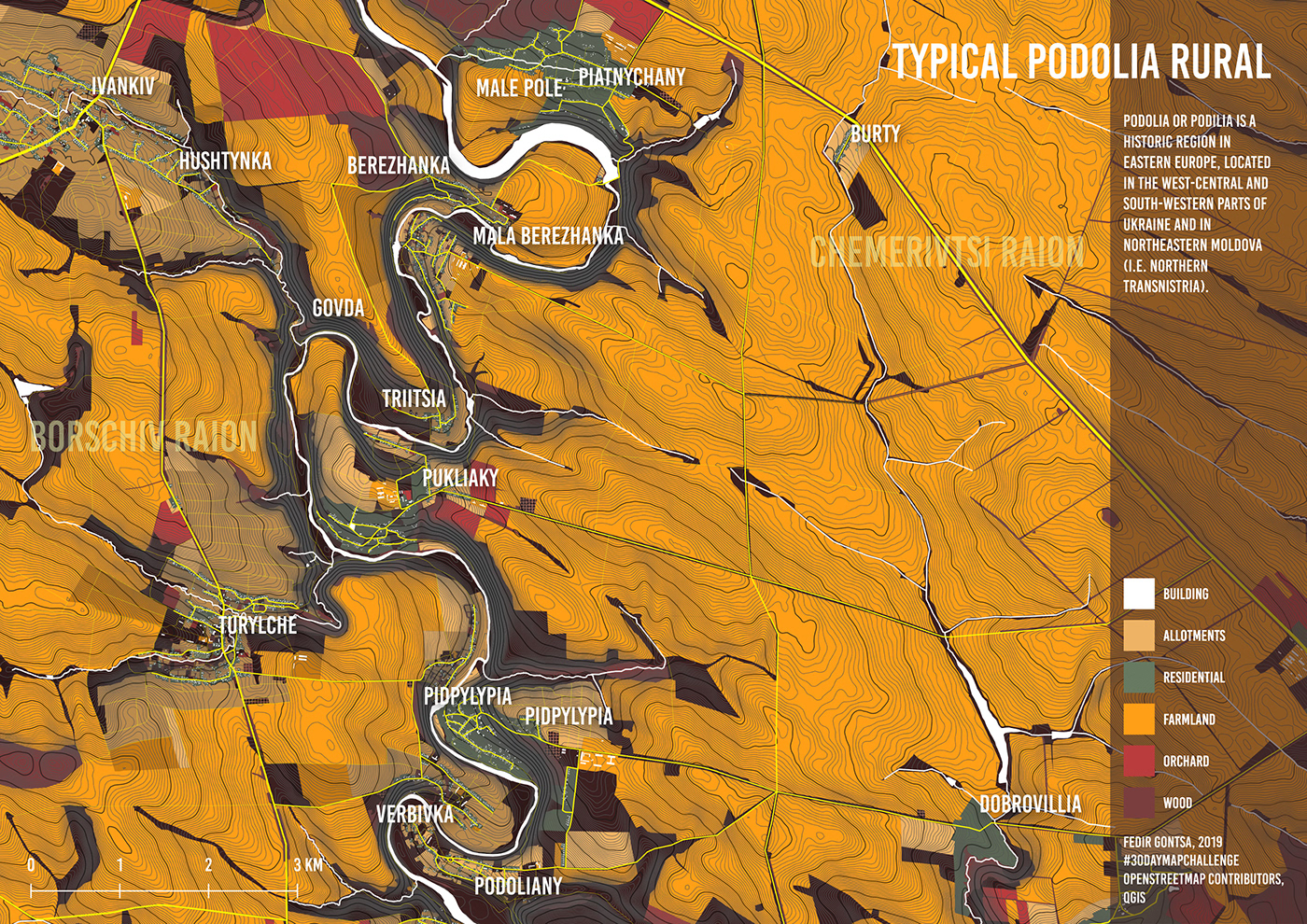
Day 20: Rural
River Zbruch millennial natural border. I tried to show the typical structure Podolia countryside.
Left side Ternopil region, right Khmelnytsky region of Ukraine.
Podolia or Podilia is a historic region in Eastern Europe, located in the west-central and south-western parts of Ukraine and in northeastern Moldova (i.e. northern Transnistria).
Data: OpenStreetMap contributors, qgis
Left side Ternopil region, right Khmelnytsky region of Ukraine.
Podolia or Podilia is a historic region in Eastern Europe, located in the west-central and south-western parts of Ukraine and in northeastern Moldova (i.e. northern Transnistria).
Data: OpenStreetMap contributors, qgis
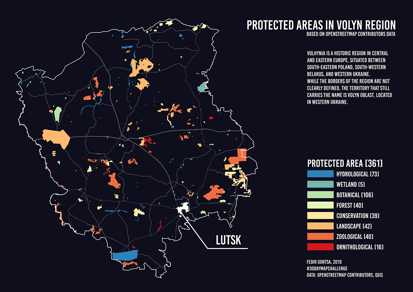
Day 21: Environment
Protected areas in Volyn region, Ukraine. Based on Openstreetmap contributors data
Data: OpenStreetMap contributors, qgis
Data: OpenStreetMap contributors, qgis
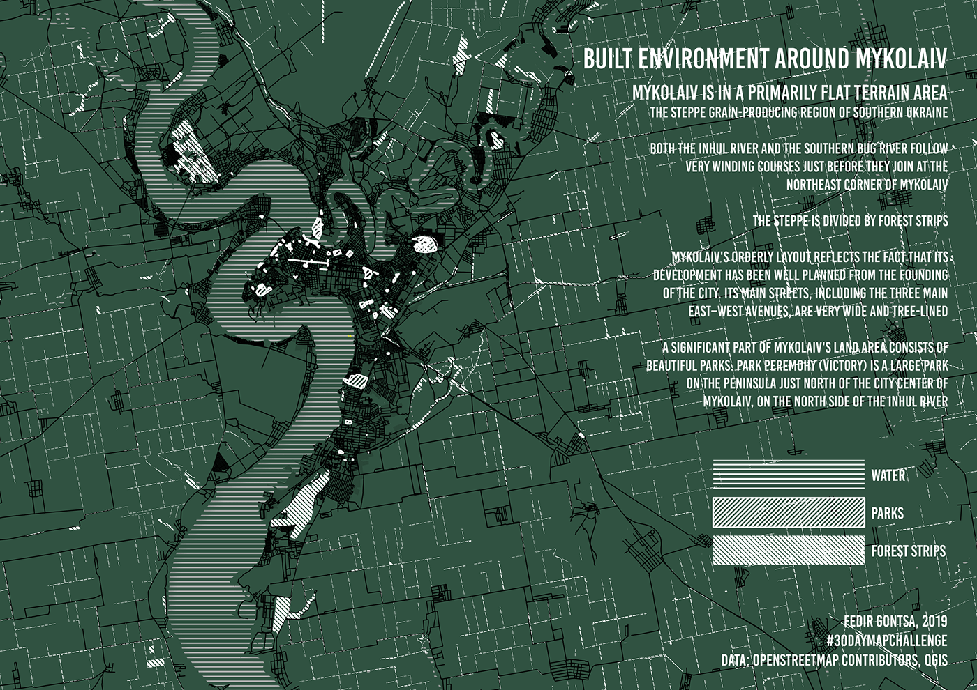
Day 22: Built Environment
Built environment around Mykolaiv, Ukraine.
Data: OpenStreetMap contributors, qgis
Data: OpenStreetMap contributors, qgis
Day 23: Population
Map of depopulation of Ukrainian SSR in 1933.
Today's theme of the MapChallenge is related to the population.
Today is the Holodomor Remembrance Day In Ukraine.
So I created this map. More http://gis.huri.harvard.edu/historical-atlas/the-great-famine.html
Data: Ukrainian Research Institute at Harvard University,
Ukrainian Institute of National Remembrance «The Memorial to Victims of the Holodomor» National Museum

Day 24: Statistics
Abstract statistics on fertility, mortality and migration processes for the first part of 2019
in some regions of Ukraine.
Data: OpenStreetMap contributors, qgis, ukrstat.gov.ua
in some regions of Ukraine.
Data: OpenStreetMap contributors, qgis, ukrstat.gov.ua

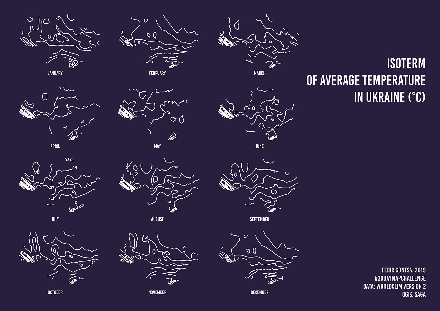
Day 25: Climate
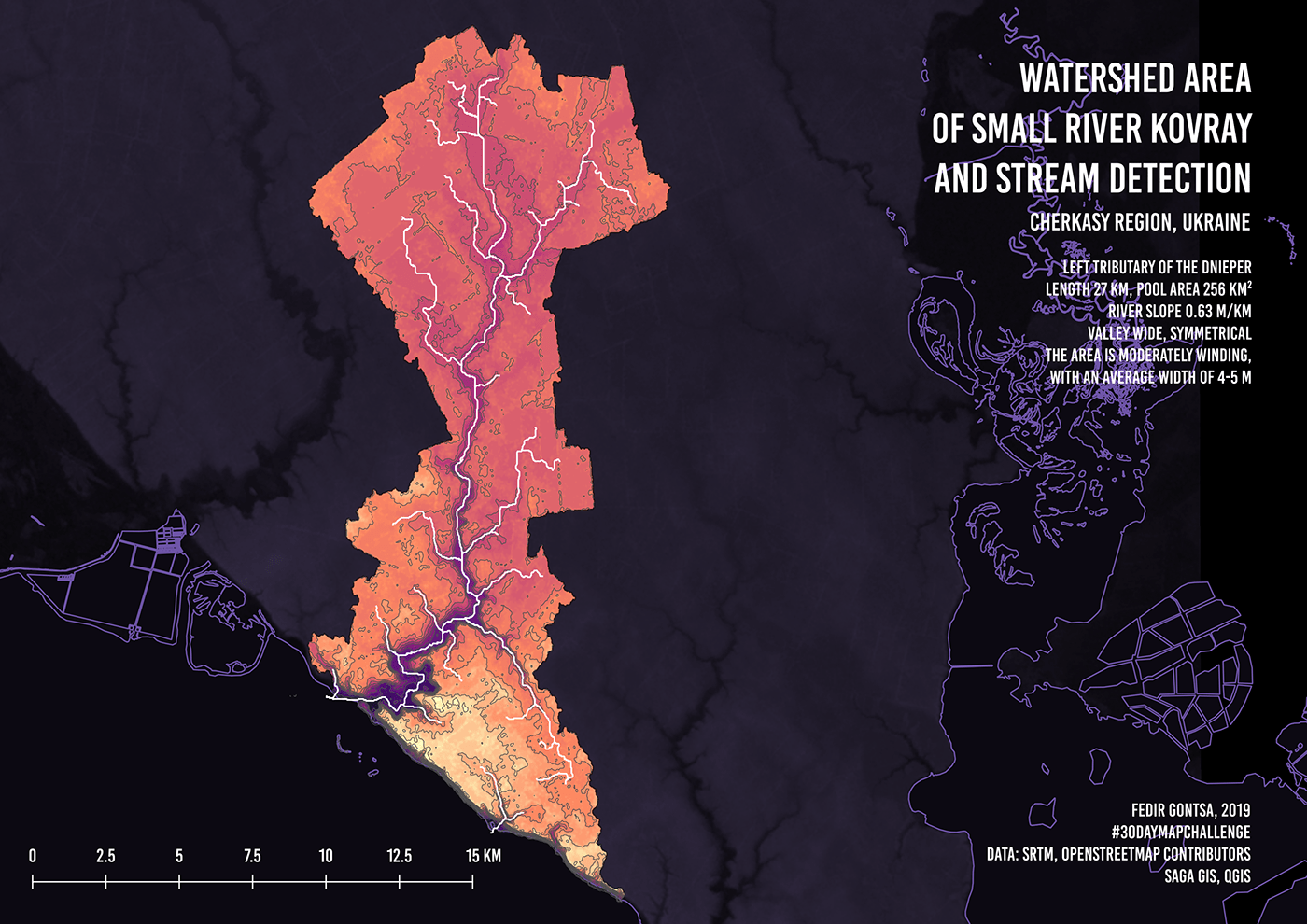
Day 26: Hydrology
Watershed area of small river Kovray (Cherkasy region, Ukraine) and stream detection.
Data: SRTM, OpenStreetMap contributors
SAGA GIS, QGIS
Data: SRTM, OpenStreetMap contributors
SAGA GIS, QGIS
Day 27: Resources
Open-pit mining in the Dnipropetrovsk Oblast. Kryvorizkyi Iron Ore Basin (Kryvbas)
Data: OpenStreetMap contributors, qgis
Data: OpenStreetMap contributors, qgis

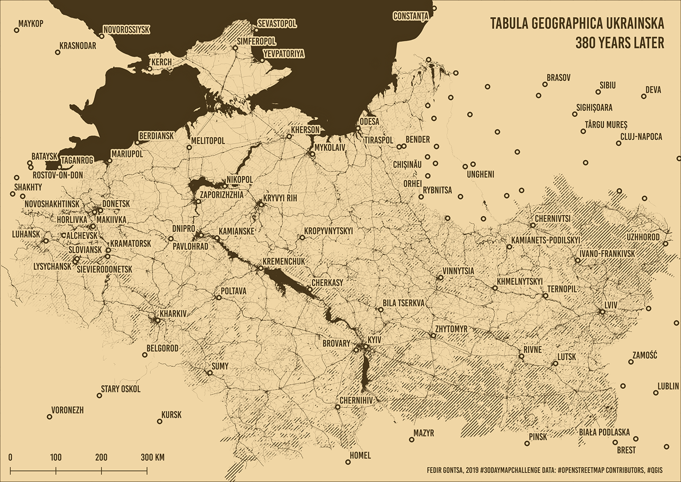
Day 28: Funny
My allusion. In 1639, Beauplan created the first "descriptive" map of Ukraine.
Guillaume Le Vasseur de Beauplan
«Delineatio Generalis Camporum Desertorum vulgo Ukraina. Cum adjacentibus Provinciis».
«Delineatio Generalis Camporum Desertorum vulgo Ukraina. Cum adjacentibus Provinciis».
The main feature - oriented to the south.
Data: OpenStreetMap contributors, qgis
Note: the first edition of the map was created 380 years ago. This map is just the first prototype. This Challenge outlined directions for my future development. So there are many prototypes here. Every day, a new prototype isn't so bad ;) Of course, achieving the skill with which this series of maps was created is not an easy task. But I will try;)
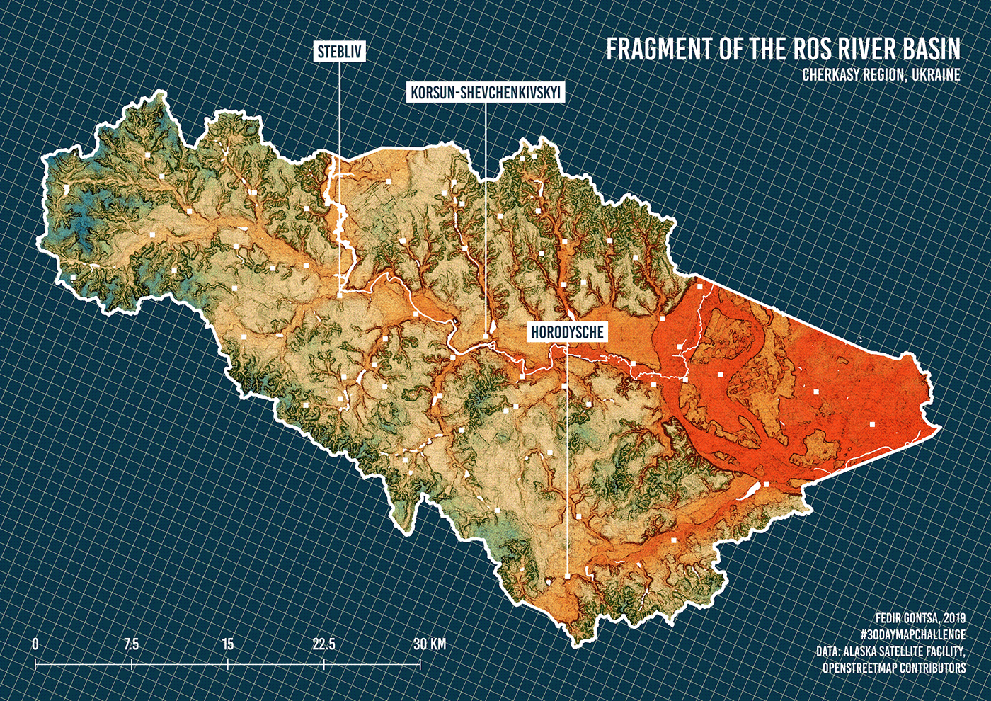
Day 29: Experimental
Fragment of the Ros river basin.
Data: Alaska Satellite Facility, OpenStreetMap contributors
Data: Alaska Satellite Facility, OpenStreetMap contributors
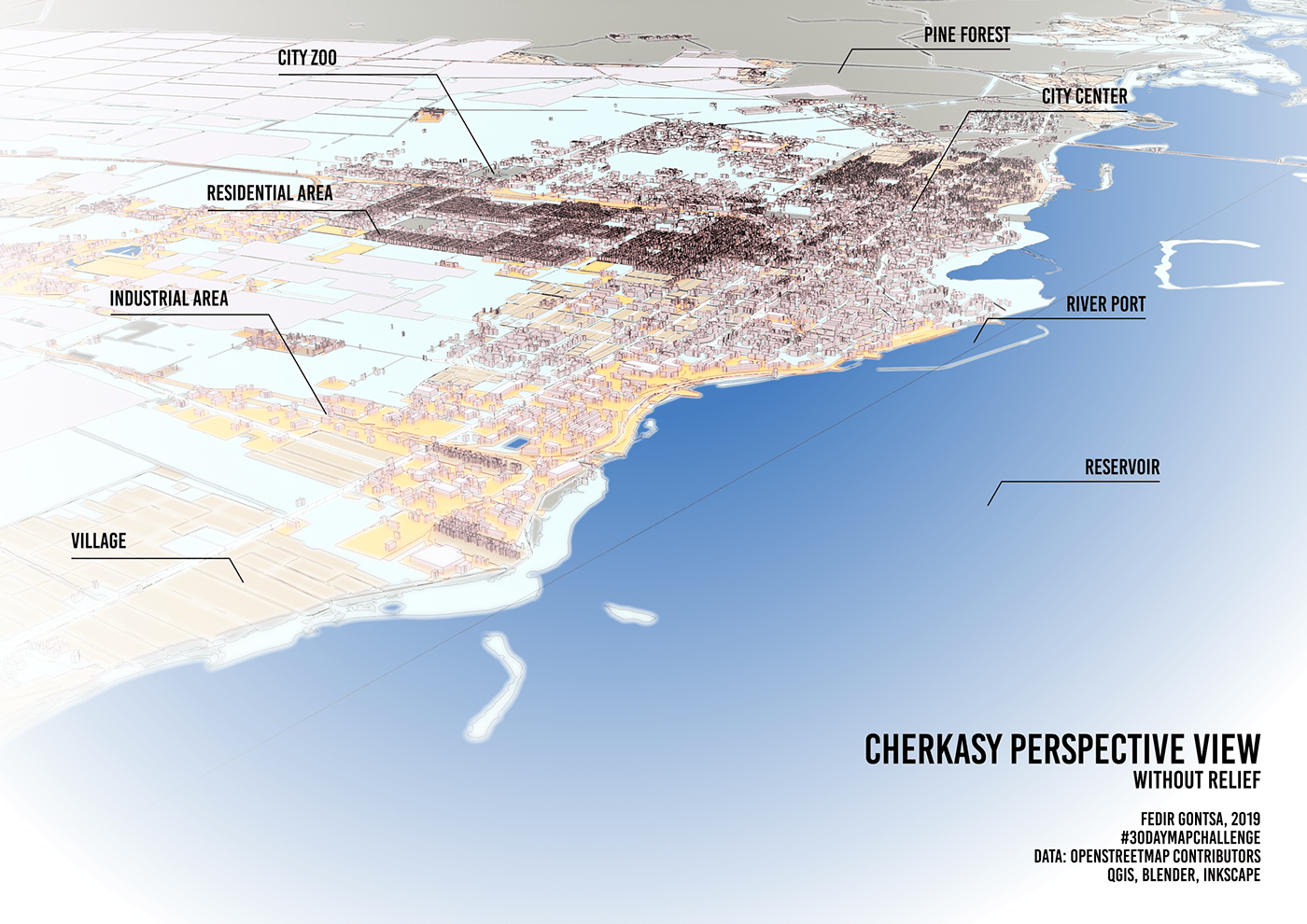
Day 30: Home
The City of Cherkasy. Perspective view without relief.
Data: OpenStreetMap contributors
QGIS, Blender, Inkscape
Data: OpenStreetMap contributors
QGIS, Blender, Inkscape
That's all!
Thank you for watching!
Thank you for watching!
30 days. Create a new map every day and published. It was difficult but it was worth it.
Thank you @tjukanov for activate the planet Earth on #30DayMapChallenge :)
Thank you @tjukanov for activate the planet Earth on #30DayMapChallenge :)
Thanks to everyone who didn't give up. Thank you to everyone who joined, even in part.
It's amazingly beautiful!
ALL MAPS IN TABLES
ALL MAPS IN TABLES
UPDATE
OSM: Perspective view of Cherkasy is the "OpenStreetMap Featured Image" on Week 50 (from Monday 9 December 2019 to Sunday 15 December 2019) !: https://wiki.osm.org
Texty.org.ua (in Ukrainian): Колекція захоплюючих карт про Україну (ІНФОГРАФІКА) http://texty.org.ua/pg/news/devrand/read/98373


