

Milan Radisics
SUR/REAL LANDS
a chapter from @water.shapes.earth project
On the border between documentary and abstraction
Sur/Real Lands series by photographer Milan Radisics is a chapter from his awarded water.shapes.earth project, exploring artistic farmlands in dry area of Spain near Zaragoza and Toledo, where, along the backs of mountains, dried out streams had become farmland. Not only were these parcels easy to reach, but the soil’s moisture content and the fertile conditions produced by the stream’s deposits helped farmers weather the dry summer season.
Surely, the local farmers are not aware what abstract formations their work has created, since they are only visible from the sky. As a result of the photographer’s painstaking research work, he was able to choose the most interesting sites from satellite maps. Later, on location, he immortalized them with his drone.
The completed artworks are actually aerial photographs that appear to be abstract paintings recall the work of historical spanish artists like Pablo Picasso, Joan Miro and Salvador Dali.
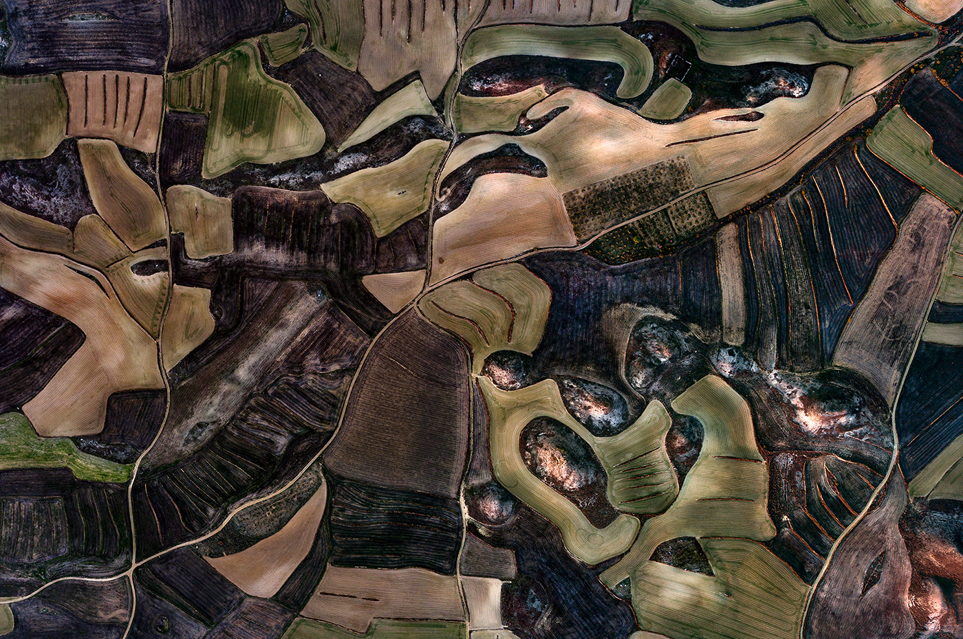
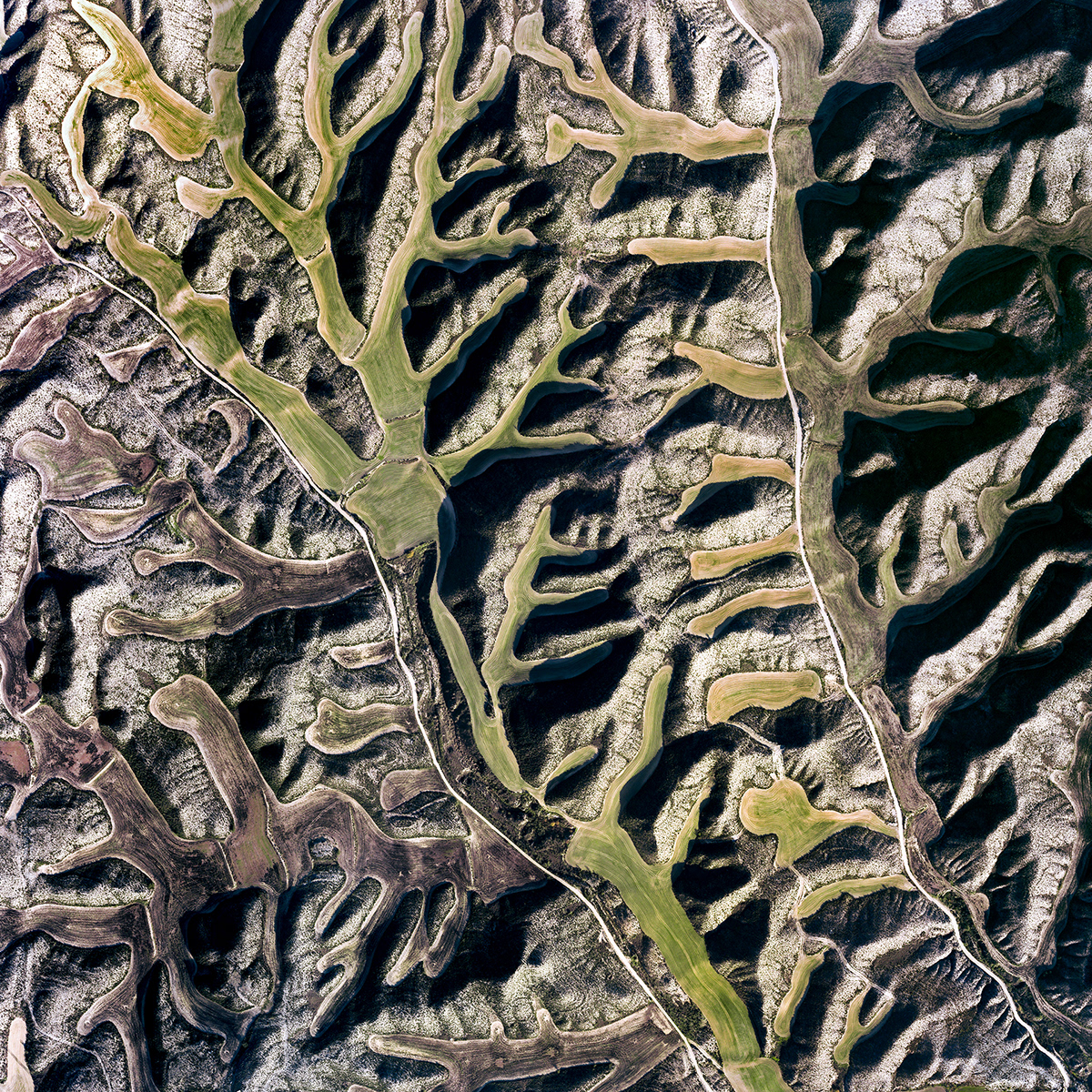
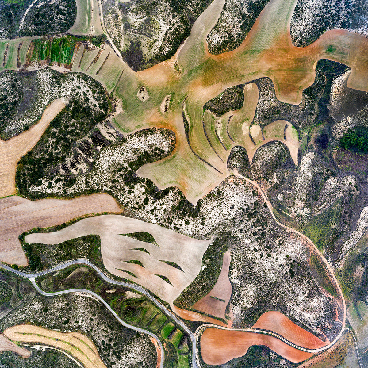
Camino del Molino
Amorphous forms of hatched wheat plots, freshly cultivated areas, and irregularly shaped lands covered with uncultivated dry vegetation were shaped by late streams and reliefs. Villamayor de Gállego, Zaragoza, Spain. 12/29/2018
Visible width: 1310 m
Casar a la Guardia
Tiny parcels are shaped by long-gone streams and volcanic relief, while the red color of the landscape is attributed to the high concentration of bauxite in the soil. The Cedron river basin, La Guardia, Toledo, Spain. 12/31/2018
Visible width: 1130 m
The landscapes with no horizon. The aerial perspective flattens the topography onto a plane, thus reinterpreting the landscape. Hills become patches and the slopes in between become lines, drawing map-like traces along the surface, which seems like a painter’s canvas. Time and space are suspended, and it is up to the beholder to decide what they are seeing – one-million-year-old geology, Surrealism from the early twentieth century, Mankind’s everyday struggle, or a prediction of future droughts.

Esquivias
Farmers use small parcels to level the sloping terrain in order to retain the rare rainfall. The gray color of the landscape is imparted by the high concentration of borax in the soil. Esquivias, Toledo, Spain. 12/31/2018
Visible width: 793 m


El Presado Quadrado (left) - Farmers create small parcels to level the sloping terrain for easy cultivation and sparse rainfall. La Guardia, Toledo, Spain. 12/31/2018. Visible width: 920 m
Sant Pere de Riudebitlles - Small vineyards planted around with olive trees illuminated by the first rays of the rising sun. Sant Pere de Riudebitlles, Barcelona, Spain. 12/28/2018. Visible width: 865 m

Val de Sonda
Small hills covered with dark, withered grass was surrounded with crop fields where fresh wheat just hatched. Tini lines are stone walls to keep soil and water on the lands. Villamayor de Gállego, Zaragoza, Spain. 30. 12. 2018.
Visible width: 680 m


Botorrita (left) - Stone walls around the former hills determine the form of parcells where we encounter exclusively wheat, which is harvested at the start of summer before the drought sets in. Botorrita, Zaragoza, Spain. 30. 12. 2018. Visible width: 428 m
La Muela - Various forms of soil and the varied colors of the vegetation mix in the dry, hilly area of amorphous plots. La Muela, Zaragoza, Spain. 12/30/2018. Visible width: 714 m
The creative process takes these photographic compositions in the direction of turn-of-the-century Cubism, Surrealism, or Abstract Expressionism. Strong pareidolic forms in some of the pictures recall the work of Picasso, Miró, and Dali. Other works have no focal point like Vasarely’s art, reminiscent of patchwork. Or we see endless, frame-defying patterns in the vein of Simon Hantai, famous inventor of the Pliage technique. Milan further emphasizes the painterly effect by composing most of his pieces in the square format.
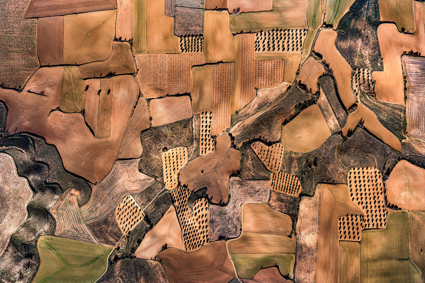
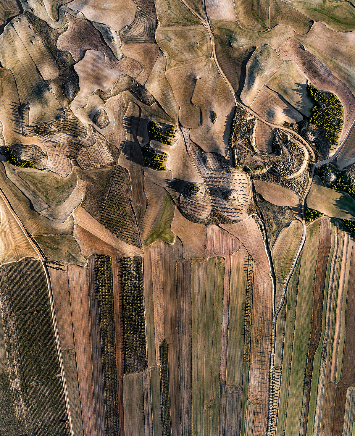
Valdecarábanos
Patterns of alternating olive and wheat fields south of Madrid, in the catchment area of the Cedrone River, where these two crops can withstand extreme drought and high summer temperatures. Huerta de Valdecarábanos, Toledo, Spain. 12/31/2018
Visible width: 1400 m
Between the slopes soil’s moisture content and the fertile conditions produced by the stream’s deposits helped farmers weather the dry summer season. That is why in the picture we encounter exclusively two crops: olive plantations, which can bear the great heat, and wheat, which is harvested at the start of summer before the drought sets in.

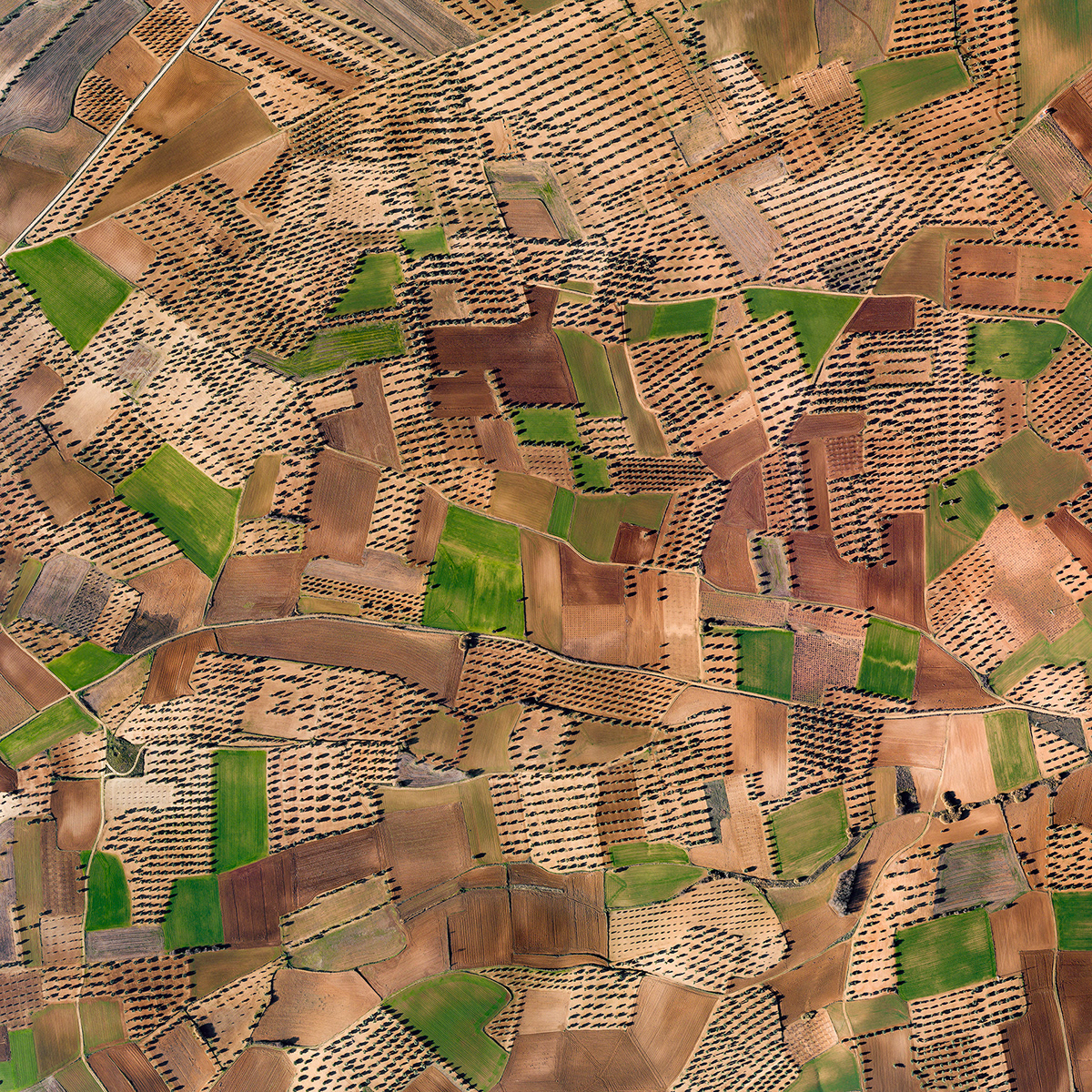
Sierra del Romeral
Tiny parcels filled with olive trees on the slopes of Mount Romeral, illuminated by the last rays of the dusk and the last of 2018. El Romeral, Toledo, Spain. 12/31/2018
Visible width: 1584 m
Valdemoracho #1
Spots of harvested wheat fields on the slopes of the hills where the moisture content of the soil helps the plantations survive the hot dry summer season. Parque Eólico Arias, El Burgo de Ebro, Zaragoza, Spain. 07/14/2018
Visible width: 928 m
Barranco de la Virgen
Wheat fields across the hills along flat, former wet areas where the moisture content of the soil helps to withstand the hot, dry summer season. Barranco de la Virgen, Castillo de Alfajarín, Zaragoza, Spain. 12/30/2018
Visible width: 1400 m
Milan's works, awarded with Grand Prize at the 37th Hungarian Press Photo Competition and Award of Excellence at the 76th POYI (Pictures of the Year International) in USA are visual oscillations between the realistic documentation of a dried-out environment and the extravagance of painting. Ultimately, they evoke shock in spectators and inspire them to think. That thought, hopefully, will motivate action.
The art pieces are actually composite pictures made up of multiple aerial photos. The largest items contain as many as 100 megapixels. The unbelievably high resolution makes it possible to blow them up to human scale (1.5 meters or nearly 5 feet), so they may take their rightful place alongside paintings on gallery walls.


Vall de Mateo #1 - #4
Along the dried up river, different levels of cultivated soil reveal millennial sand-pebble deposits in different colors.
Fraga, Huesca, Spain. 12/28/2018
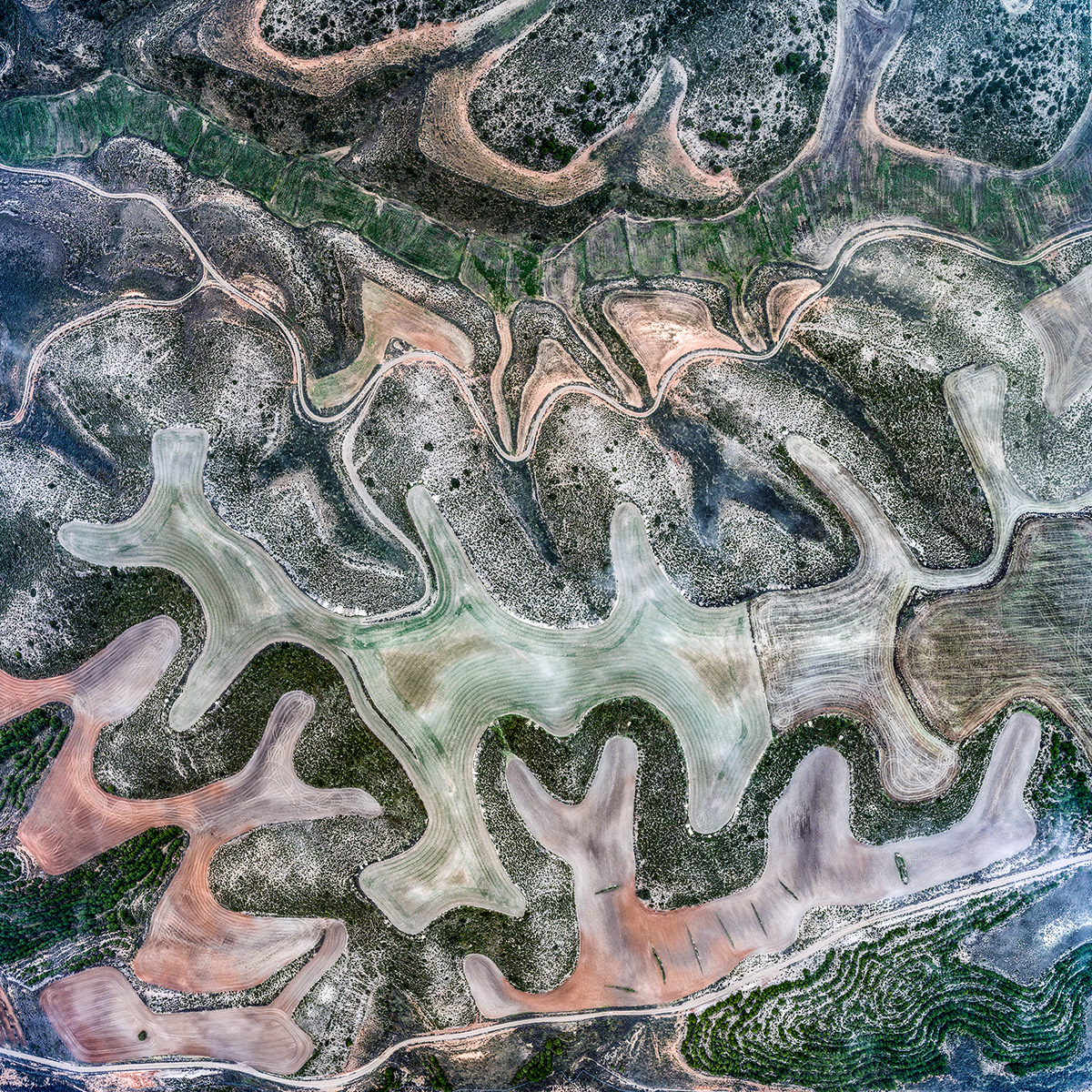
El Romeral Sur
The tiny, amorphous plots are shaped by long-gone streams and volcanic relief, while the elongated plots are formed on the site of a former river or flat lake bed. El Romeral, Toledo, Spain. 12/31/2018
Visible width: 862 m
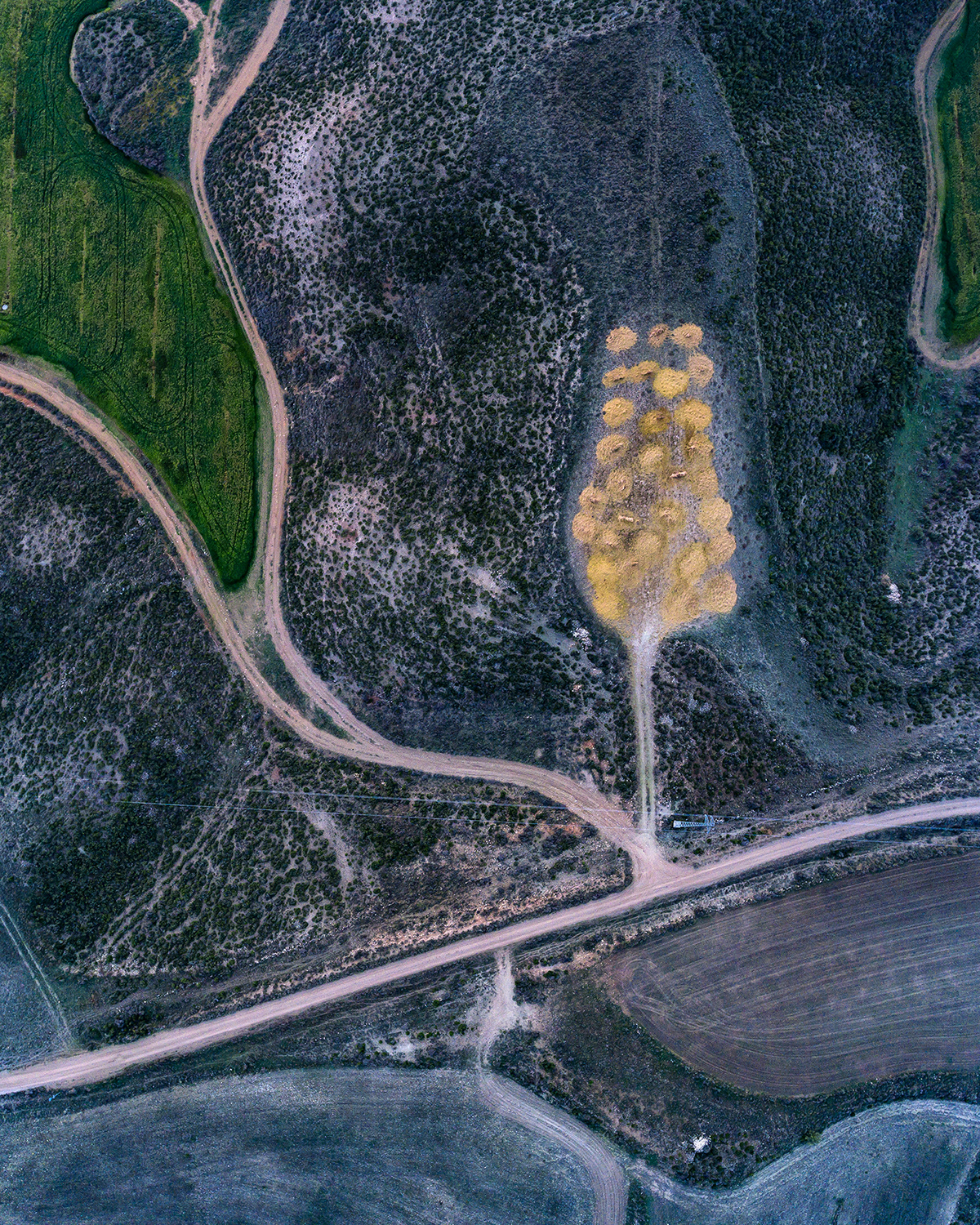
Candasnos
Stacks of straw piled on the top of a hill next to a wheat field at sunset in the blue hour. Near Candasnos, Huesca, Spain. 12/28/2018
Visible width: 264 m
The pictures’ names are also in harmony with the title of the series. “La Muela,” “Val de Sonda,” or “El Presado” would pass for fantasy names, but they are actually precise references to local geographic features. Both fantasy and document.


Camino del Molino de Cerca, El Pozo, Val de San Jorge
Valdecelada de Cerca, Las Arroyadas de Cerca, Val de Carro

Las Arroyadas
Colmenar de Oreja, Spain, Visible width: 1660 m
Milan’s works are testimonies, visual oscillations between the realistic documentation of dried-out environments and the extravagance of painting, and this ultimately stuns the spectator. While the photographs are fundamentally real (after all, they record reality), they manage to achieve more. The reality that Milan spreads before us is uncommonly dynamic, organically flowing, both near and remote, fragile and timeless. The images arouse a tempest of associations in the viewer. How shall we grasp and recognize what we are seeing, on the micro or macro level?
If this is truly how nature is, then could it be that we do not create art, since we already live in a realm or art that we have simply not noticed?
Peñalba Brumoso
Cultivated landscapes reveal layers of soil of different colors, deposited thousands of years ago by rivers in the Ebro catchment area, and reveal the amorphous features of the terrain, photographed in foggy conditions.
Visible width: 803 m
Valdecelada
Cultivated landscapes reveal diverse layers of soil that have been deposited thousands of years ago by rivers of the Ebro catchment area. Peñalba, Huesca, Spain. 12/29/2018
Visible width: 738 m
The Hungarian photographer, who has also worked for National Geographic, visited the Spanish sites on two occasions. In the course of one road trip, on his own El-Camino, he traveled 10,000 km (approx. 6,200 miles) in scarcely more than two weeks. At each location, he could remain for days until the very best light conditions revealed the true character of the given land.
The SUR/REAL LANDS series was produced in winter, when the first stalks of wheat emerged from the soil.

Barranco del Tollo
Dry cracks and abstract patterns of wheat fields sweep across the hilly area to reveal where the stream once flowed and where it deposited the foundations of the plants growing today. Botorrita, Zaragoza, Spain. 12/30/2018
Visible width: 790 m
The SUR/REAL LANDS series is one part of the Water.Shapes.Earth project. It is a chapter which uses aesthetic means to present and to document faithfully the scale of Humanity’s struggle when faced with a water shortage, as well as to demonstrate the water crisis that is now at Europe’s doorstep.
SUR/REAL LANDS
On the border between documentary and abstraction
The complete collection consists of 40 pictures, available for purchase in limited editions of
three and six @faurzsofigallery in Budapest.
© 2019 Milan Radisics
milan@radex.hu


