
Cebu Jeepney Transport Map
I have been struggling moving around the cities in the Philippines, especially in Metro Manila and Cebu where there are no official maps to refer to. Google map is a great reference but not reliable enough to provide an accurate information.
So, I decided to start creating my own transport map. I was inspired by the transport network map by New York subway and other European cities. I decided to create a map for one of the city in the Philippines, Cebu City, with a unique mode of transport dominated by what we called "Jeepneys".
A Jeepney is a cheap and popular mode of public transport in the Philippines. It evolved as up-cycled leftover U.S. Willy Jeeps used during World War II.
Note: This map project is not updated regularly. Routes may change without any notice so take extra caution when getting information from this map.
View or download Cebu Jeepney Map


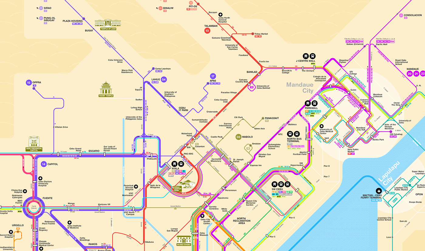
Downtown Cebu where most of the Jeepney traffic are concentrated.

Northern part of Mactan Island

Along the Capitol and Osmeña


When you ask locals about directions when using a Jeepney, most of them would answer only 2-3 key locations they know where the Jeepney passes through.This was the simplified structure of the routes based on the approach of identifying the key stopovers.

Most popular landmarks in Cebu City

Complete view of the map
View or download Cebu Jeepney Map
Follow my Works
X (Twitter): twitter.com/josephricafort
LinkedIn: linkedin.com/in/josephricafort
Instagram: instagram.com/joricafort
Buy Visual Products
Gumroad: josephricafort.gumroad.com
Subscribe to get products updates (Soon)!
Subscribe: josephricafort.gumroad.com/subscribe


