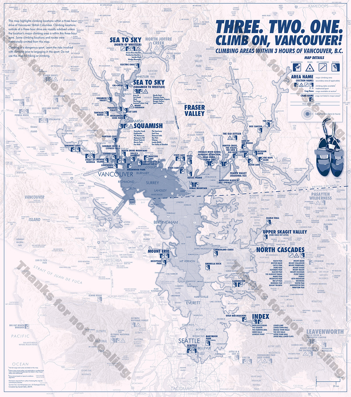
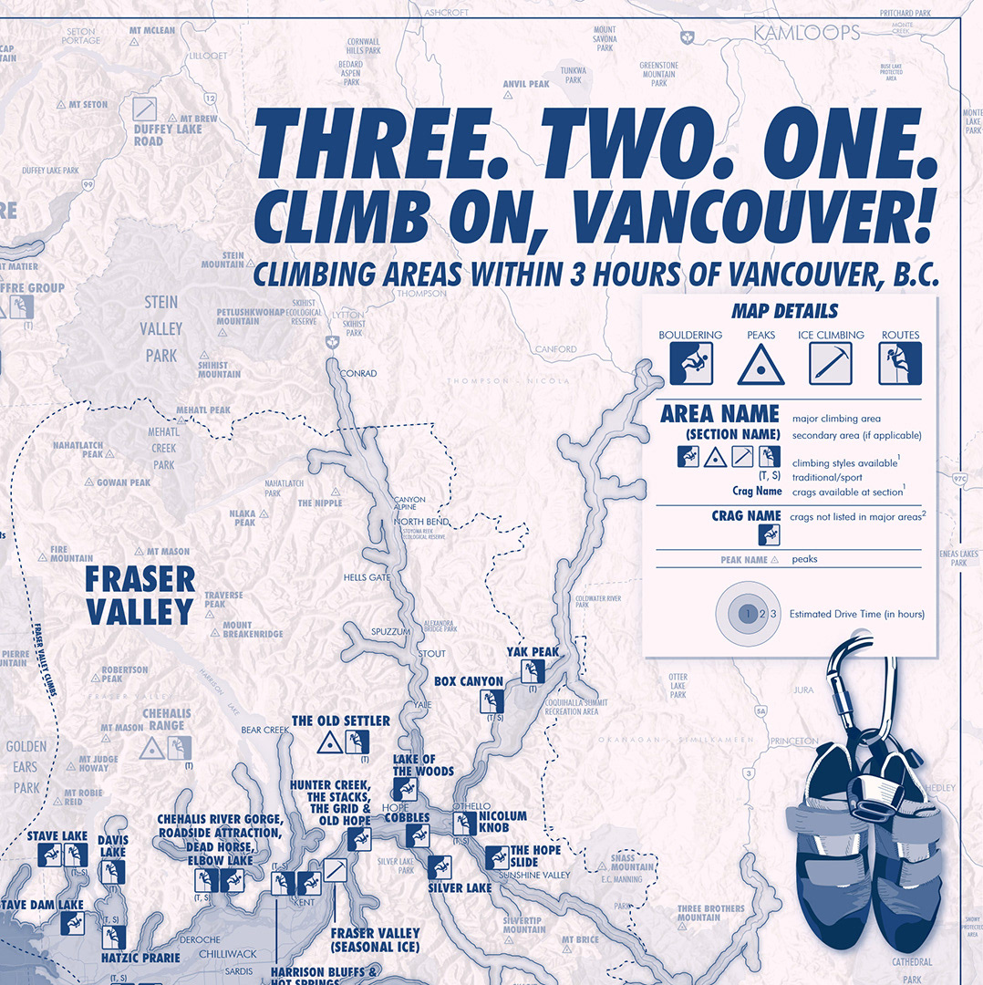
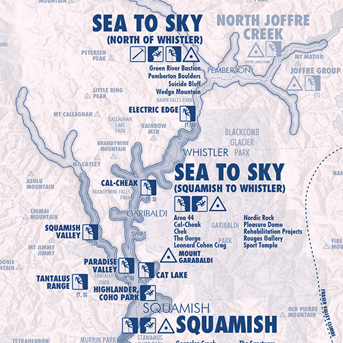
I wrote here about how any map-curious person can make a map like this. Sometimes people ask me if I had to choose between climbing and mapping, which would I do. I respond by making maps about climbing. This map is 12 in. x 13.5 in. It is completely monochrome, including the shoes-and-carabiner graphics, which were all drawn with vector graphics using Adobe Illustrator. This monochrome map is my submission to the SomethingAboutMaps.com Monochrome Mapping event. This map features all rock climbing areas within a three-hour drive time of Vancouver, British Columbia. The drive time areas are generated from an algorithm based upon normal driving times.
A few years ago I became enamored with tri-toned maps, and I found Daniel Huffman's call for monochrome maps to be a welcomed delight, and a great reason to combine my two passions of rock climbing and cartography.
Note that while many of the climbing areas are within three hours of Vancouver, not all the crags and peaks within that area are necessarily within three hours. Nevertheless, their crags are listed in the bold (see North Cascades, for example).
Remember, Leave No Trace!
-Sarah Bell