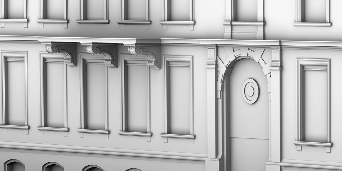
Full detail modelling of laser scanned elevation of historical building
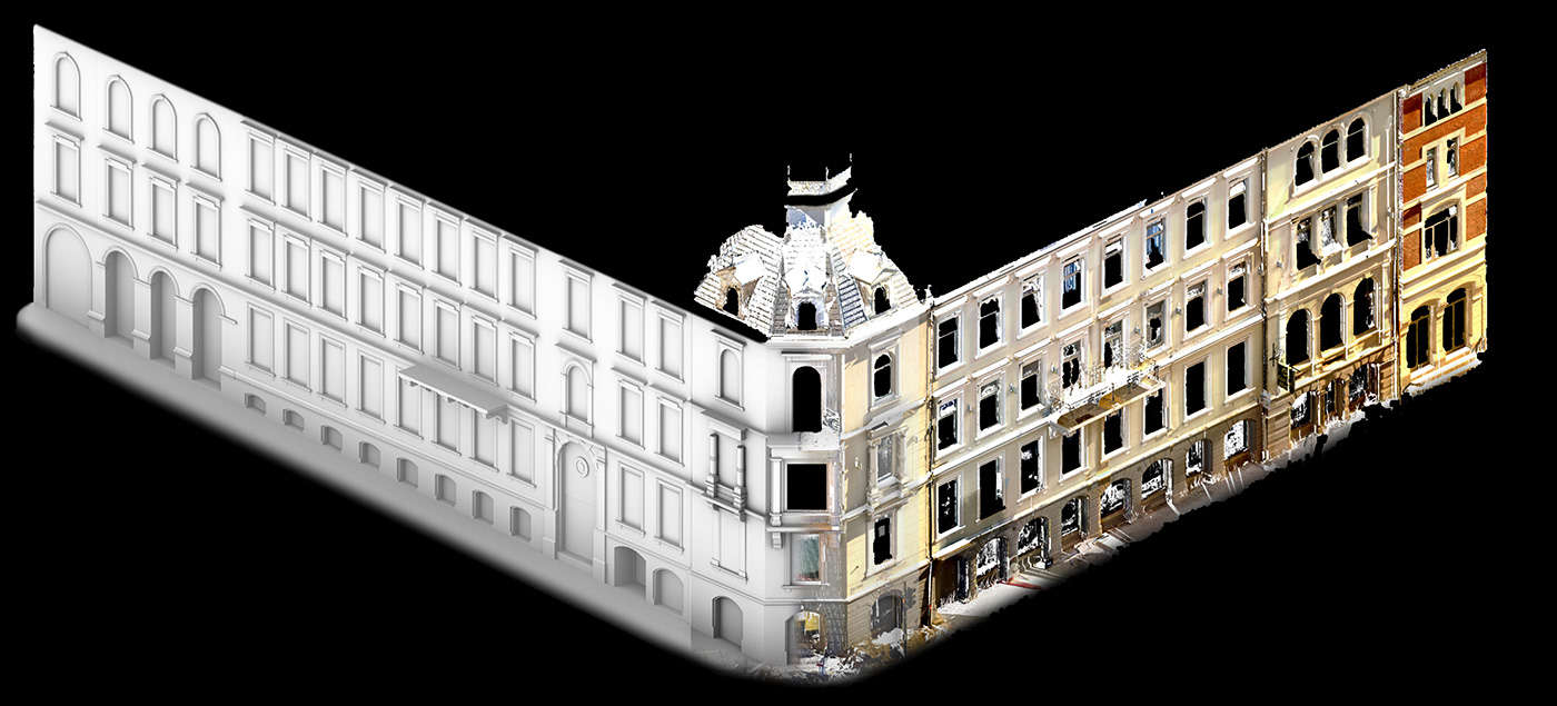
Case of delivering project made in every stage - geodetic survey, laser scanning, registration and full detailed 3D modelling - all done by Scan Measure. Gathering and processing data took less than two working days. More time was spent on detailed modelling (every window frame was fitted to the pointcloud, there was no room for copying elements).
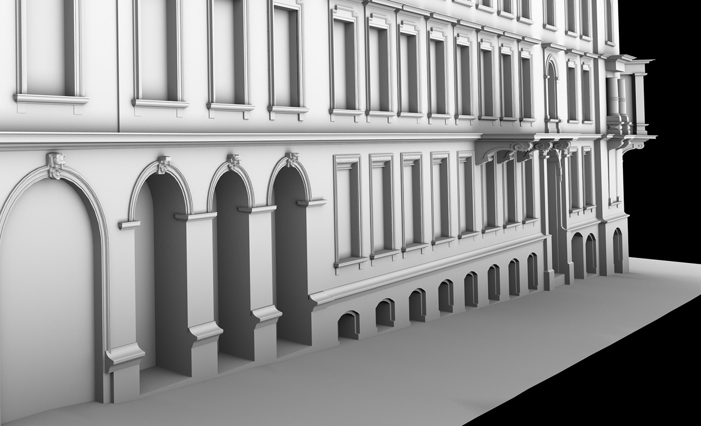
Elevation contains also sculptures on the entrance arcs - to get their geometry, higher resolution 3D scanning was made from the best possible angle. 3D mesh was created directly on pointcloud and then processed to fill every gaps.

Here example of using profiles for 3D modelling of the balcony:
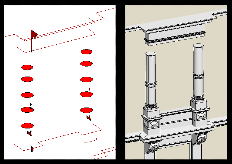
Hybryde of parametric modelling and 3D mesh, based on pointcloud (to get the best representation of shape). Model was supposed to be used for 3D printing of molds.