Accessing Nature was a report produced in collaboration with RPA's Energy and Environment team that proposed a regional trail network that would provided greater connectivity to open spaces. This reports was part of series of releases that expanded upon recommendations included in RPA's Fourth Regional Plan
I was responsible for the design and layout of the report along with additional maps built on the foundation of the research team's GIS work.

The cover image is from the Highlands vision by Port+Range as part of “Four Corridors: Foreseeing the Region of the Future”, a project of the Fourth Regional Plan. The full series can be viewed at 4c.rpa.org.
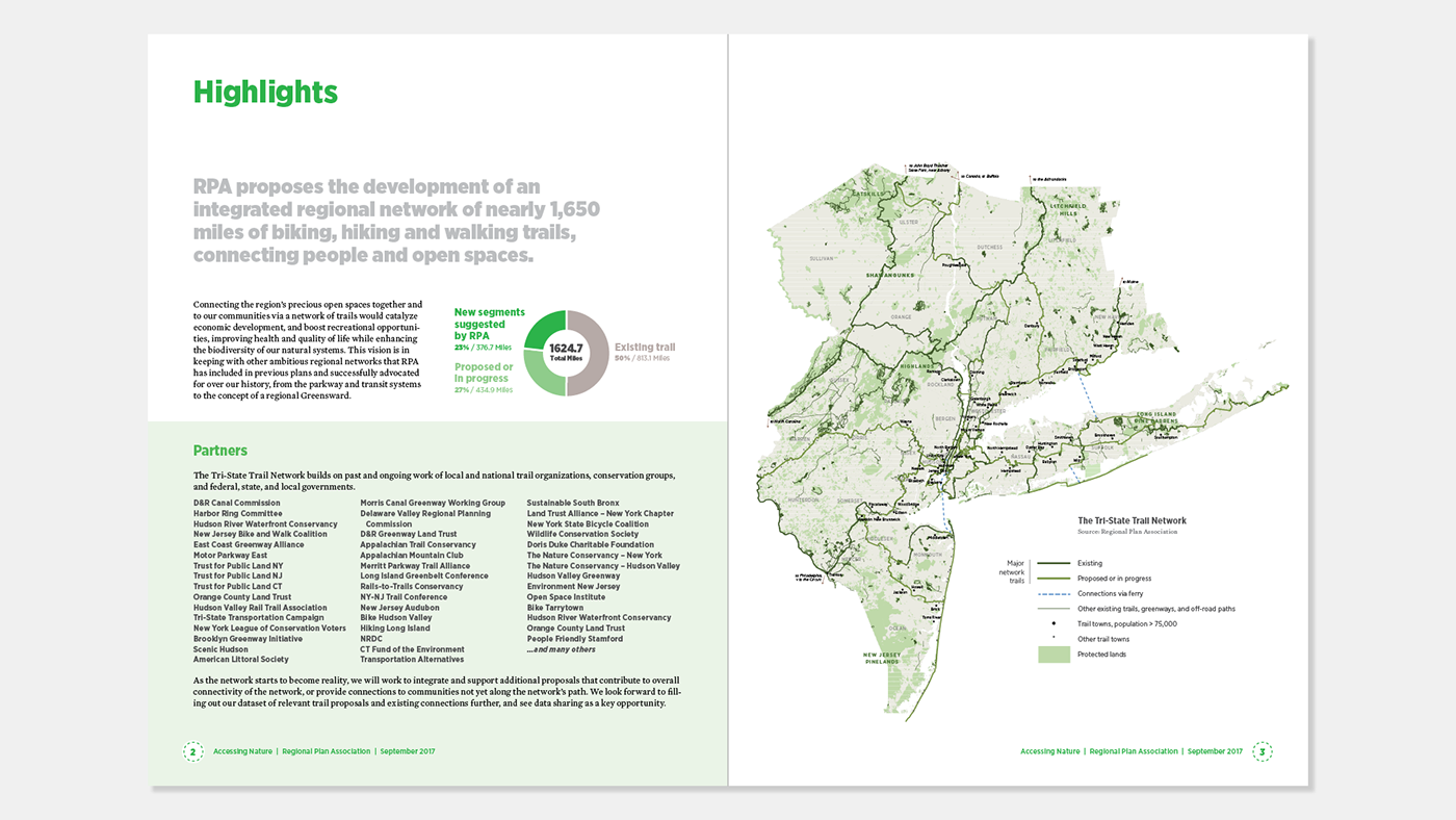
The key visual of the report was a map created by the research team highlighting a proposed trail network that would provide greater connectivity for the region's open open space.

Working with the trails dataset from the research team I also developed supplemental maps to highlight key trails in each subregion.