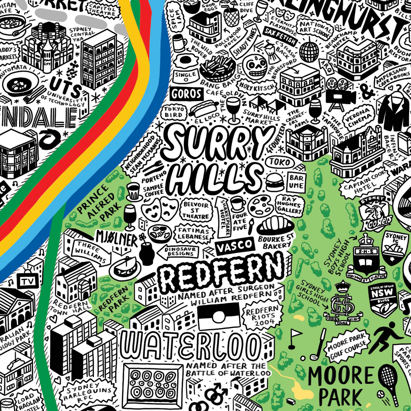
Hand Drawn Map of Sydney


I was sent over on a research trip to Sydney in March 2018, after already having done some preliminary research using books, the internet and Google maps/Google Earth, as well as watching documentaries and Youtubers talking about what it was like to live in the city.

During the research trip I spent 2 weeks being what I like to refer to as a 'professional tourist' - doing all the tourist traps, sketching buildings, taking photographs as well as getting to know the local people. I kept a visual diary every day of my trip.

When I got back to my East London studio I then spent the first month back studying and collating all my research and transferring the places that I'd found onto a personalised Google map. I also looked at the photographs and notes that I'd made while out there - certain things like street signs and local slang/local food choices etc that is difficult to know unless you've visited the city.

Once the research had been all collated I spent the long, arduous process of drawing the city. This took roughly 4-5 months, of 10-12 hour working days, 6 days a week. OR over 1000 hours of drawing time! The hardest thing about creating this map was the mental toll that took place - after spending a whole day working hard on the map I would zoom out and see that I'd only covered the smallest bit, which was really disheartening.

To work around this, I found the best way was to break every task down into chunks, then smaller and smaller chunks to make it palatable. I'd start off by breaking the research down into categories (e.g. cafes, bars, galleries, museums, historical facts, sociological facts, wildlife, transport). I would then mark everything out according to it's whereabouts before sketching it out, then drawing the final image. Sketching out the drawings first allowed my brain to let me draw for longer as it relieved some of the pressure to get everything right and made the process more enjoyable.

During the process there were many, many problems that would arise, the main problem being the fact that because the city is mainly suburban with coastal areas there wasn't an even distribution of space, which meant I would have to pick and choose what should go on there - and with maps everything is so subjective so it is impossible to please everyone. The CBD area was particularly difficult to illustrate as it has so many huge skyscrapers as well as lots of important bars/cafes/city infrastructure. This had to all be fitted into a small space yet also be readable and look pleasant.

After 1000 hours of drawing the map there was a huge editing effort - this was done by Evermade getting in contact with some of the local people that I'd met on the trip and getting them to be brutally honest on what I'd missed out on, spelled wrong, put in the wrong place etc.

Finally, 9 months in total since I'd started research to final product, the Hand Drawn Map of Sydney was finished!