Kent Towpath: Signage & Wayfinding
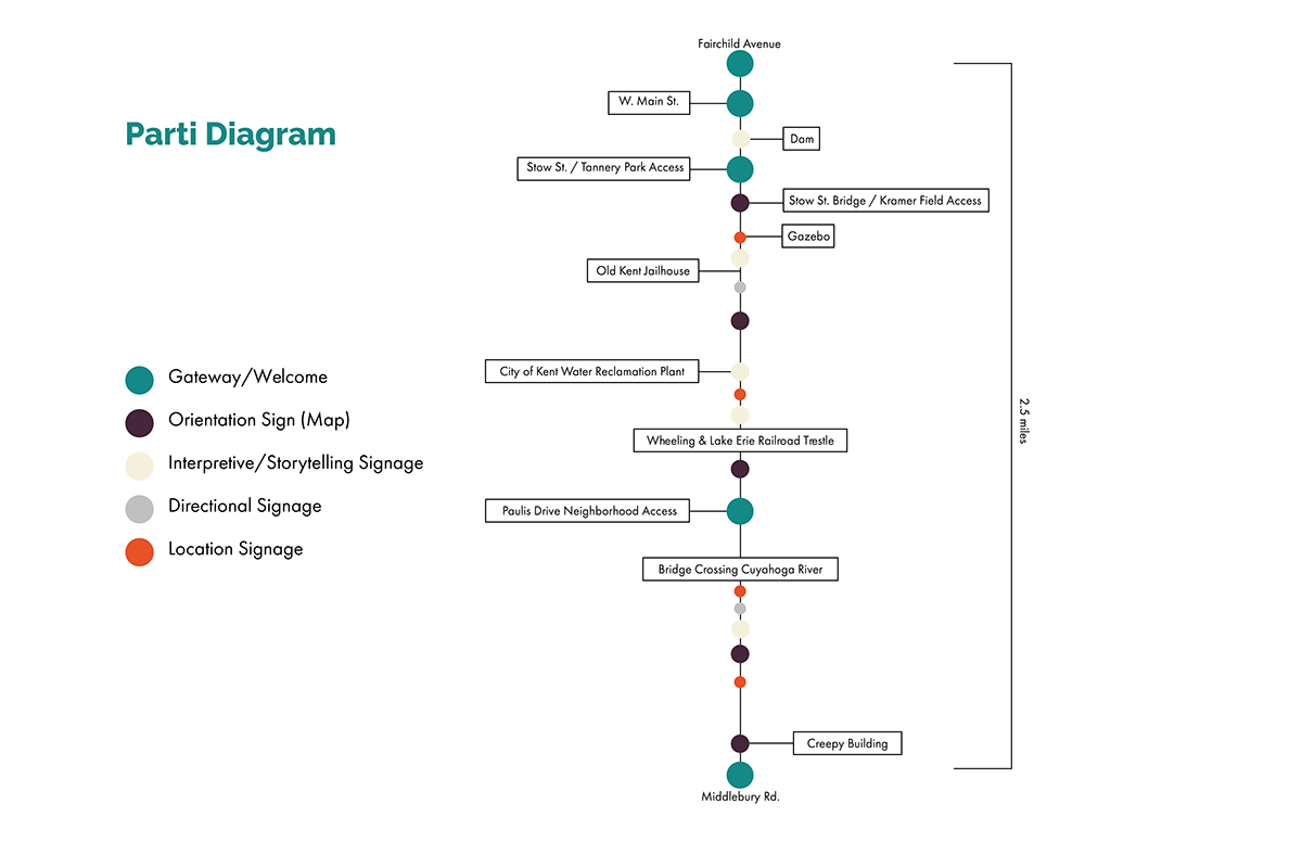
In Kent, OH along the Cuyahoga River, there is a towpath that is open to hikers and bikers. The current wayfinding throughout the trail is extremely confusing for hikers, bikers, and everyone in between. The distances between each sign are inconsistent and hold no value to the location on the trail. Signage feels dispersed and random. The system lacks cohesion, necessary design elements, and proper directional aspects.
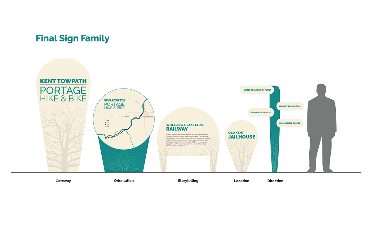
In order to create a more cohesive wayfinding system, a brand was developed to have consistency amongst signage. The signage is now identifiable against the greenery of nature, but also feel as though it belongs. There are now contrasting levels of typography to help the hiker/biker quickly identify their location and other elements throughout the trail. The designs follow expressive nature that feels artistic and natural in order to encompass the general feeling through the length of the trail.
The goal of the project is to create a signage and wayfinding system for the Portage Hike & Bike Trail, also known as the Kent Towpath through Kent, Ohio. The path is roughly defined as the pedestrian/bike path that runs between Fairchild Ave to the north and Middlebury Rd to the southwest.