Drone Scanning
Sharing my experience on aerial 3D scanning with multirotor R/C aircrafts for an undergoing project for the Florida International University (FIU). My role is to create the entire campus in 3D for a mini game, but with broken old DWG blueprints files of the buildings, it was double the work. I had to set free my creativity to compress time, so I used my drone skills and tried to 3DScan the FIU campus to get real world scale instantly by scanning the campus with my DIYdrones and DJI R/C aircrafts. After a few flights I gathered all the data from the scanned areas, providing me a lot of advantages like textures, other world objects, real world scale and distance between buildings, geographic height map,and deformations, tree shapes, colors and many other things. Plus the buildings re-topology was very easy by having shapes and all the needed visual iconic details from the buildings. Here I share some of my work flow from 2015... excellent results ! Enjoy
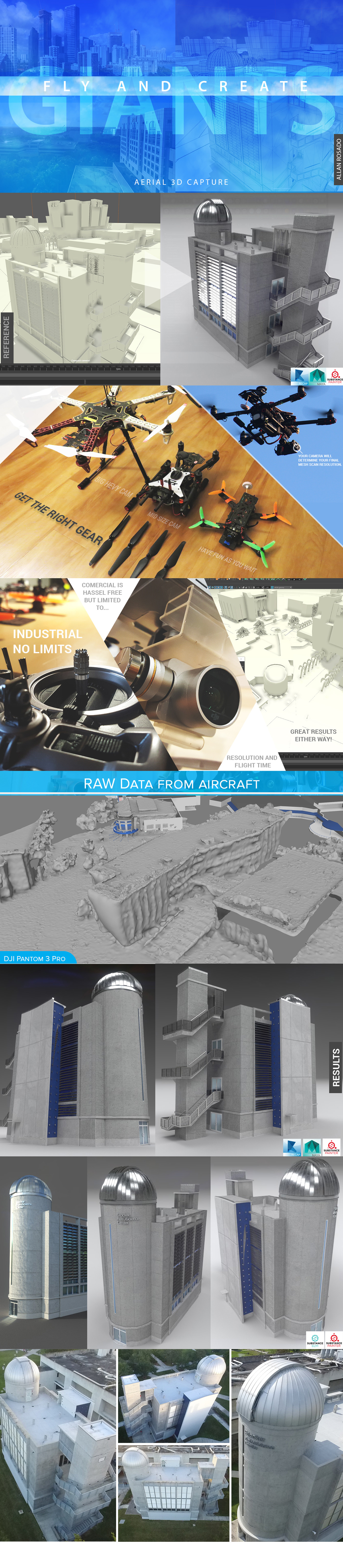
Full Result of the building photo geometry data in PBR for Unity3D Game