
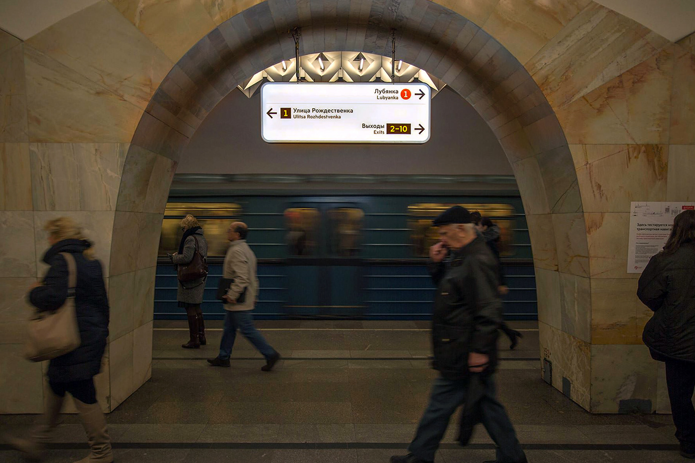
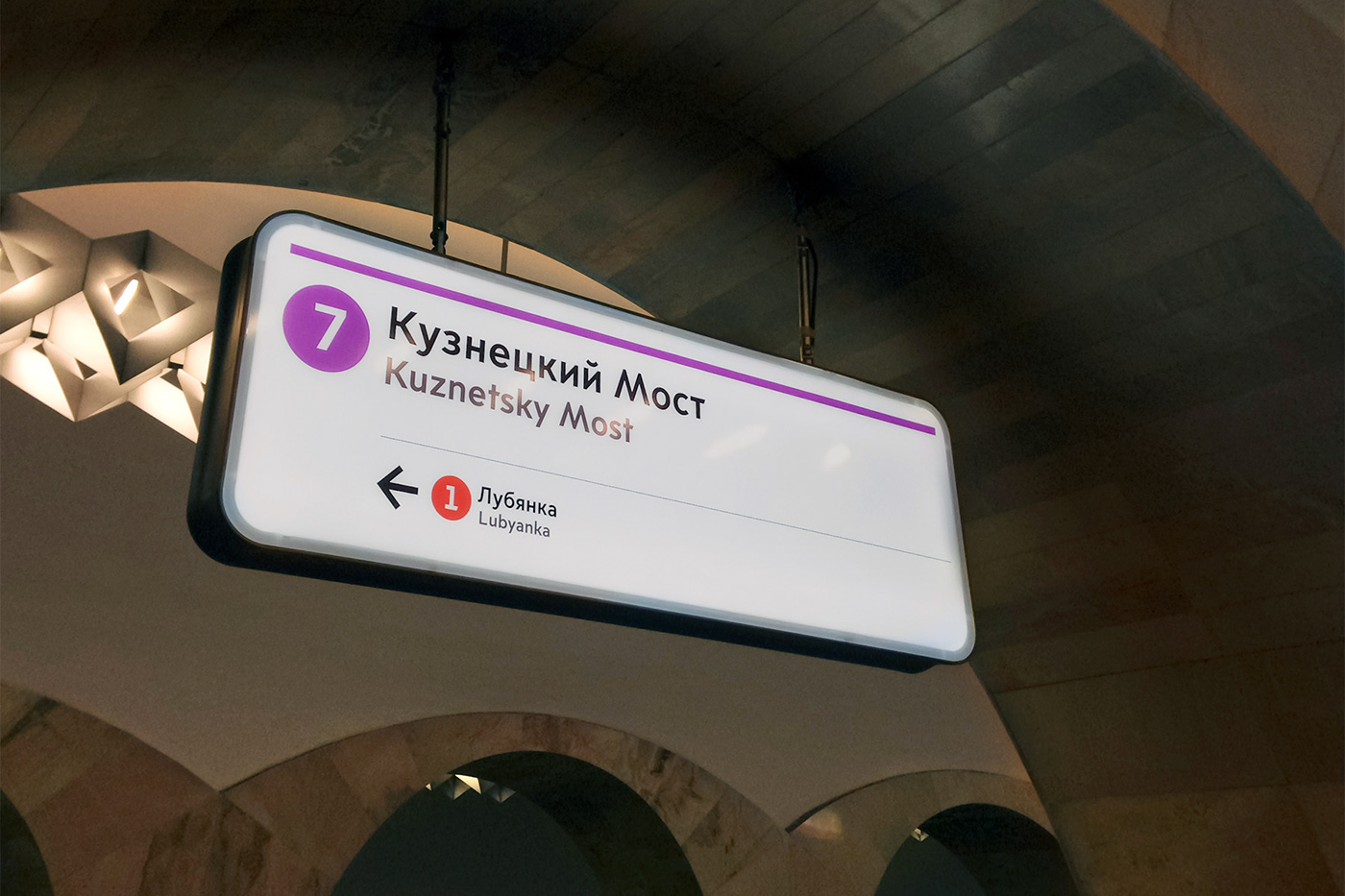
Wayfinding for Moscow is a city-wide, user-centered, bilingual, and multi-modal wayfinding program that helps over 12 million Muscovites and visitors to the Russian capital find their way. Completed by City ID for the Moscow Department of Transportation as a pilot in the fall of 2014, it has now been expanded to over two hundred Metro stations, as well as hundreds of above-ground locations at bus shelters, transportation hubs, public spaces, and streets of Moscow.
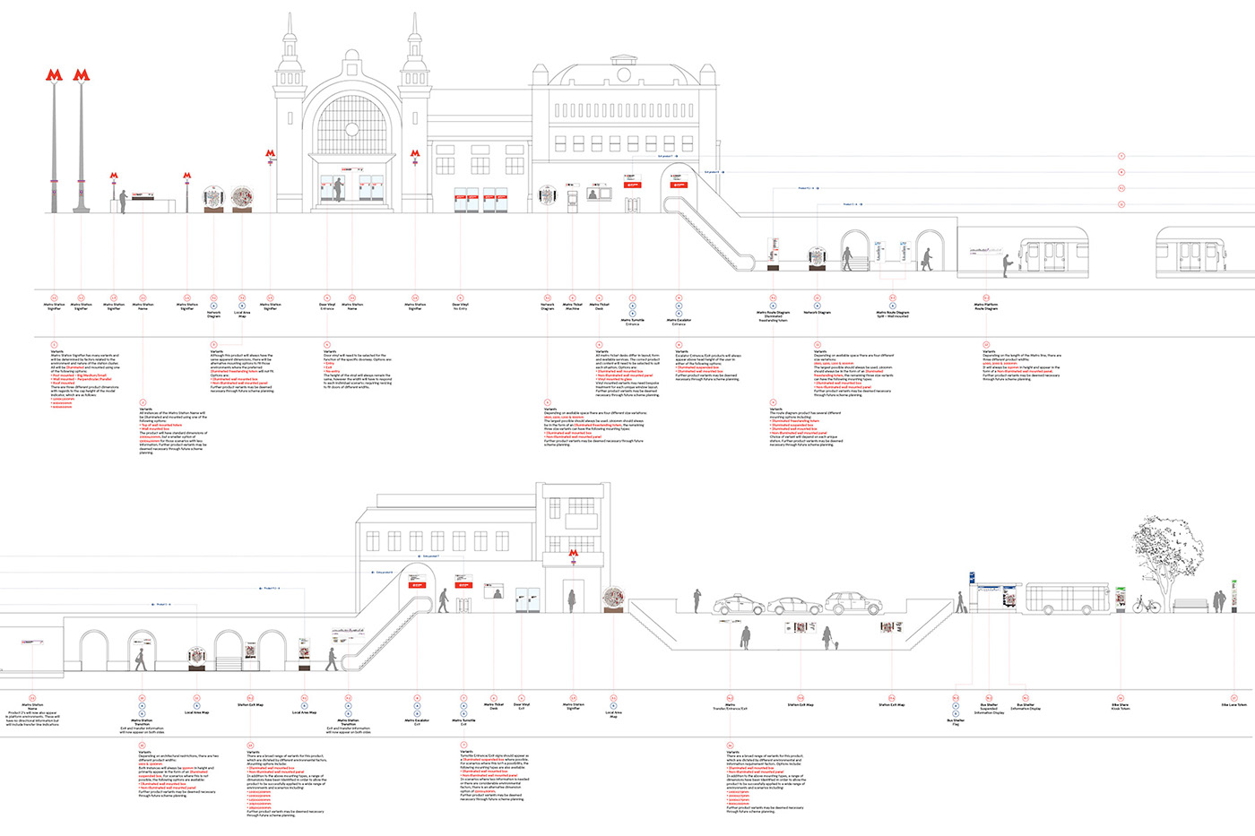
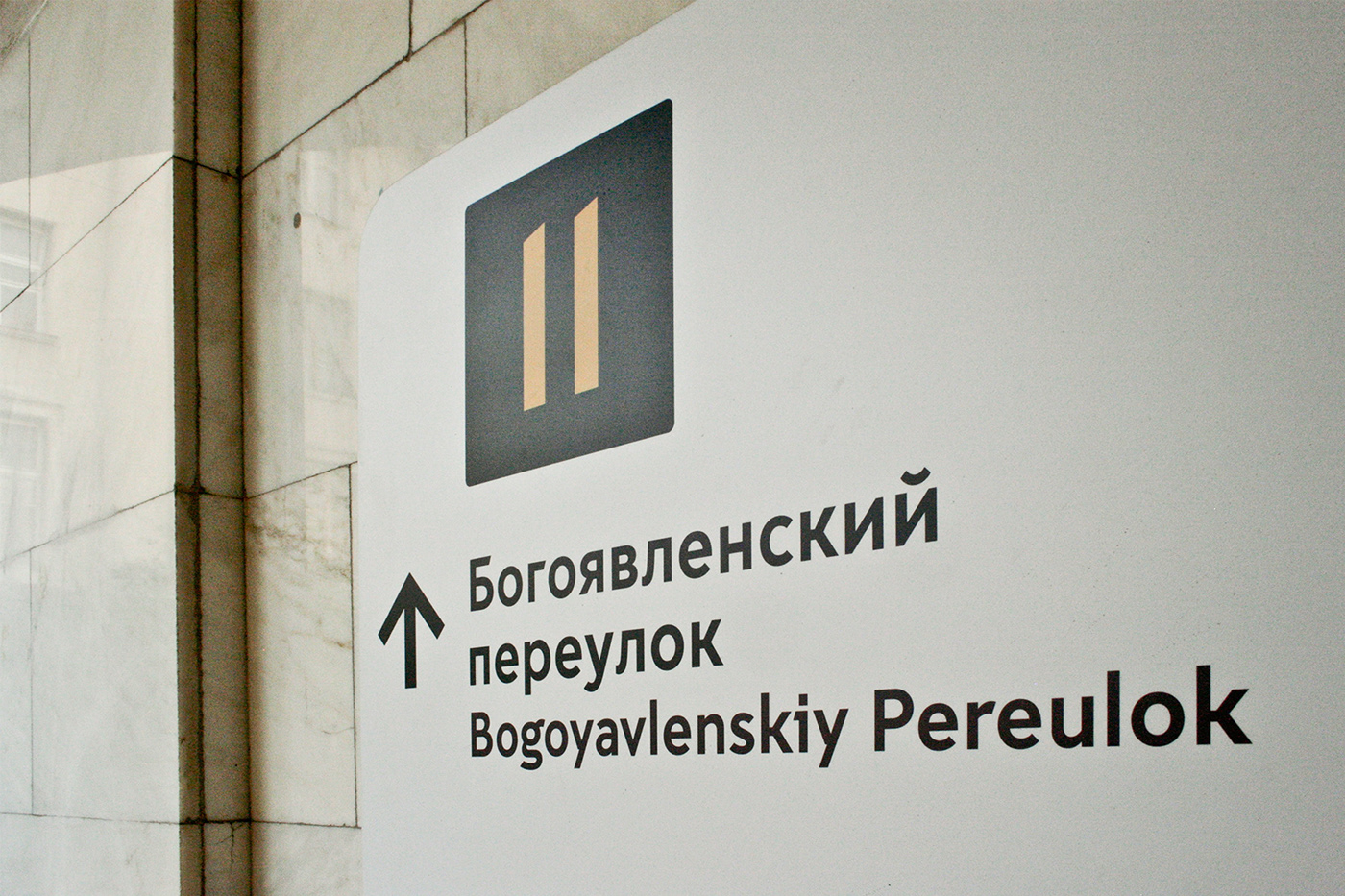
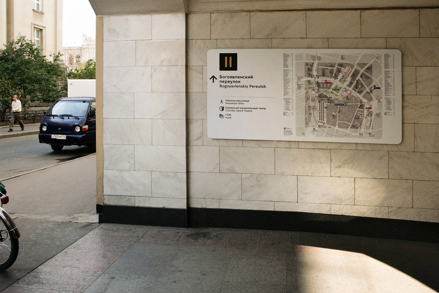
The pilot phase included development of program's information design; the complete set of physical products across modes and various geographies; as well as completion of the system's graphic standards featuring bespoke typography, iconography, mapping, and illustrations.
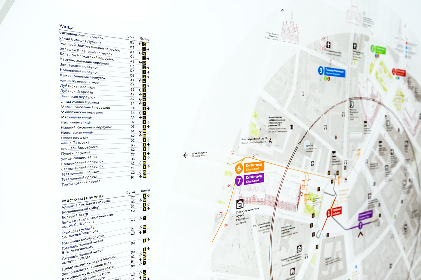
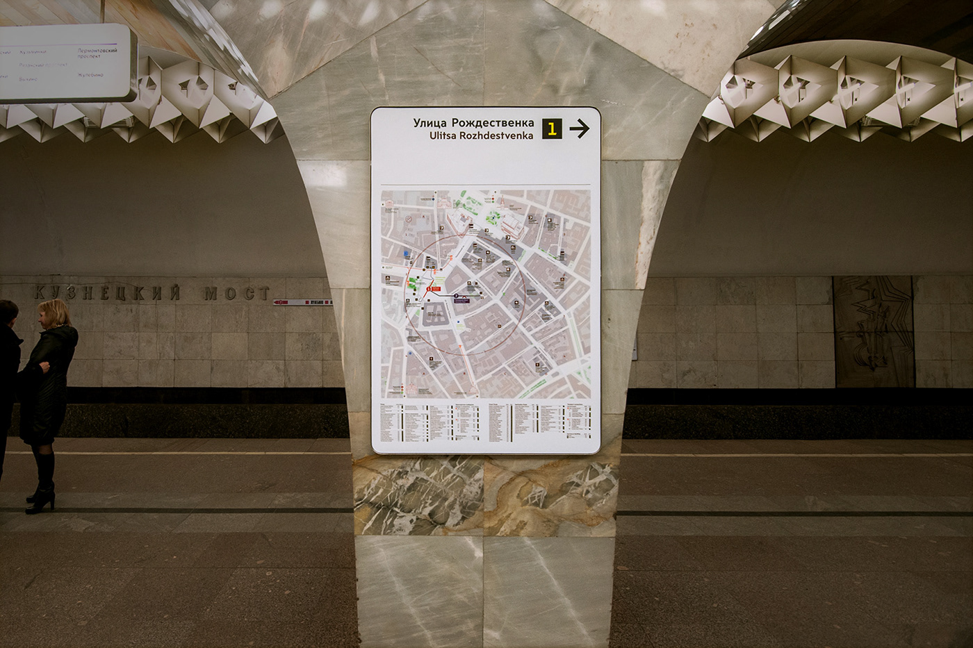
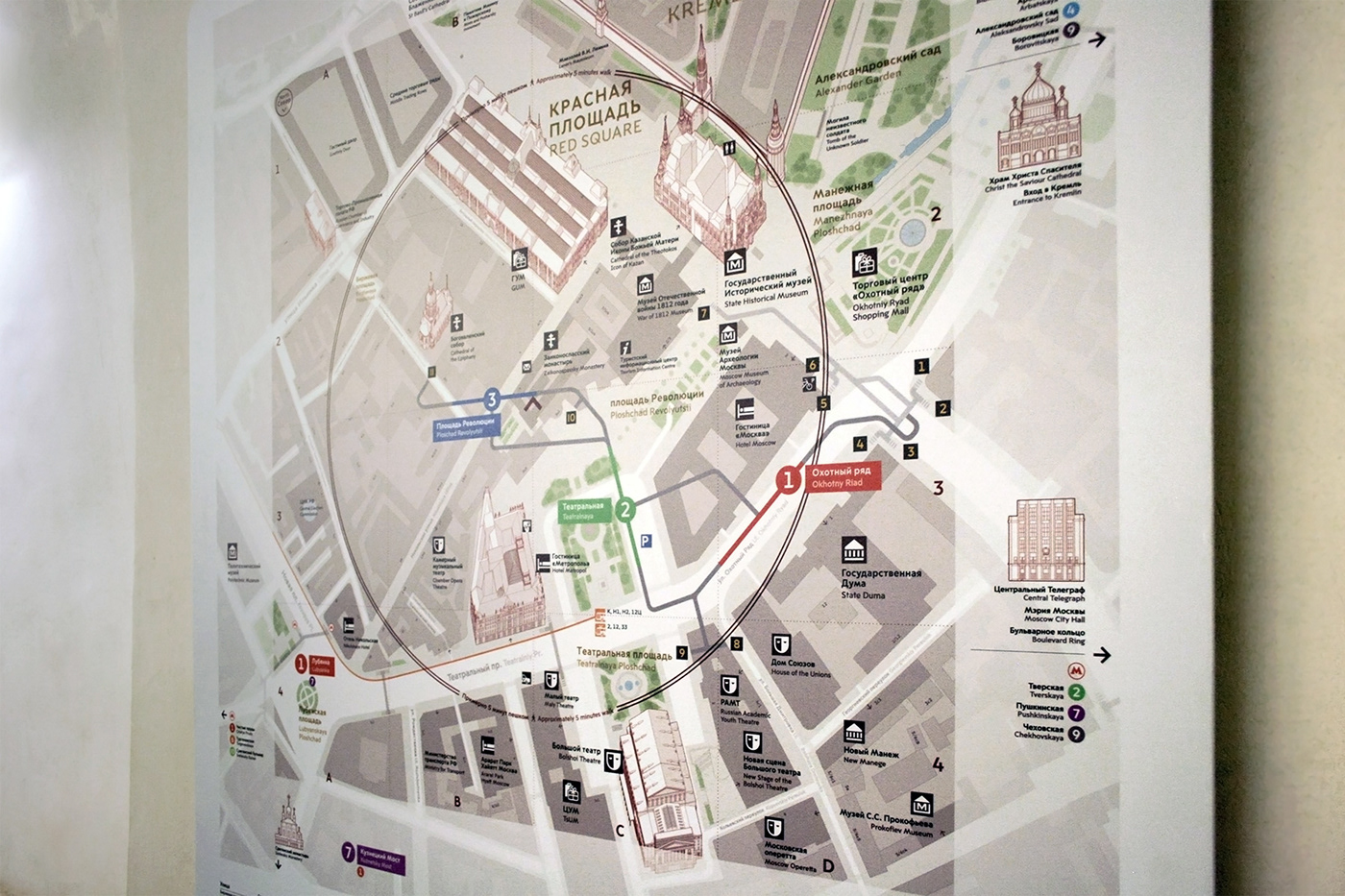
Pilot products covered some of the largest and most complex underground Metro hubs in the city, located in the vicinity of the city center and the Kremlin. One of the new information design strategies implemented included showing a visually simplified subway station layout overlaid over a geographically accurate map, for navigating the intricate network of subway tunnels and underpasses.
Completed in 2014
Role: Designer / Design consultant, City ID, focusing on visual identity, graphics, typography, and information design
Photography: 11, 12 – Alexey Mityaev; 1, 14, 15, 16, 17, 18, 19, 22 – Ivan Anisimov / Courtesy of City ID; 20, 28 – Stanislav Konstantinov, 23 – Alexander Belenkij; 21, 24 – Moscow Department of Transportation


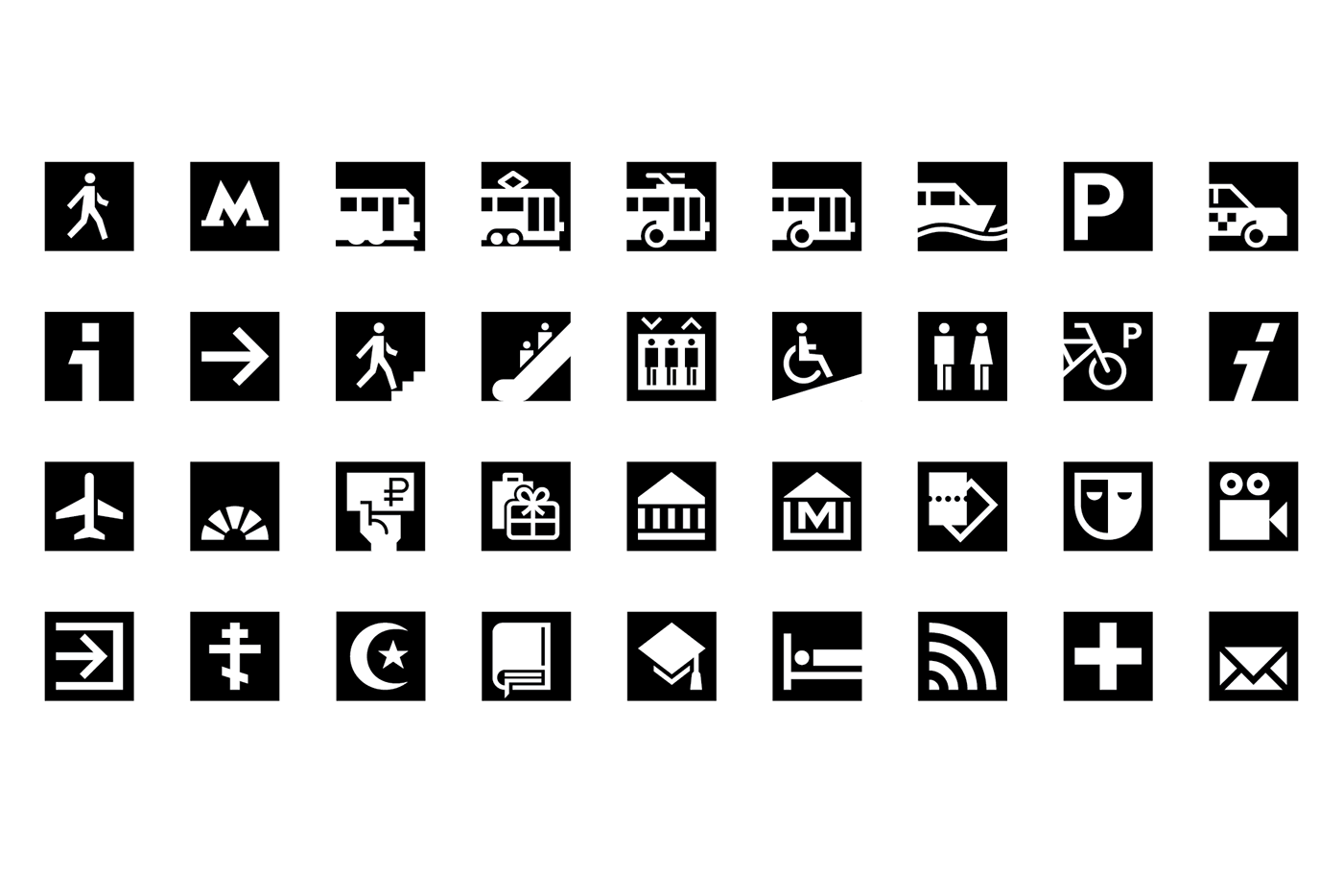
Pictograms and typography by A2 Type / A2/SW/HK for City ID


2D and 3D building illustrations by City ID / Ocula


Credits: City ID, Design Lead: Mike Rawlinson (design director); Jason Smith (project manager); Matt Jephcote (principal designer); Jenny Janssen, Lottie Webb (planners); Tom Eves, Cal Jepps, Josh Sherwood, Gavin Boorman (designers). Design Consultants: Nick Durrant, Michael Thomson (strategists); Daria Syuzeva (planner); Misha Kvrivishvili, Isobel Colebrook (designers); A2 (typography and pictogram design); City ID and Jason Clark (cartography); City ID and Ocula (illustrations). Billings Jackson Design, Industrial Designer: Eoin Billings (industrial design director); Dale Newton (principal industrial designer); Niels Denekamp, Lisa Gustavsson, James Lawton (industrial designers). Fabricator: Lindner Group (product engineering and manufacturing)


