Boulder Dam
Unrealized source of Southwest Life
Unrealized source of Southwest Life
Creating a natural border between Arizona and California,the Colorado River runs like a major artery carrying life giving water. Once running free, the river periodically flooded the surrounding regions, and created the Salton Sea in 1905. The adjacent Imperial Valley was a vast sparsely populated desert, and the nascent population centers of Southern California were yet to mushroom with bloated expansion.
The dam project in Black Canyon was the centerpiece of the New Deal, and brought needed jobs, electricity to illuminate the Southwest, a steady water supply which permitted the Imperial Valley to flourish, and Southern California to begin what appeared to be boundless growth. But at what cost? Lives were lost during construction, and the dams on the Colorado have accelerated the desertification of Northern Mexico.
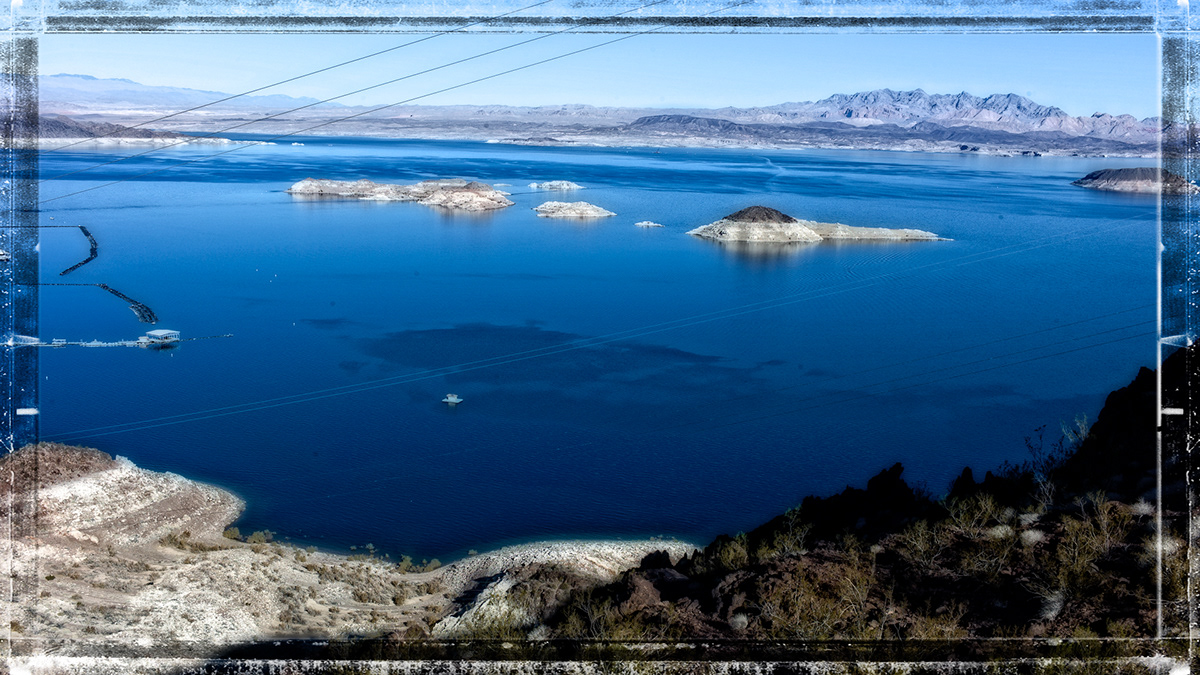
As you look at the photos you should reflect on the visible evidence of drought, most notably the “bathtub” ring around Lake Mead, and the low level of water adjacent to the dam. The Natural Resources Defense Council projects that by 2030 the average flow of the river could be reduced to only half of the level on which the original water allocations were based, and that in ten years the water level in Lake Mead might fall below its outlet. If that happens, it will presage a new Dust Bowl.
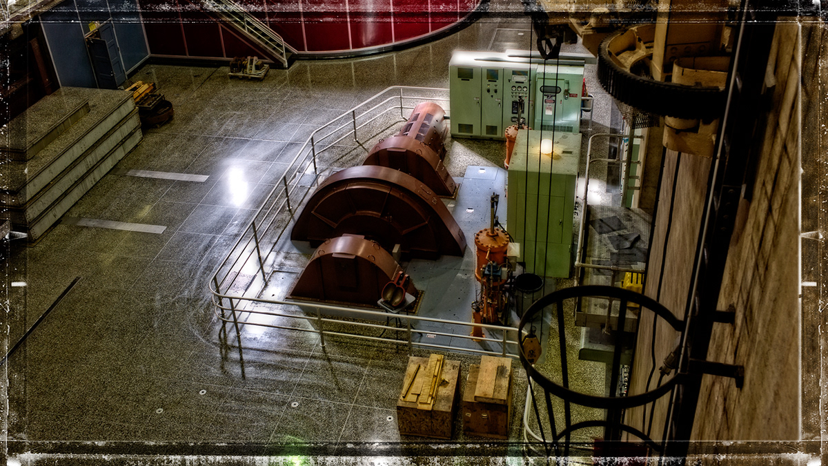
The photos also show the reliance upon mechanical devices, which must be updated, repaired, and maintained. The dam is literally showing its age. Will we bewilling to devote the enormous sums necessary to this task? The recent completion of the Mike O'Callaghan– Pat Tillman Memorial Bridge shows that contemporaneous construction in the dam area is needed, yet that quarter billion dollar project was begun in 2003. Is the nation up to the task of duplicating this level of effort in 2012?
The dam project in Black Canyon was the centerpiece of the New Deal, and brought needed jobs, electricity to illuminate the Southwest, a steady water supply which permitted the Imperial Valley to flourish, and Southern California to begin what appeared to be boundless growth. But at what cost? Lives were lost during construction, and the dams on the Colorado have accelerated the desertification of Northern Mexico.
As you look at the photos you should reflect on the visible evidence of drought, most notably the “bathtub” ring around Lake Mead, and the low level of water adjacent to the dam. The Natural Resources Defense Council projects that by 2030 the average flow of the river could be reduced to only half of the level on which the original water allocations were based, and that in ten years the water level in Lake Mead might fall below its outlet. If that happens, it will presage a new Dust Bowl.
The photos also show the reliance upon mechanical devices, which must be updated, repaired, and maintained. The dam is literally showing its age. Will we bewilling to devote the enormous sums necessary to this task? The recent completion of the Mike O'Callaghan– Pat Tillman Memorial Bridge shows that contemporaneous construction in the dam area is needed, yet that quarter billion dollar project was begun in 2003. Is the nation up to the task of duplicating this level of effort in 2012?