
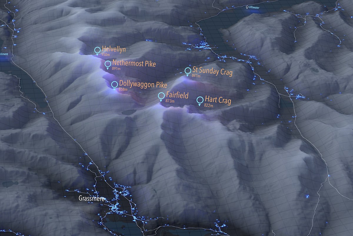
This has been one of my favourite projects and ultimately one of the most interesting set of renders I have produced. I really enjoy mapping national parks, probably because of the topography, city mapping is cool but there is something about rendering terrain maps that just looks instantly cool.
I started off with the Snowdonia National Park as it's familiar territory, however after playing around with some gradients I decided to take a different tilt on conventional National Park maps. I loved the idea of a night/dark theme highlighting some of the smaller villages by allowing them to emit a glow capable of casting enough light to cast reflections on the surrounding landform. Road networks were also given a small degree of light emission which highlights them slightly.
When I began some of the sample renders I realised it kind of took a futuristic feel - someone told me it looks like a terraformed moon which is pretty different. In any case I thought why not add a grid to enhance that kind of feel. The grid was a bit tricky and a bit of a resource hog to complete, I started by creating a plane and subdividing enough to create a dense enough grid, I then converted the edges to splines and subdivided the splines - increasing the vertex count enough to account for the more subtle terrain changes. The tricky bit was projecting the splines/verticies onto the terrain, multiple crashes later I finally got the grid sitting flush. Sweep nurbs created the geometry and a similar gradient to the terrain was applied. I then rendered separately onto a transparent background for later compositing.
I really like the labels for the peaks, probably because of the glow effect they have on the peaks of the mountains. I found the blue and orange glow to have a certain synergy together so I was quite pleased with the result. Finally I used an overlay texture in the alpha channel to create the water mask which gives the park some context.
I think the natural progression of these maps is to apply more accurate terrain data, unfortunately LiDAR coverage isn't close to complete for these areas so maybe subdividing and using displacement textures would achieve this. I was also going to add route maps but am conflicted to the purpose of these maps - at the moment its a bit of fun but maybe they could be used as functional maps for National Parks? Any National Park afficionades out there have any advice?
Lake District National Park

Snowdonia National Park
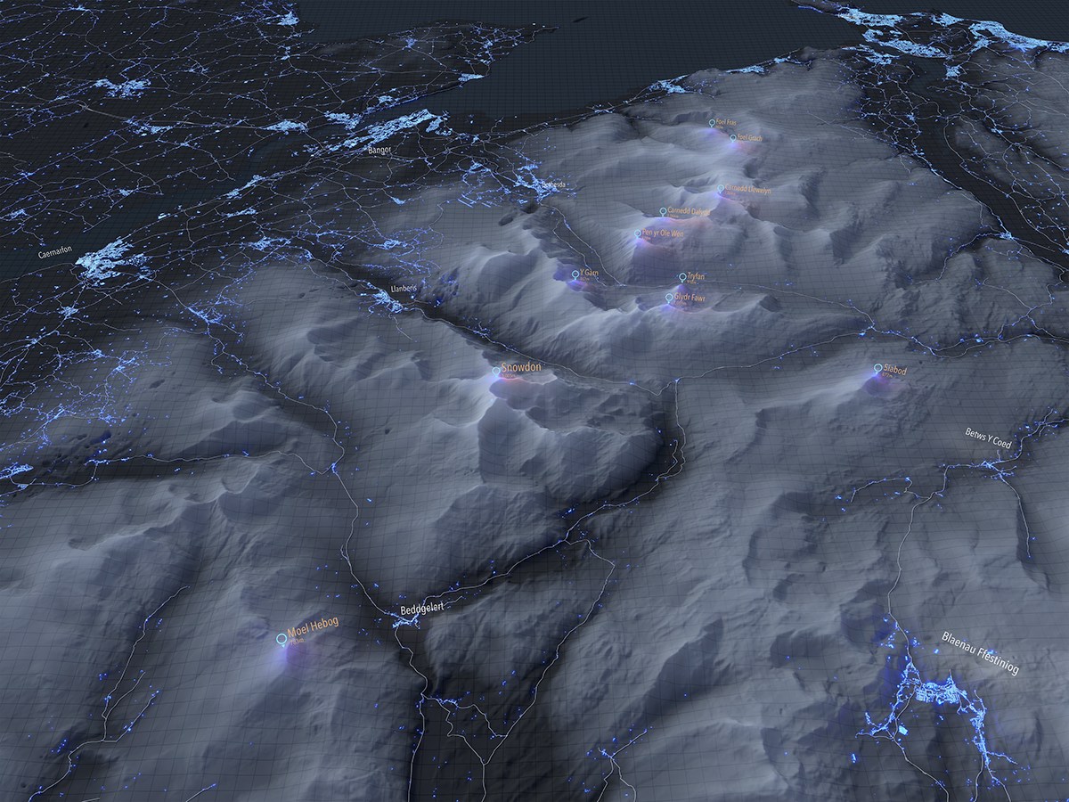

The below was an accident, I forgot to turn on the HDRI skylight but its kind of interesting to see how the glow effect on the labels lights up the peaks along with the more built up settlements.


