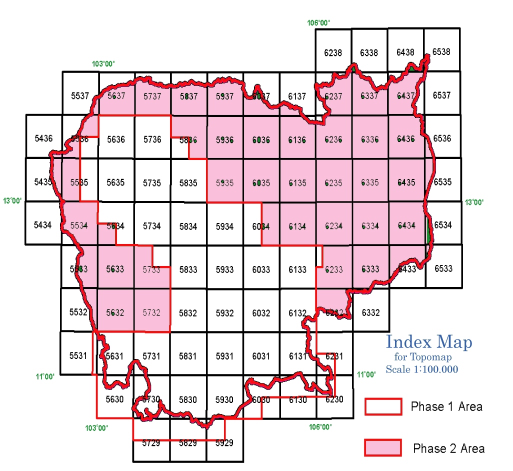
National Topographic Map Mosaic of Cambodia
Derived from the official national topographic maps produced by the Government of Cambodia under JICA Funding in 2001. Scale is 1:100,000. Projection is Indian1960 & LatLong/UTM48 WGS84. Available in Erdas Imagine, MrSID and Google KML formats.
Derived from the official national topographic maps produced by the Government of Cambodia under JICA Funding in 2001. Scale is 1:100,000. Projection is Indian1960 & LatLong/UTM48 WGS84. Available in Erdas Imagine, MrSID and Google KML formats.