
Digital Design Tools
Projects Completed for Larc 221 Spring 2012
Projects Completed for Larc 221 Spring 2012
Larc 221 is a course designed for the development and application of computing skills as used by thelandscape architecture profession. This Computer-Aided Design and Drafting (CADD) course develops computer drafting using a variety of software programs. It also introduces students to Geographic InformationSystems (GIS) mapping technologies.
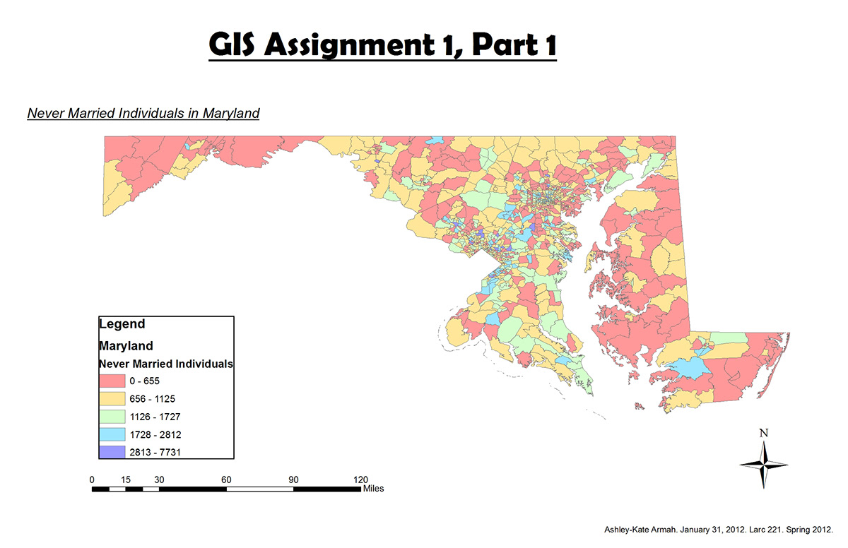
ArcGIS assignment that demonstrated the various information that can be found within the program.
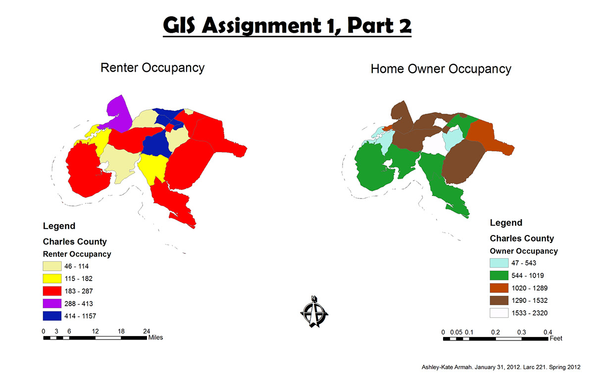
Another ArcGIS assignment.
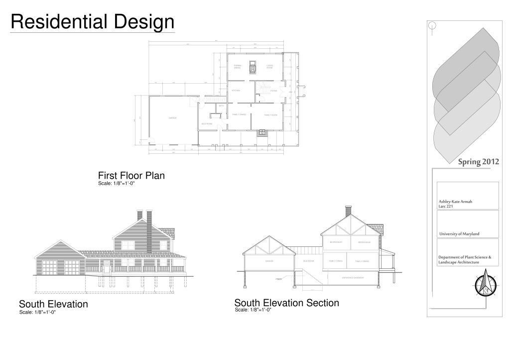
Stine Residence projects that were created through the use of AutoCAD.
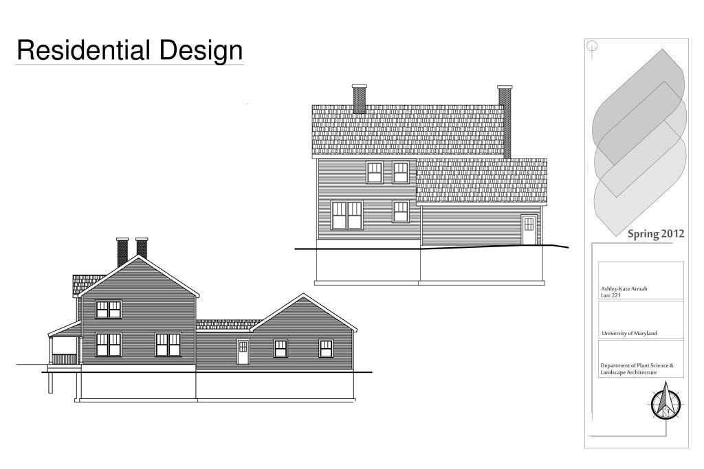
Stine Residence project using AutoCAD.
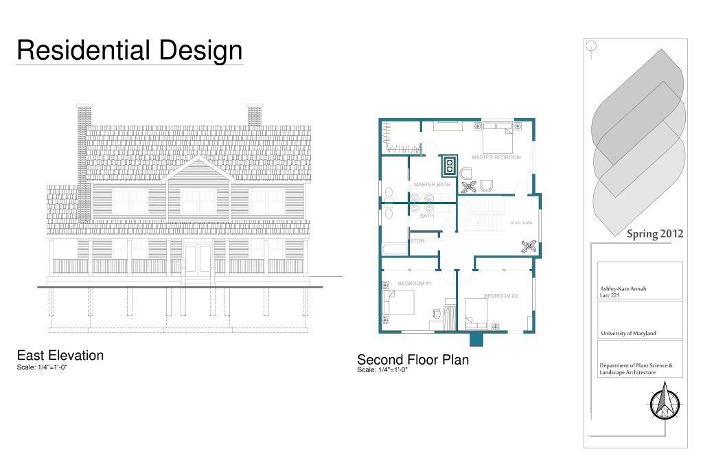
Stine Residence Project using AutoCAD.
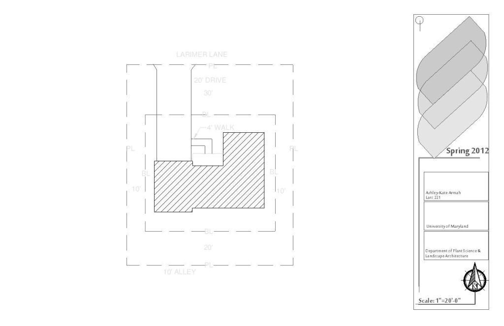
Plat Plan created through AutoCAD which taught students how to import and overlay PDF files into the program.
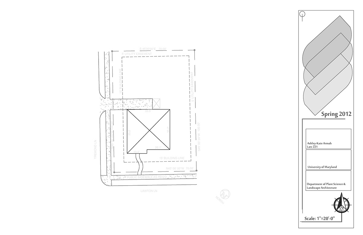
Habitat for Humanity Assignment. AutoCAD.
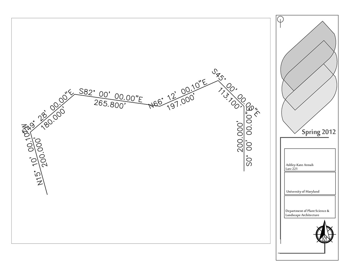
Open Traverse Assignment which demonstrated the use of Bearings over Distance in AutoCAD.
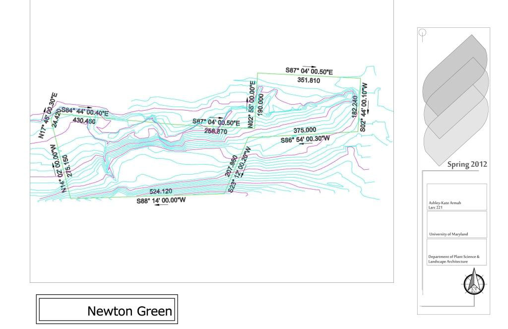
Topography and Boundary Lines in AutoCAD.

Rendered Surface in AutoCAD.

Another rendered surface in AutoCAD.
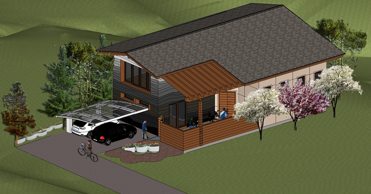
This Google SketchUp Assignment taught us how to import a surface into the program, utilize the 3D Warehouse and manipulate various tools within Google SketchUp.
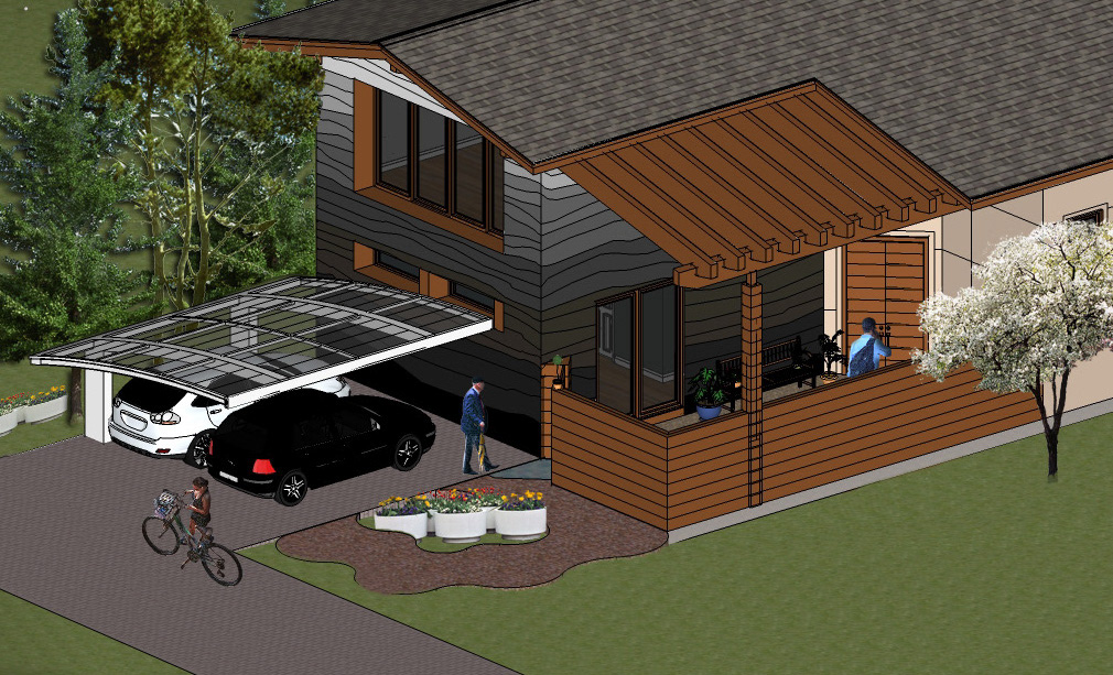
A close up image of the assignment.
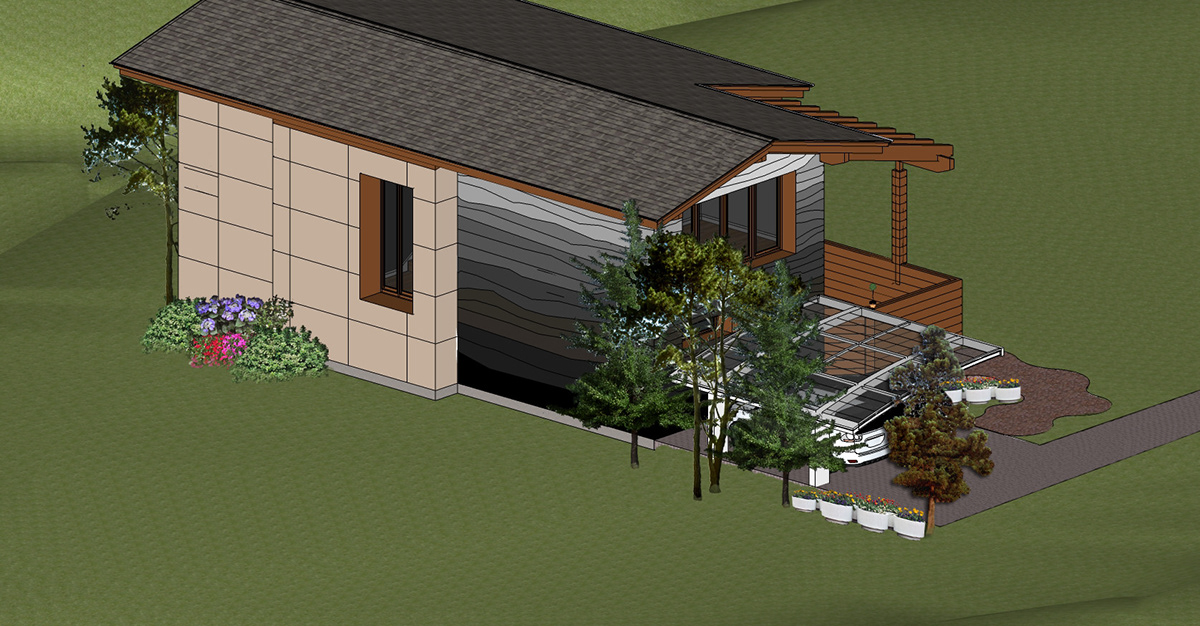
Another view of the house created in Google SketchUp.


