RIT Map Re-Design
Information Design, project
Information Design, project
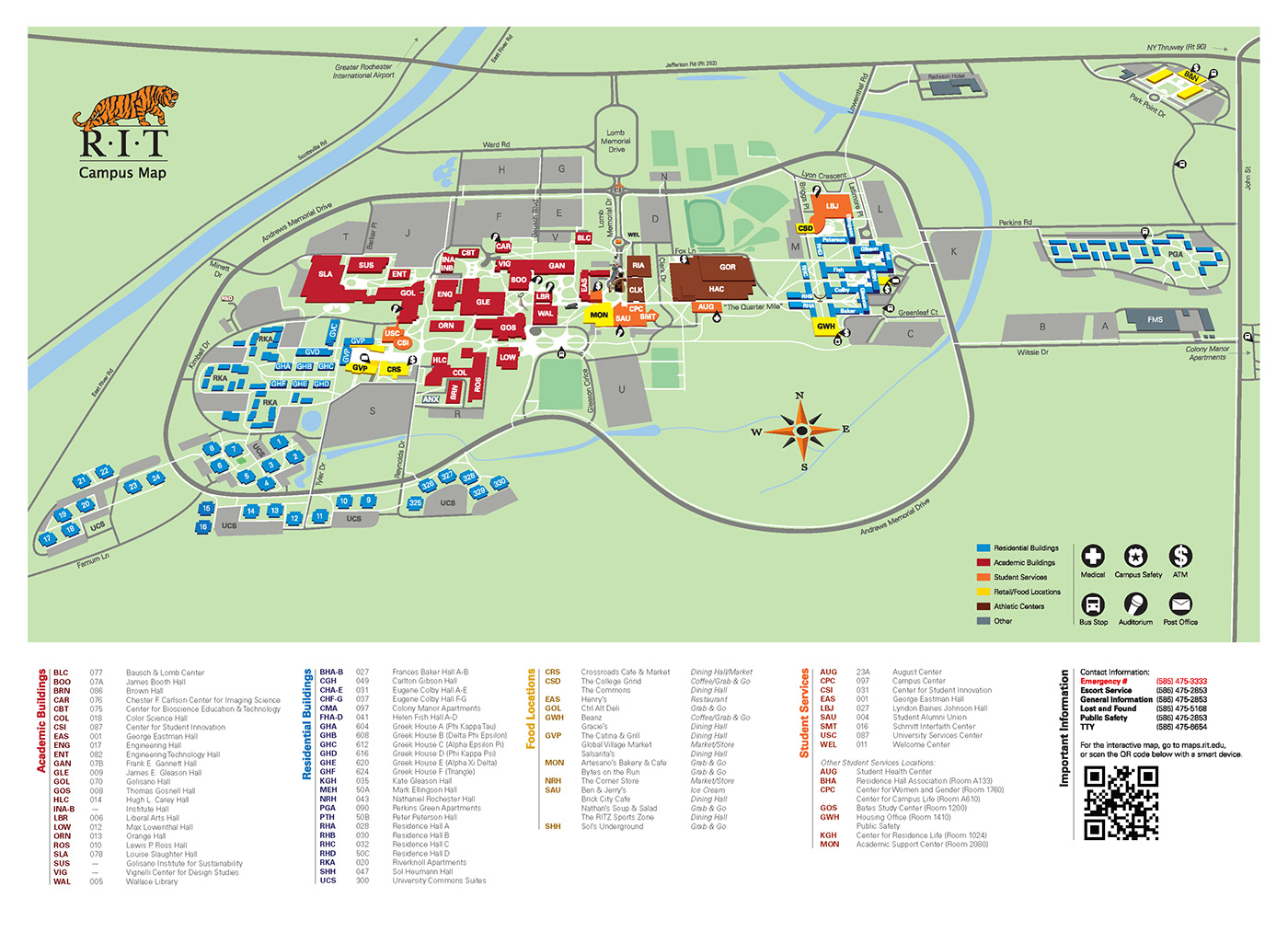
One project for my Information Design class involved wayfinding and creating a map. You could chose either to create a map for a fictional park, or re-design the current campus map for Rochester Institute of Technology. I chose the later, as there are so many better ways this map could be displayed. My professor strongly encouraged us to create 3D maps, to help visitors find their way around campus by knowing what the building faces looked like or such. I chose a perspective from which the campus map was still easily recognized, but also allowed me to create the buildings and other assets for the map in 3D. I also added sculptures that are commonly used in directing people to specific locations: the Tiger Statue, the Sentinel, the Infinity Statue, and the Sundial. Color coding the map was another idea that will allow viewers of the map to easily identify academic buildings from food locations, where student services are offered, what buildings are residential, etc.
We were also required to create a set of at least 6 icons to put on our map. I chose to create icons for medical, ATM locations, Campus Safety, bus stops, auditoriums, and the post office locations, using simple vector shapes within bubbles that pointed to the correct location.
We were also required to create a set of at least 6 icons to put on our map. I chose to create icons for medical, ATM locations, Campus Safety, bus stops, auditoriums, and the post office locations, using simple vector shapes within bubbles that pointed to the correct location.
Final map

Closer look at final map, academic side

Vectorized landmarks & graphics for this project