National Geographic Ladar Scan
To evaluate the ground of a very overgrown area, it's possible to use a Ladar Scanner attachted to an airplane. For the story "Lost City" in National Geographic's October issue, we visualised the high resolution point cloud which was generated in the boundary region between Honduras and Nicaragua, to find some ancient settlements which were unknown so far.

In this cross-fade you can see the canopy and the computed floor from the ladar scan. Scientist are able to detect former settlements on the basis of the generated floor images and to mark excavation sites to explore former buildings and other remains.

One of the two stories, we contributed graphics for, is about the exploration of the "Lost City" (right upper corner image) in the current October 2015 issue of National Geographic Magazine.
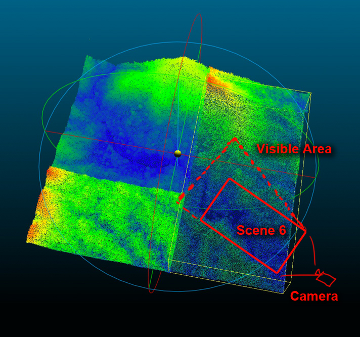
Here you can see assembled raw data which was processed by the ladar scanner. This whole point cloud was about 4,5 GB file size.
A zoom into one smaller tile shows the dotted point cloud. Bluer areas contain less dots as they show regions the scanner couldn't reach.

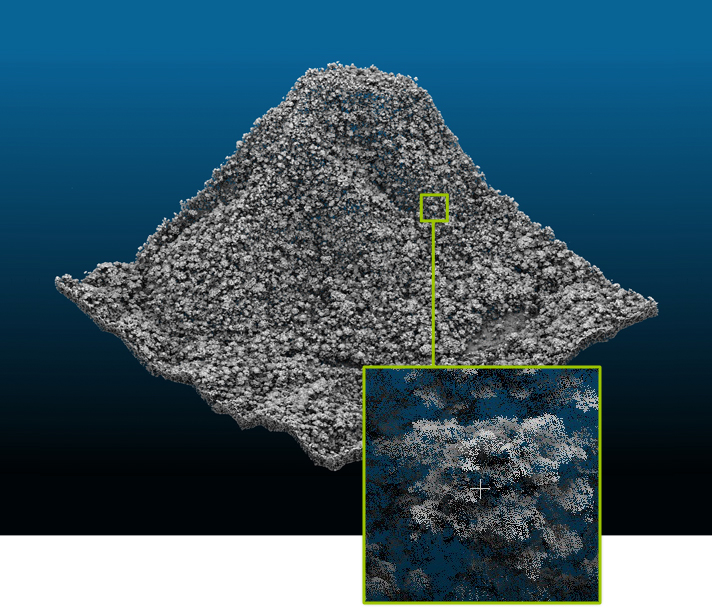
The whole cannopy formed by trees and leaves is useless for the evaluation of the ground but generates about 90-95 percent of the point cloud. The green line indicates all the points which will be necessary to generate a floor later on.


