

All of the maps in this series are available to purchase as fine art prints
via my online store: https://www.etsy.com/shop/thisismikehall
via my online store: https://www.etsy.com/shop/thisismikehall
For my illustrated map of central London, please visit:
https://www.behance.net/gallery/21329973/Illustrated-map-of-central-London
https://www.behance.net/gallery/21329973/Illustrated-map-of-central-London

Angel Islington, N1 (2012)

Brixton, SW2/SW8 (2012)

London Borough of Camden (2011)
featuring Bloomsbury, Camden Town, Hampstead, Highgate, Holborn, Kentish Town, Kilburn and St. Pancras

The City of London (2014)

Crouch End, N8 (2012)

Royal Borough of Greenwich (2012)
featuring Abbey Wood, Charlton, Eltham, Greenwich, Plumstead, Thamesmead and Woolwich

London Borough of Hackney (2012)
featuring Clapton, Dalston, Hackney Central, Hackney Wick, Haggerston, Homerton, Hoxton, Shoreditch and Stoke Newington

London Borough of Haringey (2015)
featuring Bounds Green, Crouch End, Finsbury Park, Harringay, Highgate, Hornsey, Muswell Hill, Tottenham and Wood Green

London Borough of Islington (2011)
featuring Angel, Archway, Barnsbury, Canonbury, Clerkenwell, Highbury, Holloway, Pentonville and Tufnell Park

Royal Borough of Kensington & Chelsea (2013)
featuring Brompton, Chelsea, Holland Park, Kensington, Knightsbridge and Notting Hill

London Borough of Lambeth (2011)
featuring Clapham, Brixton, Kennington, Lambeth, Stockwell, Streatham, Vauxhall, Waterloo and West Norwood

London Borough of Lewisham (2011)
featuring Bellingham, Blackheath, Brockley, Catford, Deptford, Forest Hill, Lewisham, New Cross and Sydenham
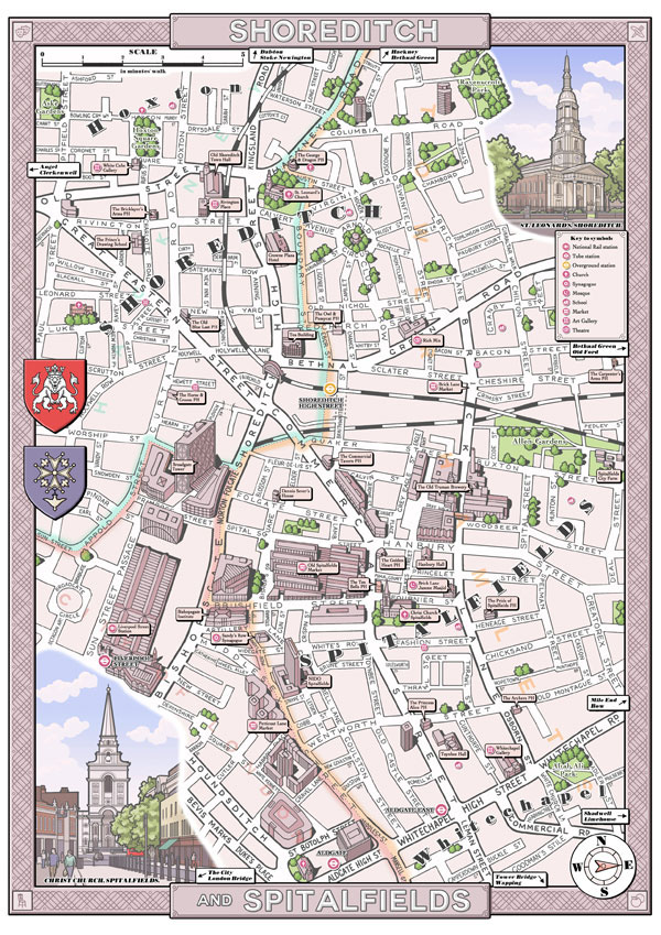
Shoreditch & Spitalfields, E1/EC3 (2012)

London Borough of Southwark (2013)
featuring Bermondsey, Borough, Camberwell, Denmark Hill, Dulwich, Peckham, Rotherhithe and Walworth
featuring Bermondsey, Borough, Camberwell, Denmark Hill, Dulwich, Peckham, Rotherhithe and Walworth

Stoke Newington, N16 (2012)

London Borough of Tower Hamlets (2011)
featuring Bethnal Green, Bow, Isle of Dogs, Limehouse, Spitalfields, Stepney, Victoria Park, Whitechapel and Wapping

London Borough of Waltham Forest (2014)
featuring Chingford, Highams Park, Leyton, Leytonstone and Walthamstow
featuring Chingford, Highams Park, Leyton, Leytonstone and Walthamstow

City of Westminster (2013)
featuring Bayswater, Covent Garden, Hyde Park, Kilburn, Knightsbridge, Marylebone, Mayfair, Paddington, Pimlico,
Regent's Park, St. James's, St. John's Wood, Soho and Westminster
Regent's Park, St. James's, St. John's Wood, Soho and Westminster


