
Walkthrough from main entrance, down to platform.
Maverick Redesign
Redesign of Maverick Square, East Boston and MBTA subway station station below
Redesign of Maverick Square, East Boston and MBTA subway station station below
The nautical history and old maps of Boston create an identification and wayfinding system for Maverick Station in East Boston.
Using metal inlays and concrete stains, the floor on the interior of the station will be transformed into one large chart of Boston Harbor from colonial times, orientated so that as you enter through the main entrance you are standing on the original islands that compose East Boston.
As you make your way through walking down the platform, you walk across the Boston harbor towards downtown, mirroring the same path the subway takes under the harbor.
The imagery of the floor will continue onto the walls culminating with a horizon line view of the harbor, also taken from old charts of the area. Back-lit acylic panels line the walls opposite the platform; lighting would change slowly through the day to mirror sunrise and sunset. Areas of the floor and walls without the char graphics are stained a pale blue.
The ceiling will have wooden ribbing like the inside of a ship, with cove lighting hidden inside for general lighting and to accentuate the forms of the ceiling. The columns will be made to look like wooden masts. The signage and typography reflects old hand rendered nautical charts.
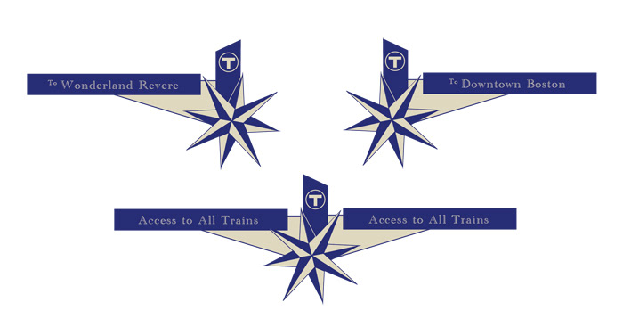
Above ground the wayfinding and signage will be consistent with that underground, using compass illustrations and navigation channels to inform the users of direction and location. Etched onto alternating glass panels of the head-houses with be images and names of clipperships built by Donald McKay. Constellation patterns, another form of nautical wayfinding, will be etched onto glass ceiling panels of the entrances.
Informational kiosks located around the square and at station entrances will provide information on the square and display times for train and bus arrivals and departures.
Using metal inlays and concrete stains, the floor on the interior of the station will be transformed into one large chart of Boston Harbor from colonial times, orientated so that as you enter through the main entrance you are standing on the original islands that compose East Boston.
As you make your way through walking down the platform, you walk across the Boston harbor towards downtown, mirroring the same path the subway takes under the harbor.
The imagery of the floor will continue onto the walls culminating with a horizon line view of the harbor, also taken from old charts of the area. Back-lit acylic panels line the walls opposite the platform; lighting would change slowly through the day to mirror sunrise and sunset. Areas of the floor and walls without the char graphics are stained a pale blue.
The ceiling will have wooden ribbing like the inside of a ship, with cove lighting hidden inside for general lighting and to accentuate the forms of the ceiling. The columns will be made to look like wooden masts. The signage and typography reflects old hand rendered nautical charts.
Above ground the wayfinding and signage will be consistent with that underground, using compass illustrations and navigation channels to inform the users of direction and location. Etched onto alternating glass panels of the head-houses with be images and names of clipperships built by Donald McKay. Constellation patterns, another form of nautical wayfinding, will be etched onto glass ceiling panels of the entrances.
Informational kiosks located around the square and at station entrances will provide information on the square and display times for train and bus arrivals and departures.

View of main subway entrance and surrounding Square (courtesy MBTA).
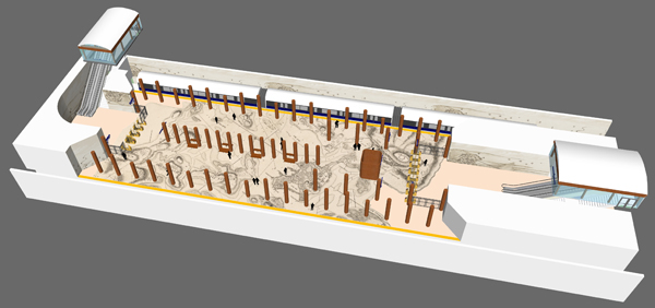
Axonometric view of Maverick Station.
Signage and Graphics

Welcome sign into Maverick Square.

Lightpost banner for Square.
Subway platform directional signage.
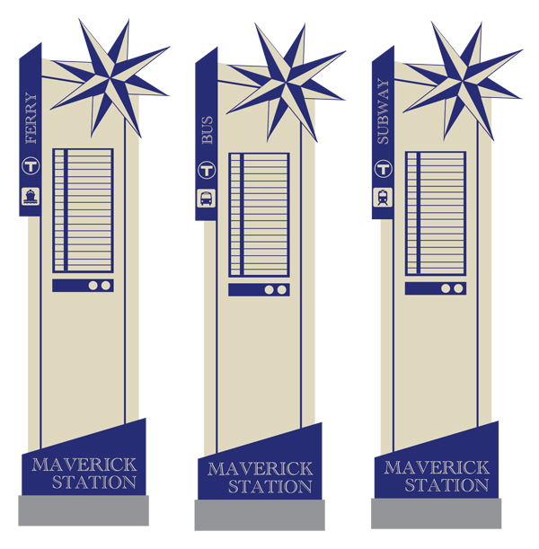
Kiosk design, for kiosks displaying arrival and departure times for ferries, busses, and train (respectively).

Informational panels for text and images on subway platform.
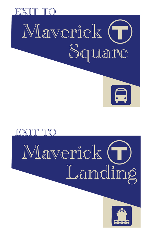
Exit signs for subway platform and above ground wayfinding signage.

Graphic of Colonial Boston Harbor (courtesy BPL map collections) to be applied in concrete stains to subway walls opposite platforms and light to simulate conditions at ground level.
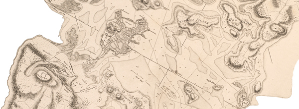
Subway platform graphic of Colonial Boston Harbor (courtesy BPL map collections) to be applied in concrete stains.
Renders and Mock-Ups
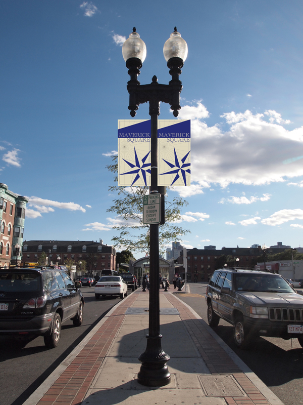
Maverick Square Banners.

Maverick Square banners and welcome sign.

Ground level wayfinding signage.
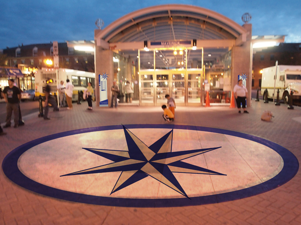
Main entrance with ground graphics and schedule kiosks.

Walls opposite subway platforms with map of Colonial Boston Harbor applied, with lighting simulating conditions at ground level above, connecting both environments.

View of subway platform at fare gates.