M A P P I N G T H E C I T Y
Research, eastside of Heerlen city, the Netherlands, 2015.
Research, eastside of Heerlen city, the Netherlands, 2015.
The research is focused on the eastern part of Heerlen city center and the surrounding area in Parkstad Limburg. The region involves much vacant buildings that are on the list to be demolished. This analysis is a search for new development strategies and urban transformations. The context is reflected with a variety of methods such as bird views, infographics, diagrams, urban sections, sketch impressions, isometrics and photo sequences. The city structure, the municipal character, the significance of present public space and social commitment are of key importance. The qualities and weaknesses are mapped out. In addition to that, the research also investigated a prospective usergroup, namely students. It assesses what should be done to the existing context to make it suitable for the new program and its inhabitants.
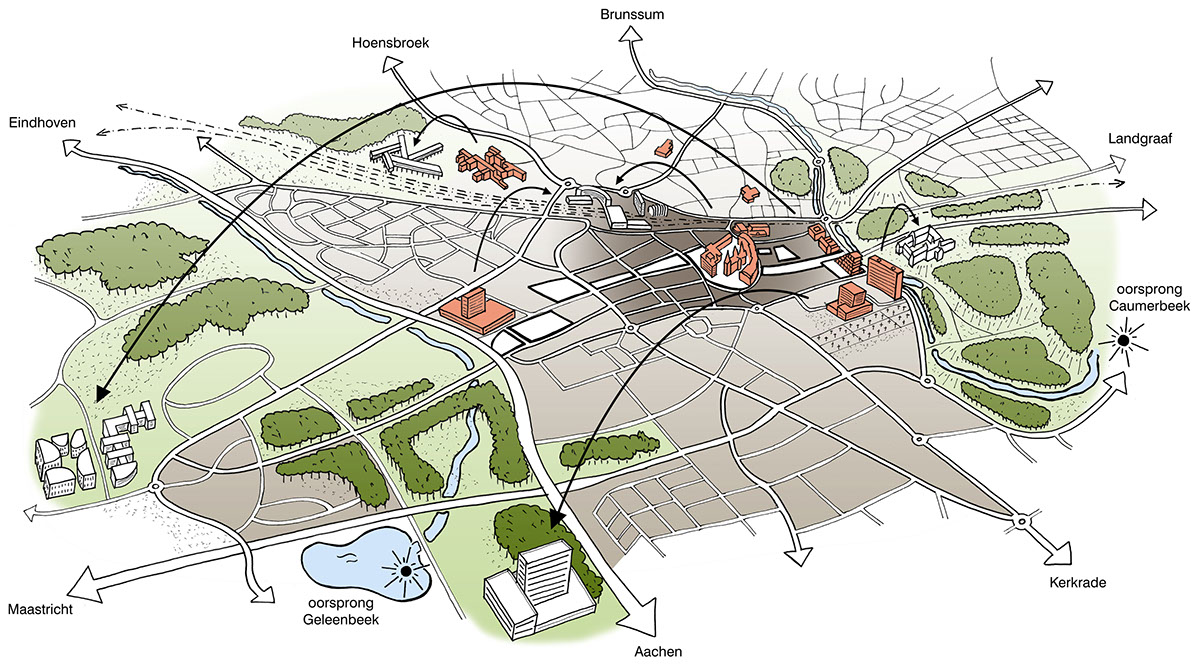
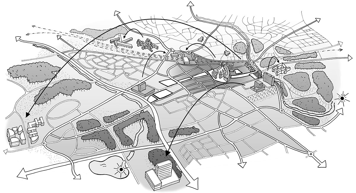
E V O L U T I O N O F T H E C I T Y relocation patterns of businesses, schools and retail

D E M O G R A P H I C S population decline and aging

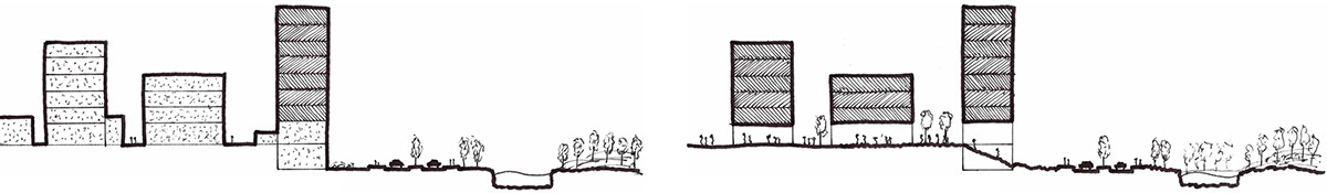
T H R E A T S & O P P O R T U N I T I E S defragmentation of the public space
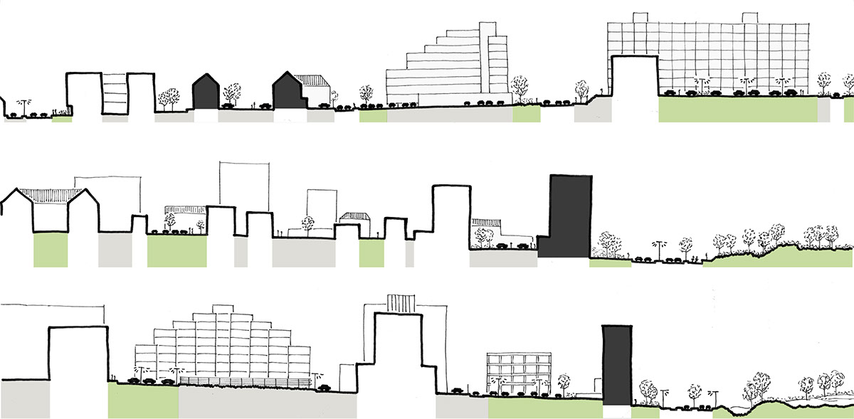
T H R E A T S & O P P O R T U N I T I E S defragmentation of the public space

C O N T E X T connecting the park and the city
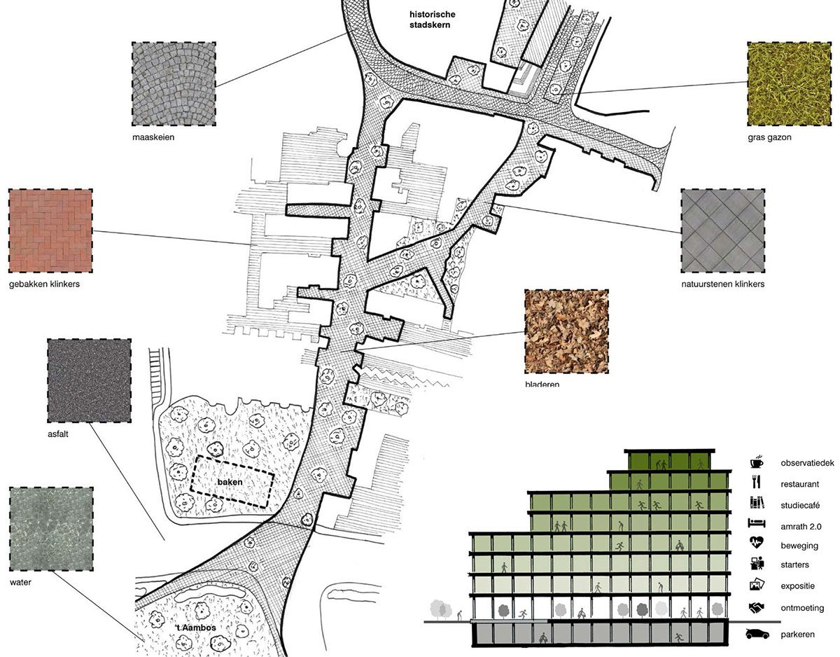
T H E B R I C K C A R P E T connecting park and city
I N T E R V E N T I O N S T R A T E G Y raising the base

R A I S I N G T H E B A S E ground floor as public space
R A I S I N G T H E B A S E ground floor as public space

A N A L Y Z I N G T H E U R B A N P L A N N I N G structure, conntections & function diversity

I N F O G R A P H I C increasing number of college students

F I E L D O F I N T E R E S T target group (students)

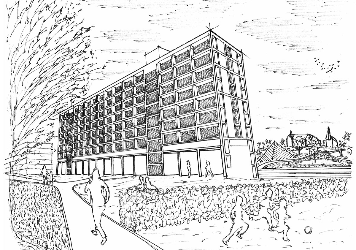
STATUS QUO photo sequence


