The Expo Site is bordered by the four municipalities of Milan, Rho, Baranzate and Pero. However, only the municipalities of Rho, Milan and Pero have ownership of the site.


The Expo area is characterized by a similar mixture of functions that exist within a complete and functioning city centre. In the city center, the historic grid structures a cluster of small units connected by a continuous regular street network. The fragments in the Expo area are in the contrary of this architecture, divided by large impenetrable infrastructures which disrupt continuity and an ordered structure. Accordingly, the goals are structured to recreate systems of flow, exchange and interaction of people, services and experiences, similar to those supported by and evident within the historical grid of the city.

The Expo Site will host the urban form and strategic programs which reflect the intersection of the habitation, production and recreation elements. It will be an opportunity space which demonstrates best practices in mixed use development, and act as a socio-economic hub and exchange platform for the surrounding communities.


Production: A linkage between the industrial district of Mazzo di Rho and the office & commercial district of the Stephenson District is the goal of the Production Axis.
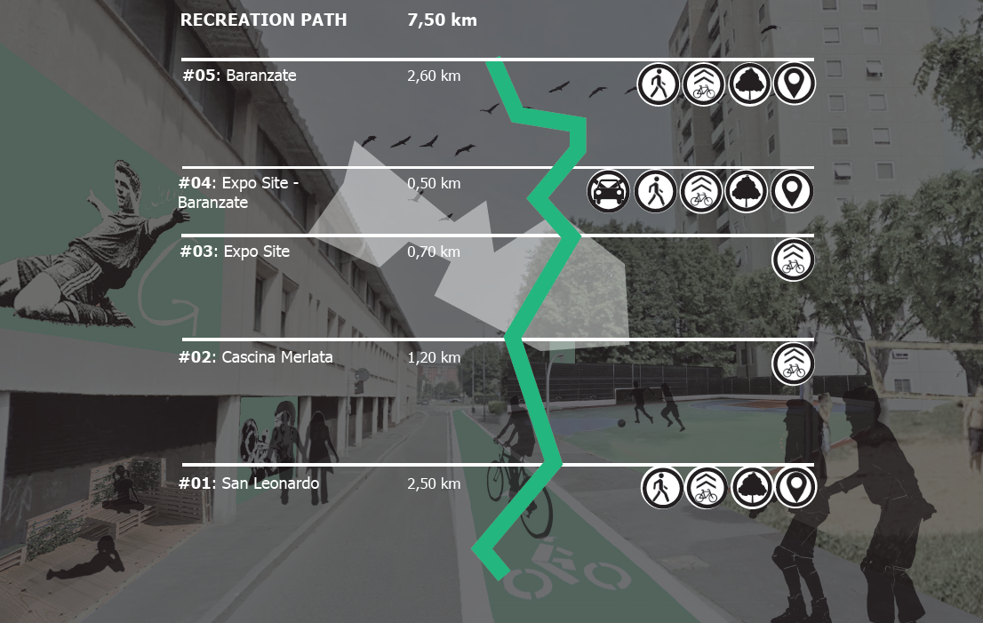
Recreation: The superior focus is connecting two high-quality natural and leisure areas in western Milan - the Parco di Trenno and Bosco in Città area in the south of the Expo Site and the Parco delle Groane in the north.
Habitation: The focus is on enhancing the accessibility and quality of pertinent areas of usefulness and interest for residents via connections created by bicycle and walkways along existing road network.
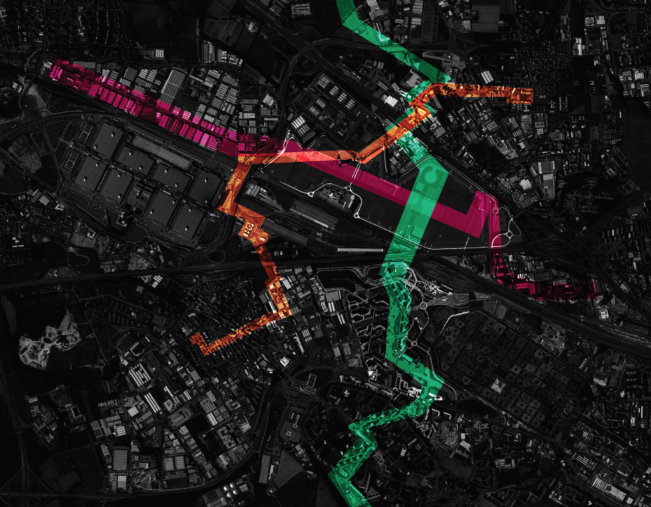
The network of the paths will serve as a backbone of Città d'Expo. Like a metro network, the bike and pedestrian ways will improve the connections and exchanges between the most interesting facilities and activities of the Habitation, Production and Recreation Axis. The paths counteract the fragmentation and create a grid for this urban edge area.