
As part of Mayor Bloomberg’s call to ‘re-imagine the public realm’, New York City has taken a series of major strides in recent years to improve its streetscape through the creation of new public plazas, wider sidewalks and wide ranging greening initiatives across the city that give pedestrians more room and a safer environment. The
city recognised that a well-designed infrastructure was only part of the solution and commissioned Applied, in collaboration with New York based design agency Two Twelve, to develop a unified pedestrian wayfinding strategy.
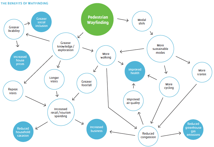
Our experience and research in other cities tells us that improved wayfinding can generate more walking or use of public transit, increase footfall in retail areas, and encourage residents and visitors to explore parts of the city that are new to them. The I Walk NY study contained extensive research around how people perceive and use New York City alongside a rationale for wayfinding.
We identified that even though Manhattan’s grid may make the city seem easy to navigate, New York is a city of many different grids that create confusing transition zones where they collide, merge or separate. Ironically, the uniformity of Manhattan’s primary grid can be challenging because so many journeys are made underground.
The unrelenting uniformity can make identifying locations, establishing direction or recognising distinctive and memorable features a problem for the city’s five million daily subway riders as they emerge from stations.
The unrelenting uniformity can make identifying locations, establishing direction or recognising distinctive and memorable features a problem for the city’s five million daily subway riders as they emerge from stations.

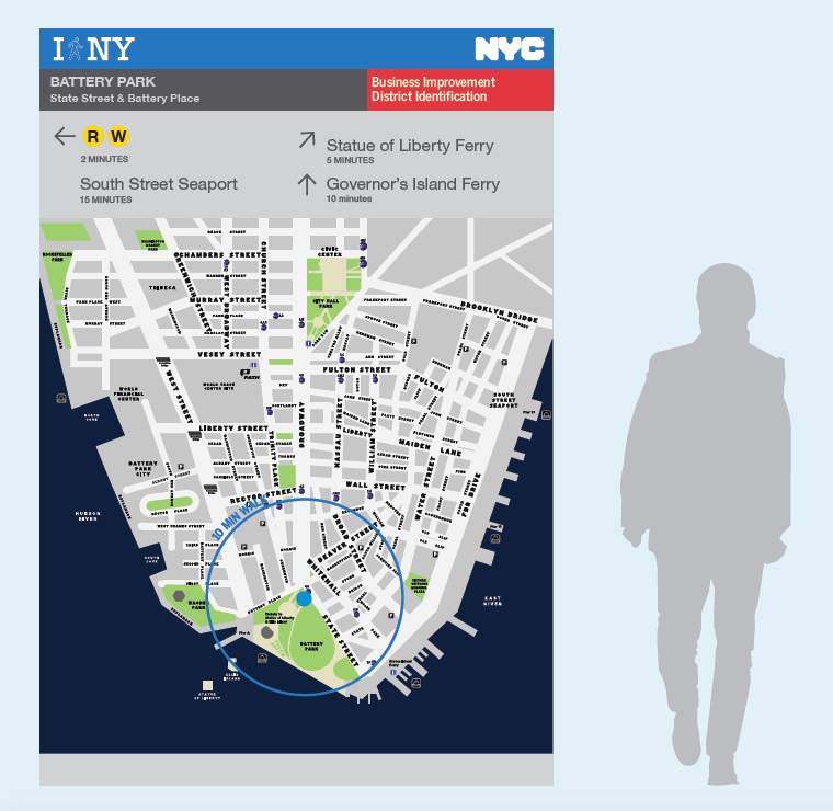
On occasions when signage schemes had been implemented in recent years, it has been carried out by Business Improvement Districts. Even when it has been of a high quality, it has resulted in a patchwork of localised and inconsistent efforts that are of little use to New Yorkers, commuters or the city’s 49 million annual visitors.
The final I Walk New York report called for a unified NYC pedestrian wayfinding system and recommended diverse concepts for digital and physical elements of the system. I master geographical information system formed the basis of the system, for both management and consistency of visual mapping. The report also recommended the implementation of pilot projects in 2012/13 that would test how people respond to the system in different settings and assess what synergies work best between various elements, with an ultimate view of deploying a NYC wayfinding system on a much wider basis.


