The Legible London concept represents the most comprehensive approach to implementing a wayfinding system in a global city. The project, conceived by Applied in 2004 in response to a study brief to investigate ways in which walking could be improved in Central London, has since developed into on-street pedestrian system with over 1,200 signs, a suite of printed tailored walking maps for commuters, businesses, visitors and shoppers, downloadable and digital maps, a number of smartphone apps, integrated public transport information, and has created a walking identity for London.
The Legible London design standards have been adopted by local government and transport authorities, private companies, land owners, business improvement districts and stakeholders with an interest in providing and publicising wayfinding information. The project is a multiple award winning information design and transportation system that has created a global gold standard for wayfinding research and design.
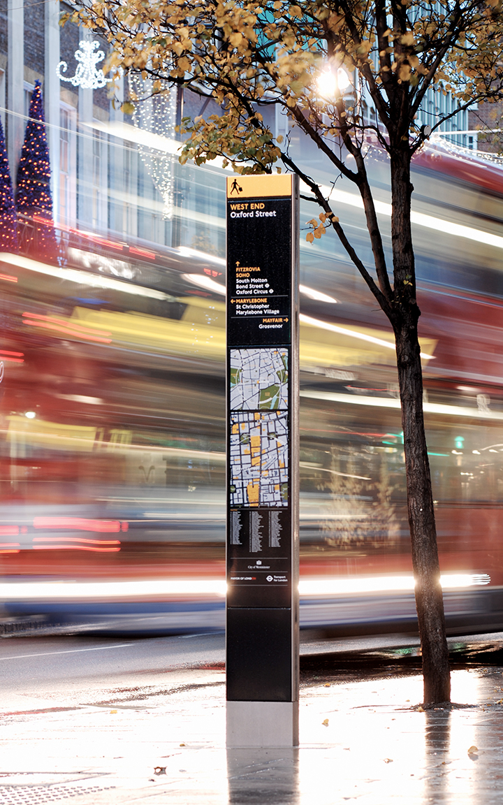
On-street minilith sign
Wayfinding Study (2006)
The original Wayfinding Study, published in 2006, set out a vision for a common solution to wayfinding, outlining the principles of a pedestrian signage system that encourages walking, takes into account the viewpoints of all stakeholders, makes London easier to understand for pedestrians, and ultimately delivers the benefits that increased walking brings. The focus of the study was twofold: on the practicalities of delivery – taking into account the needs of local, national government and transport authorities and other stakeholders – and on understanding the people it is intended for – what matters to the different kinds of walkers in the city, be they residents, visitors or commuters.
The study included detailed reviews and analyses of influential factors such as walking and transport policies, planning regulations, cognitive and behavioural research, existing sign systems and wayfinding practice to identify the major issues. The study found for example, 33 different wayfinding systems offering conflicting information and visitors using the tube map to navigate above ground, and recommended detailed investigation of how schemes could be implemented in four different areas of London, where there had been considerable interest to implement a pilot study.
As part of the study, an exhibition at the New London Architecture Centre in London was staged, at which visitors were invited to draw mental maps of the way they visualise the city. This was a key piece of research that helped us to understand what wayfinding cues people would find useful. A Legible London website was created to provide information about the system, which invited people to answer questions about the way they move around the city. It formed a useful part of the research phase and encouraged people to get involved and feel ownership of the system.

The Legible London wayfinding study
Feasibility Studies (2006 – 2007)
Feasibility studies were conducted in four areas – West End, South Bank, Richmond/Twickenham/Kew and Hackney. The studies reviewed the key considerations involved in implementing a pilot such as local distinctiveness, support, costs, management, ownership and maintenance of the system, user requirements, complexity of information planning and benefits to local residents, commuters and visitors. Each of the studies required significant local consultation, Lynchian analysis of the structure and movement of the pilot area, placement strategy, content planning, and a costing and scheduling exercise.
The studies also began to identify what constitutes local distinctiveness and where elements needed to be common in order to maintain the integrity of a single connected wayfinding system. The outcome of the studies was that a prototype should be developed for the West End to test system elements, to be followed by a phase of pilot studies in Richmond/ Twickenham/ Kew, South Bank and Covent Garden.
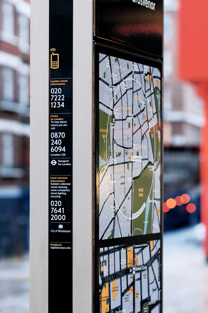
Street sign detail
West End Prototype (2007)
In 2007, the West End Prototype was set up where much of the key thinking was developed – from placing the signs, to rationalising place naming and asset selection, the design of the mapping and signs, through to product design and implementation on-street. Thorough user testing carried out by the project team, and independent research carried out by external consultants, proved the positive impact of the scheme right away.
A system of 19 on-street pedestrian signs, integrated underground and bus information centred on Bond Street underground station was deliberated, designed, manufactured and installed by the team which included Westminster City Council, the New West End Company, and the Oxford/Regent/Bond Street BID. A series of retail and business-focused printed maps were also developed. This stage was documented by the Interim Design Standard, which set the fundamental standards for the system going forward, both in terms of design and information structure.
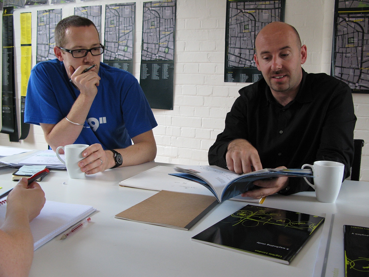
Applied Wayfinding's Ben Acornley and Tim Fendley at work on Legible London
Yellow Book and exhibition (2008)
The Yellow Book tells the story of the initial design development of Legible London up to the installation of a prototype in the Oxford Street area, improving information for Christmas shoppers from November 2007.

Yellow Book
Evaluation (2007 – 2008)
Transport for London undertook a series of qualitative and quantitative evaluations of the system to ascertain if it was meeting its objectives to make London more legible, help people move around the city more easily and give people the confidence to explore. The key findings of the reports were:
- Pedestrian tracking exercises, carried out before and after implementation showed a total of 33% reduction in the time for pedestrian journeys to destinations within the Bond Street area, as a direct result of the prototype.
- An 18% time saving improvement for pedestrian journeys was recorded for destinations beyond the prototype boundary.
- During controlled ‘mystery shopper’ exercises, a similar time saving of 16% was recorded.
- The knowledge of local area names, such as Mayfair and Marylebone had increased from 9% to 15% (a fundamental principle of the Legible London system)
- The number of people, from the UK, who stated that they didn’t know where they were, reduced from from 6% to 4%.
- For overseas visitors the number of people stated as lost similarly reduced from 17% to 8%.
- Alternatively, people’s confidence that they know exactly where they were increased from 38% to 53% for overseas visitors, which is a 39% increase in confidence.
- There was a 49% awareness level for the new system, six weeks after launch.
- Of interest to TfL in particular was the reduction in times a member of staff was asked for directions, reducing from 7% to 2% – a 75% reduction in enquiries.
- Over 85% satisfaction level for ease of use of the new system.
- 62% of interviewees stated that the new system would encourage them to walk more.
- 91% of interviewees stated that the system should be rolled out across the capital
The evaluation provided conclusive evidence of the system’s ability to positively influence walking behaviour and people’s understanding of the city, and gave TfL the tools and confidence to roll-out.

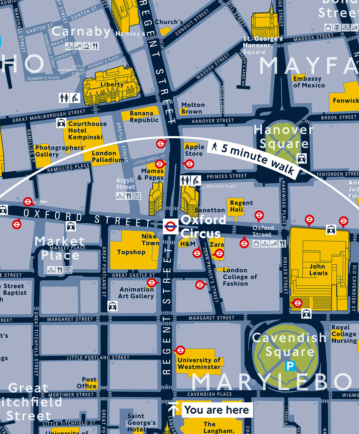
Legible London printed map for the Crown Estate
System Design (2008 – 2009)
In 2008, Applied were commissioned as System Designer for the pilot phase with responsibility to oversee the work of the scheme designers delivering the three pilot projects in Richmond/ Twickenham/ Kew, South Bank and Covent Garden. The role required drafting and distributing over 30 documents setting out planning and design guidance to ensure consistency and commonality across the pilots.
In addition, a series of workshops and meetings were hosted ensuring the dissemination and understanding of guidance and a system for scheme design feedback and reporting devised.
The system was documented, to enable the client and wider project teams to update guidance and plan for a wider roll-out over a 4-year development programme. The pilot phase included the implementation of nearly 300 signs across the three pilot areas.
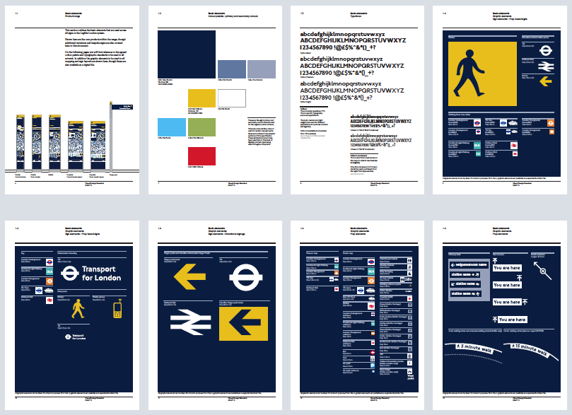
Spreads from the Visual Design Standard
Since 2009, Applied has been commissioned to deliver a number of further schemes comprising over 300 signs in some of the most important tourist areas of Westminster and Kensington & Chelsea.
Legible London is growing all the time, expanding in area and in use of different media. Recent surveys estimated the street signs are now viewed over 2 billion times every year.


